
The Ghana Geological Survey Authority (GGSA), on Tuesday, moved to the site suspected to have been hit with either an earth tremor or quake on Sunday at Mampong near Twifo-Praso in the Twifo Atti-Morkwa District of the Central Region.
Accordingly, it has declared the site a danger zone to avoid the likelihood of after-risk effects of natural disasters until the cause and nature of the landslide are established, Mr. Joseph Atichogbe, a Geologist with the Ghana Geological Survey Authority (GGSA) has stated.
He told the Ghana News Agency in an interview that: “For now, GGSA cannot ascertain if it is an earthquake or earth tremor until a thorough assessment of the disaster is done by GGSA.
“A crack team of Geologists is on-site to assess the situation so in a couple of days, GGSA will make a credible report to the public.”
He contested claims that the GGSA failed to predict the suspected earth tremor or landslide, indicating: “GGSA does not predict earthquakes or tremors. Though we forecast rainfall, we cannot predict the happenings of natural disasters.
“Earthquakes cannot be predicted, so the best we can do is to sensitize the public about measures that can be taken to reduce the effect of natural disasters.”
Going forward, Mr Atichogbe suggested that all residents of the affected areas seek professional advice for a seismic and geotechnical evaluation of the site to determine the hazards and workable solutions.
Seismic evaluation involves the use of scientific methods, such as artificial vibrations, to establish potential deficiencies in existing buildings to determine the possible impact of an earthquake on the structure.
Geotechnical evaluation is meant to obtain information on the physical properties of soil earthworks and foundations for structures to help identify and repair distress to earthworks and structures caused by subsurface conditions.
The GGSA was established as an Authority of the Ministry of Lands and Natural Resources by the Ghana Geological Service Act, 2016 (Act 928).
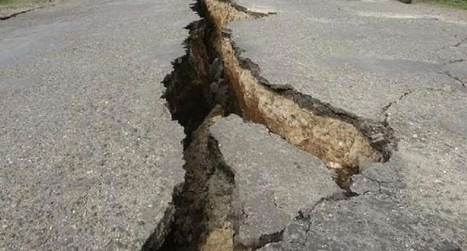
Fear grabbed some farmers and residents of the area on Sunday, when they experienced what they thought was a tremor which shook and created deep crack in the earth.
Some farmers said their cocoa farms were severely affected and had called fir government's intervention.
GNA
 Western North been sidelined for far too long; address our needs before 2024 ele...
 Effutu: 'Stop eating at night and take care of your health' — Afenyo Markin advi...
 Akufo-Addo's desperate attempt to disrupt Yagbonwura's 1st year anniversary cele...
 Armed robbers attack, rob Sethi Brothers Ghana Limited in Tema
 SML deal: We commend Manasseh for holding gov't to account, Akufo-Addo for not s...
 Our recall invocation is in good faith to consider three key issues – Majority
 You’re inviting bad luck upon yourself if you use Indian hair — Spiritualist war...
 Ejisu by-election: Police questions Kwadaso MP, two others over bribery allegati...
 Nana Kwame Bediako is Nkrumah’s reincarnate; he’ll be president if he appoints N...
 Dumsor: Mahama gave us ‘dum, dum, dum’ but we are now in the era of ‘dum sie sie...
