
(Introduction: many Africans are oblivious that maps are political tools. Like most things used by Europeans to maintain their hegemonic control of the world, geographic maps are used to squeeze Africa into a speck while the proper sizes of Europe are magnified beyond measure.
This article is my contribution to the African Factbook (AF), edited by the inimitable and irrepressible Balfour Ankomah, my former editor at the NewAfrican magazine.)
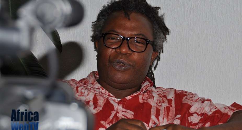
Here is Mr. Ankomah presenting me with my copy of the AF.
I begin with a Big Thank You to my paid subscribers. I am immensely grateful for your not only reading my articles but also for offering me your financial support!
As we say in Yoruba: Mó dúpẹ̀.
In his book, The World Through Maps: A History of Cartography (Toronto: Firefly Books, 2003), John Rennie Short makes a profound statement: "Maps are neither mirrors of nature nor neutral transmitters of universal truths. They are narratives with a purpose, stories with an agenda. They contain silences as well as articulations, secrets as well as knowledge, lies as well as truth. They are biased, partial, and selective." A map is defined as a graphic representation, usually on a flat surface, of a whole or part of an area. Produced by cartographers who attempt to describe spatial relationships of specific features or to represent specific things, maps can display natural resources, physical features, climates, roads, elevation (topography), political boundaries, population, and economic activities. Because the Earth is a three-dimensional object that is close to a sphere, globes have been used as the most accurate representation of maps. Since the Earth is very big, projecting it onto a surface makes maps lose accuracy. Maps, thus, become subjective views of the cartographer, and they represent what the mapmaker considers important enough to include or exclude, to emphasize or deemphasize, to depict as large or small.
Since it is mathematically impossible to preserve variables such as size, shape, direction, and distance simultaneously, maps inherently distort reality, however hard cartographers have tried.
Maps should, therefore, not be seen as mere graphic representations of places. They carry heavy social, economic, and political weight and are inherently deceptive.
Map projections are named after either the person who first used it, the method used to produce it, or a combination of the two. Examples include Mercator, Transverse Mercator, Robinson, Lambert Azimuthal Equal Area, Miller Cylindrical, Orthographic, Stereographic, and Gnomonic.
The problems with maps
Take a look at any world map, and you will see that the world's largest island, Greenland, is staggeringly big, and it is projected to be the same size as Africa. In reality, Africa is 14 times larger. The reason is simple: Most "Western maps" use the Mercator Projection, which makes Africa, like everything near the equator, very small. By contrast, Greenland and Alaska appear huge because their sizes are inflated like everything near the poles. Drawn in 1569 by the Flemish cartographer Geert de Kremer (aka Gerardus Mercator), the map became popular because the cartographer decided to draw a planisphere, which represented the meridians and parallels as straight lines that cross at right angles and thus preserved local angular relationships, thereby helping sailors to navigate the world's oceans. In short, the Mercator map was the perfect answer to sailors' navigational problems.
However, the greatest drawback of the Mercator map is that it massively distorts size and distance as you get closer to the poles. This has resulted in greatly misrepresenting geographic reality and has helped in creating the misleading Eurocentric world we see today, with great implications for global politics and economics and negative consequences for regions like Africa.
Although it was originally created for the convenience of 16th-century sea captains, the Mercator map has become the de facto standard for world mapping. Today, it is used in geography textbooks and Google Maps, and it is the only way most people recognize the position and size of the Earth's countries and continents.
While a revolutionary and convenient tool for ships' captains, the Mercator projection distorts the relative size of the continents to the advantage of the West, to which it gives undue prominence by pumping up the sizes of Europe and North America.
For example, on maps, Canada and Russia appear to take up about 25% of the Earth's landmass; in reality, they occupy a mere 5%.
It would be far-fetched to think that Mercator enlarged Europe and North America by accident; the cartographer was undoubtedly shaped by the politics and ideas of his time. That his map used mathematics cannot hide the fact that his was a map made for Europe by a European. He projected his native Europe as an outsized landmass to the disadvantage of places like Africa. The repercussions have been enduring and are still being felt today.
Despite its imperfections and attempts to create alternatives, the Mercator map still dominates the mapping landscape, with new digital mapping applications helping to further strengthen its position. Ironically, today's online geospatial applications on computers and mobile devices rely on the 16th-century tool created to help explorers on the high seas.
The proper size of Africa
On most maps, it doesn't look like Africa is really big, but its true size is 30.37 million square km (11.73 million square miles).
Africa is bigger than Canada, the contiguous United States, and China put together!
On maps, while Africa's size (11.73 million square miles) is shrunk, Russia's size (6.6 million square miles) is exaggerated, which makes Russia appear bigger than Africa. In reality, Africa is almost twice the size of Russia.
Canada, too, looks a lot bigger on a map than Africa when, in actual fact, three Canadas would comfortably fit inside Africa.
Another distortion is Greenland, which, on a map, looks about the same size as the whole of Africa. In truth, Greenland (2.2 million square km or 849,424 square miles) is smaller than Africa's second-largest country, the Democratic Republic of Congo (2.3 million square km or 905,355 square miles). DRCongo used to be the third-largest African country behind Algeria and Sudan. However, in 2011, when South Sudan became an independent country, Sudan moved to third place behind DR Congo.
Some attempts have been made to correct the Mercator map. One of these is the Gall-Peters Projection (1855). It is a rectangular map projection that maps all areas so that they have the correct sizes relative to each other. There is also the Van der Grinten Projection (1898), which is a compromise map projection that is neither equal-area nor conformal.
Unlike perspective projections, the Van der Grinten Projection is an arbitrary geometric construction that projects the entire Earth into a circle.
Also on the list is the Winkel Tripel Projection(1921), which aimed to minimize three kinds of distortions: area, direction, and distance.
Yet another is the Robinson Projection, which was devised by Arthur H. Robinson in 1963. It was specifically created in an attempt to find a good compromise to the problem of readily showing the whole globe as a flat image.
There is yet a fifth, the AuthaGraph map created in 2016 by the Japanese architect Hajime Narukawa, which is considered the world's most accurate map yet.
Maps as political tools
The discovery of navigational tools like the compass and modern maps like the Mercator Projection helped spur Europe's overseas conquest and domination.
The Scramble for Africa, also known as the Race for Africa or Partition of Africa, was a process of invasion, occupation, colonization, and annexation of African territory by European powers.
Contrary to what Europeans like to portray, Europe was not driven by any altruistic considerations to go on a civilizing mission. The colonial powers fought for African territory to indulge their insatiable greed for raw materials like palm oil, cotton, palm kernel, rubber, groundnut, gold, diamonds, ivory, cobalt, precious metals, quinine, and other medicines.
European cartographers arbitrarily drew up the pencil-straight maps of African countries to satisfy imperial ambitions, and they took no cognizance of people, history, or culture. The European bureaucrats who negotiated the territorial borders had little or no knowledge of Africa or the people they were dividing among themselves and did not care much.
As Lord Salisbury, the British Prime Minister, noted in 1890: "We have been giving away mountains and rivers and lakes to each other, only hindered by the small impediment that we never knew exactly where the mountains and rivers and lakes were."
In many cases, natural features like mountains, rivers, and lakes became the yardsticks for demarcating borders, with ethnic groups mercilessly divided between different colonial powers. Groups with a history of hostility towards each other were grouped together in the same colony.
Apart from wholesale killings of the inhabitants and the wanton theft and plunder of Africa's resources, this arbitrary division of people into colonial garrisons called countries caused irreparable damage to Africa, the effects of which are still being felt today.
Colonialism completely destroyed the social fabric of the colonies by promoting division and violence and by replacing Indigenous conflict resolution mechanisms with an authoritarian, punitive judicial system.
Colonialist socialization led to the creation of individualism in societies where the family is everything; the forced urbanization resulted in rural-to-urban migration with devastating consequences for closely-knit family structures. The loss of land, the loss of culture, and the conscious promotion of European values resulted in an African totally alienated from his own culture and made to feel ashamed of being African.
Indigenous governance systems were brutally uprooted and replaced with the violent totalitarianism of colonialism. The traditional ruling elite was smashed, and in its place was a new crop of elites, created, nurtured, and weaned to be loyal and pay allegiance to the colonial masters. This is one of the reasons why, in many African countries today, people's allegiance to the state is often challenged by centrifugal forces commanded by tribal and ethnic loyalties.
The economic effects of colonialism were no less devastating as the colonies were wholly de-industrialized; their attempts at industrialization were viciously smashed.
Two good examples were the textile and distillery industries, where Africans were stopped from producing their clothing and gin. Punitive taxes were imposed on local producers so that their goods could not compete in price with European imports. Africa was expected to function only as a source of raw materials for metropolitan industrial production and as a consumer of finished Western goods. African agriculture was diverted from subsistence towards the production of cash crops, prices of which were, and continue to be, set in Western capitals.
Africans were dealt several blows – uprooted from their land and turned into indentured workers. The labor of Africans was diverted from feeding themselves to feeding European factories. These are some of the inherited factors that set the newly independent African nations on an inexorable path to turmoil, and the turmoil continues to destabilize the continent. Perhaps the most insidious effect was the fact that the colonialists did not stay long enough to cohere their artificial inventions into viable nation-states before they departed. It is often forgotten that France did not break its African possessions into countries until the eve of its ostensible departure. It should not be a surprise that many of the countries degenerated into anarchy not long after the colonialists left.
Unfortunately, it is Africans who get blamed for their attempts to fix the mess created by European land-grabbers.
That overpopulation is often cited as one of the reasons for Africa's underdevelopment and can be blamed on the distorted maps that make Africa appear to be smaller than it actually is. The only charitable thing to say about those who claim that Africa is overpopulated is that they do not know what they are talking about.
The continental USA, India, Japan, China, New Zealand, and Europe can be fitted within continental Africa. Here are some tables to put things into perspective.
Table 1: Sizes of some leading countries
Country Size (in sq. km)
- China 9,596,960
- USA 9,525,067
- India 3,287,263**
- Europe 10,180,000
- New Zealand 268,000
- Total 32,857,290*
* Africa is 30.37 million square km
** At 1.4 billion, the population of India alone is bigger than that of Africa's 1.2 billion.
Table 2: Five of the largest countries in Europe and Africa with their population figures
Country Population (2018) Size (in sq. km)
AFRICA
- Algeria 43,304,346 2,381,741
- Democratic Republic of Congo 84,068,091 2,344,858
- Sudan 43,138,584 1,861,484
- Libya 6,808,092 1,759,540
- Chad 16,102,039 1,284,000
- Total 193,421,152 9,631,623
EUROPE
- Russia 145,872,256 3,972,400
- Ukraine 43,993,638 605,628
- France 65,129,728 551,394
- Spain 46,736,776 498,468
- Sweden 10,036,379 449,468
- Total 311,768,777 6,077,358
Among the significant problems inherited by postcolonial Africa was the question of what to do with the artificial colonial borders. Despite several attempts, finding an excellent solution to the inherited colonial headache has proved arduous. After decolonization, African leaders, perhaps unwisely, decided to keep the colonial boundaries. Their main reason was that redrawing them would have prolonged decolonization and caused unnecessary disruptive conflicts in the new struggling nations. Over the years, the various inter-ethnic conflicts witnessed on the continent showed that it was not the right thing to do. Africa's postcolonial leaders should have, at the least, adequately marked out the frontiers since only a third of Africa's 83,000 km of land borders is properly demarcated.
The African Union (AU) "Border Program," charged with clarifying the demarcation lines and resolving disputes, has repeatedly pushed back its deadline. Creating a type of United States of Africa, with relatively open borders between nations, is one suggestion to help resolve things. Other suggestions include the creation of federal states, unions of states, and regional economic blocs. Africa's integration is no longer a matter of choice for the vast continent of over 1.2 billion people. Africa has no choice, and no further excuse, but to plot regional and continental integration. Apart from improving people-to-people interaction, it will boost trade and security and help to reduce conflicts across the continent.
Africa can also take advantage of its true size and the peculiarities this presents to market itself properly to foreign tourists. Let's consider the example of the city of Tema in Ghana. Although, as a sphere, the Earth cannot have a true center, but by virtue of being located on Longitude Oº and Latitude 5º north of the Equator, Tema is the closest land settlement to the center of the world - that is where the Equator and Greenwich Meridian meet at ZERO coordinates (0° Longitude, 0° Latitude, the so-called Null Island).
The math is simple: Tema is 555 km north of the center of the so-called Null point located in the Atlantic Ocean, and the nearest city is Libreville, which is 1110 km. Both cities are in Africa.
Since Ghana is right in the center of the world, there is no reason why Ghanaian officials should not promote the Tema port to serve as the Central Hub for the world's shipping industry or why Ghana cannot transform itself into the World's Greatest Hub for Airlines.
Ghana Tourism officials should milk the geographic fact of their country's centrality for all it is worth. For example, a tourism brochure that promotes a visit to "Tema: The World's Heartbeat" would be most appealing. They could have regular cruise ships visiting the Null Island. Local artisans can be drafted to create appealing artifacts that loudly proclaim the centrality of Ghana to wow tourists. Hotels with attractive names like "The Centre of the World" will spring up and provide jobs.
By clever marketing, the hospitality industry and financial and other services in Ghana can be provided incentives to set up a home in what is, after all, the center of the world.
Africa appears to be waking up to the call by the great writer Chinua Achebe, who said that "until the lions start to write their own history, the story of the hunt will continue to glorify the hunters."
Africans are increasingly challenging the twisted historical narratives bequeathed to them by their colonialists. This is helping to boost the self-confidence of the people of Africa, and it will also undoubtedly contribute enormously to realizing the continent's enormous economic potential.
They should increase the tempo, allowing Africans to create the Africa of their dreams in their own image.
It will be an Africa that will be confident enough to chart its own independent course unbeholden to any foreign power. Ultimately, an Africa that will begin to use its gigantic size, immense strength, and vast resources to cater to the interests of Africans.
©️ Fẹ́mi Akọ́mọláfẹ́
Farmer, Writer, Published Author, and Social Commentator.

 NACOC raids Central University, arrests 5 students in possession of wee-infused ...
 Ireland deports 42 South Africans
 Chief Justice Baffoe-Bonnie's Canada trip self-funded — Judicial Service
 Ghana summit charts path from 'recognition to action' on slavery reparations
 Boakye Agyarko is best suited to lead NPP as National Chairman – Kpandai MP
 African Union condemns deadly Niamey airport attack, pledges support to Niger
 Don’t see Ken’s comment as war but opportunity for reconciliation — Kwasi Kwarte...
 Kennedy Agyapong’s claim Defence Committee was stopped from visiting Afari Milit...
 'We only corrected a miscommunication' — Agric Minister dismisses rift with Fina...
 Ghana invests too little in early childhood despite 80% poverty rate among under...
