



Maps are an essential technology of modern life. They help navigate streets, follow deliveries and track storms. They're embedded in election coverage, humanitarian emergencies, military briefings, and development reports. They underpin the “location intelligence” that governments and businesses use to understand where people, services, risks and opportunities are.
Most of the time, we barely notice them. Which may be exactly why they're worth noticing.
Maps carry unusual authority. Put an argument into a paragraph and readers may question it. Draw the same argument as a boundary, shade it, add a legend and a date – and suddenly it looks like evidence, even though it could be distorting reality.
The decision by the United Nations to promote fairer world maps is welcome. But it addresses only one kind of cartographic distortion.
The problem came when a map designed for navigation at sea escaped the ship's cabin and became a general portrait of the planet, hanging on classroom walls. It was never designed for that. A new map doesn't change the actual size of Africa. What changes is its representation – how it's seen.
The distinction is fundamental – a projection can misrepresent Africa's relative size because geometry forces a compromise. A propaganda map can move a boundary because somebody wants you to believe the boundary belongs somewhere else.
Maps are both measurements and images. And images have psychological lives. No flat map can be completely “correct” for all purposes. But some maps distort reality on purpose.
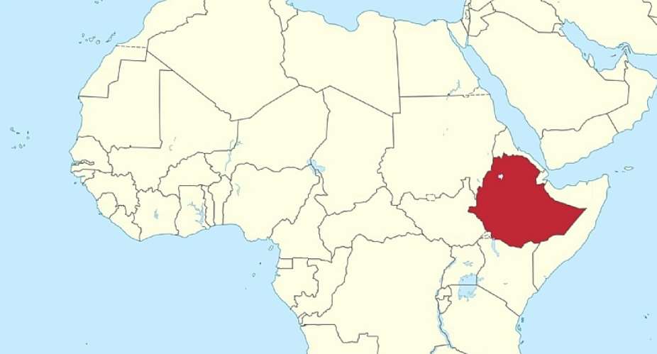
As a political geographer, I've done research on cartographic (map) propaganda in Ethiopia to examine what happens when the authority of a map meets social media and political conflict.
It considers how “maptivism” (the use of maps to promote a cause) can create false maps, capable of spreading disinformation and worsening conflict.
The case of Ethiopia
I examined maps prominently circulated on Ethiopian social media before and after the country's 2018 political reforms.
The reforms were the result of widespread uprisings between 2014 and 2018, driven by economic inequality and political repression. Ethiopia's two largest ethnic groups – Oromo and Amhara – came together to counter state-led re-engineering of territory, contested development projects, and disputed historical borders.
To challenge the government's new boundaries, the pro-reform Oromo and Amhara coalition launched social media campaigns that used maps to expose cartographic distortions by the government, and to mobilise support.
When reforms took place in 2018, the coalition quickly fractured into a power struggle that degenerated into ethnic rivalry. Both groups engaged in “maptivism” on social media, using exaggerated, fabricated, and overlapping regional maps.
The shift from pre-reform cartographic misinformation (unintentional map errors) to post-reform cartographic disinformation (deliberate exaggeration, fabrication, and manipulation) is capable of driving ethnic nationalism and adding fuel to the fire of ongoing conflicts across the Tigray, Amhara and Oromia regions.
I was interested not simply in whether the maps were technically inaccurate, but in what they were doing politically.
The study
I purposefully sampled six prominent social media propaganda maps created by both the government and the opposition coalition. The pre-reform maps highlighted a secret “Greater Tigray” boundary, a mislocated monastery, misplaced national landmarks in textbooks, truncated regional borders, and an exaggerated Ethio-Sudan border map. Meanwhile, post-reform maps generated by Oromo and Amhara “maptivists” inflated their respective regional boundaries, creating a vast, overlapping zone of contested land.
I found an important transition.
Before the 2018 reforms, the counter-propaganda maps used by the coalition acted as a force to draw in diverse opposition groups to unite against the government. After 2018, as that coalition fractured and political competition intensified, these maps did the opposite. They pushed groups apart, serving as tools for competing territorial claims. Misinformation evolved into deliberate disinformation.
In Ethiopia, for example, before the 2018 reforms, opposition groups used a deceptive map published in a school textbook as a rallying cry to expose the government's perceived hidden agenda. On this distorted map, the Amhara region is cut off from bordering Sudan, while the Benishangul-Gumuz region is narrowed, trimmed, and extended between Amhara and Sudan to adjoin Tigray's western border, reducing Benishangul-Gumuz's overall area. The Benishangul-Gumuz region's borders are significant because they determine which ethnic territories control strategic international corridors and resources.
Maptivism
Maps like these carry political manipulations. Social media escalates the problem. Once, producing and distributing maps required considerable expertise and institutional resources. Not any more.
Today a boundary can be moved, a place renamed, a “historical” territory selectively reconstructed and the resulting map distributed to thousands of people within hours. And because it still looks like a map, it inherits some of the authority traditionally associated with geography, surveying and official records.
In Ethiopia, the implications can be particularly serious. Ethnicity, territory, administrative boundaries and political representation are closely intertwined. Competing maps can become arguments about who belongs where, who governs where and who owns what.
But there is another danger, and it may be the most consequential.
Tomorrow's history
Today's propaganda can become tomorrow's “history”.
Digital misinformation ages. A politically manipulated map may outlive the dispute that produced it. Screenshots are saved. Images are reposted. Maps migrate between platforms. Captions disappear. Their original context is forgotten.
Then something curious happens: the map simply becomes old. And old maps possess a peculiar authority. Age can appear to confer authenticity. Historical conflicts show how this can happen, with devastating effect.
The Ethiopian-Eritrean War of 1998-2000, for instance, cost up to 100,000 lives. It was waged over the disputed border town of Badme – a conflict centered on differing interpretations of colonial-era treaties and distorted historical maps that had become normative.
A map does not merely document a conflict; it can outlive it – and help reproduce it.
What's needed
Correcting maps requires more than a new projection. As maps become embedded in navigation, social media, journalism, elections, emergencies and location intelligence, societies need something more fundamental: cartographic literacy.
We should learn to question maps as we are learning to question photographs, statistics and social media posts.
Who made this map? For what purpose? What data were used? What was included, and what disappeared? Why is that boundary there?
In an age when almost anyone can make a map and almost anyone can distribute one, the most dangerous distortion may no longer be the one built into the projection. It may be the one built into the message.
Daniel Waktola does not work for, consult, own shares in or receive funding from any company or organisation that would benefit from this article, and has disclosed no relevant affiliations beyond their academic appointment.
By Daniel Waktola, Associate Professor, Austin Community College
 Israel must win 'because we’ve got no other choice’, PM Netanyahu tells UN
 Mahama reiterates Ghana's commitment to two-state solution to Palestine-Israel c...
 Ablakwa calls for Return of African Artefacts held abroad
 Madina MP Francis-Xavier Sosu reportedly collapses while speaking at GIMPA
 Kumasi drivers, passengers react to 8% transport fare increase
 I will unite Africa, Caribbean and Latin America into world's biggest trading bl...
 Mahama petitioned to halt Sentuo Airport Garden City construction after sod cutt...
 Government should not fund the $4 billion Accra-Kumasi Expressway project — Alan
 Democracy must deliver tangible social benefits to citizens – Mahama
 Court to rule on bail applications of six accused in 3.9-tonne cocaine seized in...


