
The last time that cartographers mapped Benin, Elvis Presley had just released "Jailhouse Rock," the Soviets had launched Sputnik -- and the country was still a colony named French Dahomey.
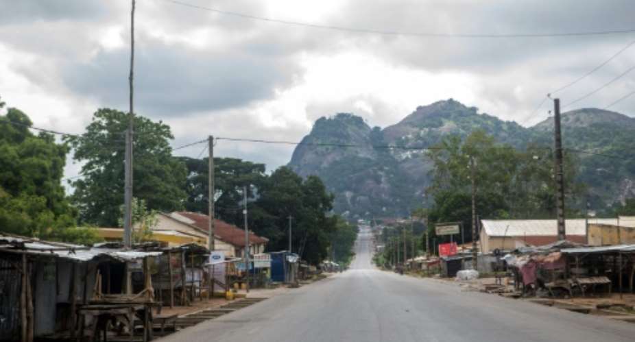
Things in the West African state have sure changed since 1957, and the old maps were left in the dust as the population nearly quadrupled and cities and towns expanded relentlessly.
Today, though, map-makers are proud to unveil a 21st-century digital chart that they hope will serve Benin for many years, helping to guide development and preserve its environment.
"It's the first complete map of (post-colonial) Benin, from the (Atlantic) ocean in the south to the Niger river in the north," says Roch Bah, director of the National Geographical Institute (IGN) of Benin.
"And we are the first country in French-speaking Africa to have one on the scale of 1:50,000," Bah adds, proudly.
For more than two years, two aircraft crisscrossed the skies to take high-resolution aerial photographs.
With these, some 30 Beninese cartographers used digital technology to map every waterway, road and building.
But that was just the first step.
Once an area was digitalised, teams on the ground had to trek through thousands of towns and villages to check on names, boundaries and the state of roads.
"We had the old maps," said Cyril Romieu, of Paris-based IGN FI, a geographic information company awarded the tender in 2014 to carry out the mapping.
"But names change when they're not written down. So we asked local elected representatives and the population.
"As for boundaries -- between the villages -- we drew those on the basis of what people told us," he said.
'Obsolete, unusable'
The project arose from work to safeguard trees around streams in Benin where deforestation can lead to flooding, pollution and greater poverty for local communities, according to the United Nations.
The study was subsequently extended to the whole country at a cost of 8.3 million euros ($9.3 million), financed by the European Union and the United Nations Development Programme (UNDP).
A comparison with French colonial maps of the 1950s shows the extent to which urbanisation has taken hold in Benin, a nation of about 11 million.
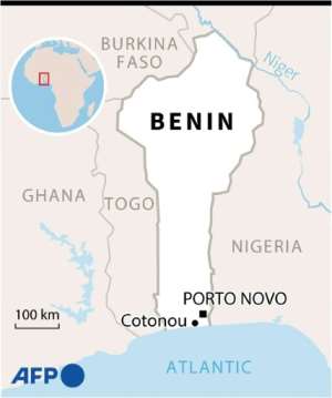 Map of Benin. By (AFP)
The capital, Porto Novo, has grown from a settlement along the Oueme river into a widely spread city.
The map-making process also revealed that there are approximately 1,550 health centres, 8,500 schools, 9,025 water sources and 9,400 places of worship dotted across the country.
In mid-April, the new National Map was presented to the Beninese authorities, who started to work with it at once.
"The old one was obsolete and unusable," said Minister of the Living Environment and Sustainable Development Jose Tonato.
"We are already basing ourselves on the new one, notably to pick the sites for the implantation of future markets."
Working with 'a jewel'
The website of IGN-FI, which operates globally, says the new map will provide crucial data for sustainable development.
Any urban planning project -- from infrastructure, transport, tourism and power supply to the impact on agriculture -- depends on accurate cartography and precise geographic statistics, says IGN FI's technical and quality director Aurelie Milledrogues.
"Once you know your territory well, you can properly think through changes and control them," she told AFP.
The map will likely prove to be a precious tool in the struggles against deforestation and the coastal erosion that threatens Cotonou, the economic capital, port and biggest city in Benin.
"We're going to get to know better our national spaces and to better plan our projects," said Aristide Adjademe, director general of Water, Forests and Hunting, for whom the map is "a jewel".
Freely accessible?
Some of the collated data has been put on the internet in French and English.
"Will we be able to have access to the full map for free?" asked Sam Agbadonou, president of the Open Street Map Benin association.
Several technology startups have asked the same question, in the hope of building the likes of tourism apps, which would require access to all the data.
For now, the whole National Map is only available on paper.
Geographer Vincent Orekan, a GPS expert and associate professor at Benin's University of Abomey-Calavi who took part in the mapping project, points out a new social need born of the work.
"In Benin, we're not used to reading maps," he said. "We need to raise awareness in the public."
 NDC demands complete overhaul of security protocols at EC to safeguard electoral...
 Ghana reaches interim deal with international bondholders — Finance Ministry
 Mahama to form joint army-police anti-robbery squads to safeguard 24-hour econom...
 Another man jailed eight months over shrinking penis
 Ghana to adjust external bond deal to meet IMF debt sustainability goals — Finan...
 IMF negotiations: We've not failed to reach an agreement with bondholders; we’ve...
 EC begins recruitment of temporary electoral officials, closes on April 29
 NPP lost the 2024 elections in 2022 due to inflation and cedi depreciation — Mar...
 Your good heart towards Ghana has changed; don’t behave like Saul - Owusu Bempah...
 Wa West: NDC organizes symposium for Vieri Ward Women
