
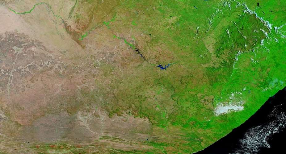
The most southerly parts of what have been called the Black/Sub-Sub-Saharan parts of the continent of Africa were once covered by large bodies of water at various times. Several millennia ago, this was primarily evidenced by Lake Makgadikgadi at ca. 10,000 Before Common Era (= BCE). Probably its greatest area is shown by fish of the cichlid variety. East African cichlids are thought to originate in Lake Makgadikgadi. A subsequent spread is shown by James Owen (National Geographic News 2005 & online). This reached the Great Lakes region of east Africa plus such rivers flowing eastwards into the Indian Ocean as the Zambezi and the Limpopo. Another to be added to this is the River Okavango (locally called the river that goes nowhere because it dribbles away into the Kalahari). So too is the River Congo that is west-flowing into the Atlantic Ocean.
This demonstrates an area that thought to be greater than that of Switzerland and to be of ca. 275, 000 square miles and is now principally the region of the Kalahari Desert. The drying out process is probably nicely shown by the words of Kalagare plus Khalaghare (= waterless place) from the language of the Tswana people naming the Kalahari. A major drainage feature here are the omuramba (= plural omurimba = dry riverbed in the Herero language) according to Wikipedia entries on related matters. The Kalahari is also described as the largest stretch of continuous of sand in the world
Easily the best known inhabitants of the Kalahari Desert are those severally known as the San, Khwe, Bushmen and innumerable other titles. The title used here is Khwe but the great number he of other labels is to be remembered. Another name to be borne is one seen to lie behind that of the Kalahari itself clearly attesting the drying out resulting from the increasing climatic deterioration.
A contributor to the New Advent Encyclopedia (online) confidently states the Khwe/Bushmen never fished. There is also an almost universal belief the Khwe never possessed boats. This in turn, would indicate Khwe did not fish from boats and a counterview is hardly helped by the faults in “Bushmen’s Art” (Erik Holm 1987) pointed out by John Parkington (The Digging Stick 1988).
The desertification already referred to resulted in inevitable economic changes and there are more than a few signs that the Khwe did possess boats and that they fished from them. Holm (ib.) described by this at Siloswane (Zimbabwe/Rhodesia). A scene noted by Ndukuyakhe Ndlovu (Incorporating Indigenous Management in Rock Art in KwaZulu/Natal online) at uKhahlamba (in the Drakensberg Mountains, South Africa) clearly shows this. More obvious still are the boats used for fishing by that branch of the Khwe called the Banoko (= River San) fishing from boats on the River Okavango. We probably need to be more tentative in accepting the thesis of Felix Chami (The Unity of African Ancient History 2005) of Khwe seafarers in alliance with Carthaginians but there are hints even here of seagoing Khwe.
Another possible line of evidence is the escape of a prisoner of decidedly Pre-Mandela days from Robben Island best known from having been where Nelson Mandela for so many years. This was by a Khwe leader named Automashata (= the Herry of the records of the Dutch colonial administration of Cape Colony in what is now South Africa). He seized a boat so rickety that it had been abandoned and made his escape in it to the mainland, which feat seems to have amazed his Dutch captors. Here maybe another strong hint there was more Khwe watercraft expertise here than is normally accepted.
The Khwe are usually recognised as having the oldest line of human genetics. A linguistic feature universally held to be as ancient is what is described as the “click” of Khwe plus related languages. For Graham Campbell-Dunn (Maori: The African Evidence 2007), these Click-tongues result from reduced prefixes from speakers of Niger/Congo (= N/C) tongues themselves ancestral to the Bantu languages.
In line with this would be the recognition of these N/C ancestors coming south in small groups as farmers growing yams plus palm-nuts not cereals, as argued by messrs. Diamond (How Africa Became Black in Discover Magazine 1994 & online), Lacroix (Africa in Antiquity 1998), Chami (The Unity of Ancient African Unity 2005), etc. To this are added the studies of skulls from Bambandyanolo (South Africa), Mapungubwe (South Africa), etc, showing Khwe and Bantoid affinities. They are mentioned in “A fragmentary skull cranium & dated Later Stone Age Assemblage from Lukenya Hill, Kenya” Richard Gramley & Philip Rightmire (Man 1973); in “Expansion of Bantu-speakers vs. development of Bantu languages in situ: an archaeologist’s perspective” by Richard Gramley (South African Archaeological Bulletin 1978), Felix Chami (ib.), etc.
It should also be noted that official sites online of Kenyan tourist authorities have seized on the reference to ports in east Africa from Sofala (Mozambique) to Ercoco (Eritrea) in Milton’s “Paradise Lost”. This was held to attest a very ancient maritime culture that if correct would be difficult not to identify with the sea-going Bantu called the Swahili. Also with those labelled as Ichthyophagi (= Fish-eaters) by Greeks and as said by such as Martin Horton (Antiquity 1992) to have initiated commerce on east African coasts. Here too may belong the views of messrs. Hall & Neal (The Ancient Ruins of Rhodesia 1902), Cooke (Human migration from the rock-art of Rhodesia [Africa 1965]), etc.
The views of Hall and Neal (ib.) have a certain irony given what they have written in the same book about the low cultural level of Africans in their opinion. However, Hall & Neal, Cooke (ib.) plus several others bring our attention to certain maps by Europeans. Among them are those of messrs. Sanuto/Sanudo (13th/14th c. Italian), Vesconte (13th/14th c. Italian), Mauro (15th c. Italian), Barbosa (15th c. Portuguese), Santos (16th c. Portuguese), Johnstone (16th c. English), etc. Of them, the Vesconte/Sanudo material is something of a surprise in that it shows what seems to be Robben Island in near-perfect relationship to the South African mainland and brings up the matter from whence comes such information.
Probably the greatest range of vessels of the Indian Ocean Region (= IOR) were from India. Particular vessel-types of India are forms of raft. They include the kattu-maran (= tied-logs) evidently giving way to two-hulled/double-hulled vessels plus that variously called a sangadam, sangada, jangada, etc. Bernard Sergent (The African Origin of Dravidians online) shows many Indian traits taken by sea to west Africa. This may have included double-hulled/double canoes shown by Stewart Molloy (in Blacks in Science ed. Ivan Van Sertima 1983) plus Michael Bradley (Dawn Voyage 1991) in west Africa. The jangada is said by Robert Bowen (Mariners Mirror 1956) to appear off the Brazilian coast owing nothing to the Pacific.
The expansion of speakers of Austronesian languages from “Indonesia” to islands of Micronesia in the west Pacific has its early phases traced by messrs. Haddon & Hornell (The Canoes of Oceania 1936-8). The raft-first/canoe-next migrants going east to Micronesia may be paralleled to that going west to Madagascar from combining from such as the rati (= rafts) described by Pliny with the several Roger Blench works about west-going Austronesians on the Indian Ocean. To Sergent (ib.) writing about Indian-type instruments in west Africa is added Blench (ib.) among those tracing Austronesians via more instruments, the nasty disease called elephantiasis, varieties of banana, etc, that are held to appear in west Africa.
Another possibility are Phoenicians either from the Lebanon homeland or those settled at Carthage (nr. Tunis = Carthaginians/Punics) or Gadir (= Gades/Cadiz, Spain = Gaditanians). Combining Herodotus (5th c. BCE Greek); Avienus (4th c. CE Romanised Gaul/Celt?); Hanno of Carthage (ca. 600 BCE); Eudoxus (2nd c. Greek) may show this. Herodotus says Phoenicians sailed round Africa; Avienus says Himilco of Carthage was sent to explore west Europe; Hanno wrote he was sent to explore west Africa (as said by Pliny & Macrobius); a vessel typical of Phoenico/Punics of hippos class was found by Eudoxus in east Africa found at Cape Delgado (?) on the Mozambique/Tanzania border facing the Indian Ocean.
That this continues is probably confirmed by the Indian ship close to the Table Bay/Cape Town region of western South Africa described on the above-noted map of Fra Mauro showing this of the 13th c. Something of the same is most likely shown by the vessel recreated from depictions in the Burobudur Temple (Indonesia) that successfully crossed the Indian Ocean then sailed round the southern tip of Africa to as far north as Ghana. Phoenicians said by Herodotus to have sent by Necho (Pharoah of Egypt) sent round Africa are said by James Wheeler (The Geography of Herodotus 1854) have spent time in southwest Africa. More Phoenico/Punics from Carthage plus Gades were chronicled on west African coasts by Hanno and are said by Pliny, Martianus Capella, Chami, etc, to have rounded Africa but is denied by most but then there is the hippos found in east Africa by Eudoxus.
This all indicates that passing from ocean to ocean by circumnavigating the southern tip of Africa probably occurred more frequently than the surviving texts now allow us to surmise. The Phoenicians said by Herodotus to have gone round Africa were sent out by Pharoah Necho of Egypt. It was said the sun was on their right for part of their three year journey, that they sowed and harvested crops en route and this includes places in east, southwest plus west Africa. Their report about the sun is held in modern times to prove authenticity and their knowing where to plant crops somewhere with growing seasons opposite to the Phoenician homeland of Lebanon shows some prior knowledge.
With the Table Bay/Cape region of what is now western South Africa apparently looming large in the eyes of the crews concerned, there is the matter of the source of the dissemination of the geographical knowledge noted already. One of the first European accounts of the Bay/Cape area of Cape Town is in the poetic form of Os Lusiadas (= the Lusiads) by Luis de Camoes (17th c. Portuguese). Cyril Coetzee (Myth of Adamastor online) is one of those noting Camoes building up of the Greek word of adamostos (= unconquered) into the giant named Adamastor. This giant was purportedly a member of the Greek giants called the Titans.
The Camoes version has Doris arranging a tryst between her daughter Thetis (= the Sea?) and Adamastor. The love-struck giant rushed to hug his beloved but he found himself hugging a rock that absorbed him to become Table Mountain overlooking Cape Town (Sth. Af.). One translation of Os Lusiadas has the Portuguese meeting Adamastor in the form of a monstrous storm-cloud threatening any ship passing what was Cabo das Tormentosa (= Cape of Storms) but renamed as Cabo da Boa Esperanca (= Cape of Good Hope) on Capes of Good Hope, Point and Agulhas finally past and passage from the Atlantic to the Indian Ocean achieved with all good hopes plus prospects ahead.
The Greek and Roman writers had a consistent habit of wishing Greco/Roman names on to the gods of the peoples they conquered. So this has a long European history behind it and Greco-Roman/Classical writers followed by Camoes would be no great surprise and is hardly the only example of this. In this case not only we have Atlas turned to stone by gazing at the head of a female (that of Medusa held by Perseus) but to his south was Umlindi Wemingizimu (= Watcher of the South). Umlindi too was a giant turned to rock by a female.
Another analogy is that as Atlas stands at the northern end of west-facing Africa, so Umlindi stands at the extreme south of Africa. His name is purely Bantu and is also the Bantu name for Table Mountain and is still invoked by Bantu fishing in Table Bay overlooked by the Mountain. The Bantu are to be seen as arriving in Cape Town no earlier than 1850 but that this plainly does not square with the aforementioned maps It will also be obvious that these Africans are a distinct possibility as the source of the information about the near-perfect locating of the tiny speck of land called Robben Island relative to Cape Town.
David Jones (The Origin of Civilisation 2007) has made a comparison of maps held to originate in that part of Africa in the northeast that is otherwise called Egypt and those equally to come from Sumeria/Babylonia. He concluded those of Egypt were the older and superior. Thomas Bassett (The History of Cartography Vol.2, Bk. 3 1998 ed. David Woodward & Malcolm Lewis) showed “Indigenous Map Making in Intertropical Africa” showed accurate maps drawn by Africans in sand at European behest. Few made it on to paper but that drawn on the orders of Mohammed Bello for (Sultan of Sokoto, Nig.) for Captain Clapperton seems to be as accurate as any of the much-admired maps drawn for Hernan Cortez (16th Spaniard). Joan Covey (Af. Presence in Early America ed. Ivan Van Sertima 1999) describes “African Sea Kings in Early America?: Evidence from Early Maps”.
What this leads to is the conclusion that the most probable source of the information about Robben Island appearing on a map showing Islamic influence but drawn by a European but from a place unknown to either Islam or Europe at the date required is African. Some hint of a past maritime expertise here comes with Chami’s (ib.) arguments about distinctly Pre-European sailing on southwest African coasts, the Automashata/Herry episode, etc.
What is epitomised by Umlindi in the Europeanised guise of Adamastor in what are in any case treacherous sub-tropical seas bring us to another point. This is what has been written about such as the surmised mega-flood forming the Black Sea; the 2004 tsunami starting on side of the Indian Ocean but affecting the east African coast, etc. Just what this can mean is neatly summed in the title of a now-online TV-film titled “Prehistoric Megastorms-Noah’s Great Flood”. We can now fully appreciate why Umlindi is still invoked almost in god-of- the-sea/tutelary protector by Bantu fishermen at sea.
East Africa
Mention of the 2004 tsunami is but one example something starting on one side of the Indian Ocean coming to affect the other side. Another evidently began in East Africa in that there is general agreement that true mankind emerged first in southern Africa and as Homo sapiens (= Thinking Man) there too. Here too may be further remnants of the one-time great bodies of water in parts of Sub-Saharan Africa to be seen in the form of the Great Lakes region of east Africa. The oldest known manmade tools were named as Olduwan after material revealed by excavations at Olduvai Gorge (Tanzania) but which appear to belong to the same horizon as those known as scattered finds on the salt-pans of what was once Lake Makgadikgadi.
Another placing of humankind as early in east Africa was as far back as the Creation described in that book of the Old Testament according to the long poetic commentary by John Milton (Paradise Lost 1674). This includes ports from Sofala (Mozambique) “thought to be Ophir” to Ercoco (= Arkiko, Eritrea). Accounts of the “snowy mountain” from which at least one of the Great Lakes plus the tributaries feeding what became the River Nile were very vaguely known to the Classical world.
This continued till the 19th c. and the days of David Livingstone plus John Hanning Speke and is taken by official sites of Kenyan tourist agencies to indicate a considerable antiquity for east African civilisation, so accords with suggestions that (a) the Bantu had arrived very much earlier than normally accepted; (b) that so too had the mainly Bantu seafarers called the Swahili had emerging on the Indian Ocean coasts of east Africa.
Probably the best of all Great Flood myths are those of Atlantis best known from the retelling by Plato (5th c. BCE) plus that of Noah retold in Genesis. The notion of Okeanos (= the Ocean = World-stream) is one that goes back to at least the geographers of ancient Greece and regards a world-stream enclosing all the land of what we now call the Old World. This makes it possible to locate Atlantis nearly anywhere on the planet and this has actually taken place. In this regard, it may be that the tiny islands of the Mauritius, Seychelles plus Comoros groups can be regarded as the equivalents in the Erythraean Sea (= western Indian Ocean) of such as Madeira, Azores plus Cape Verde groups in the Atlantic Ocean.
There are instances of the Indian Ocean drowned-lands due to sea-floods. Most famously, they include Sahulland, Sundaland plus more claimed off the Indian coast such as Kumari. However, notions of an Erythraean Sea version of Atlantis are hardly helped by what has been written about Lemuria.
The concept of Lemuria came about at roughly the time when “The Origin of the Species” by Charles Darwin. The term was coined by another British scientist names Philip Sclater. It was based on his perception of the distribution of the small primate called that he saw as stretching from Madagascar to Malaysia. The name was enthusiastically taken up by the early Theosophists led by Helena Blavatsky.
The Theosophists applied Lemuria to what was otherwise called Mu in the Pacific. To be taken more seriously is another aspect involving Madagascar. Such stories as “Did a Comet Cause the Great Flood?” by Scott Carney (Discover Magazine 2007 & online) report that “chevrons” attest the track of a comet on the west coast of Madagascar that caused flooding worldwide. Here too is another relevant version of myths about Great Floods that are again worldwide.
It is noted by Pierre Verin shows “The African Element in Madagascar in Azania 1976; Cultural influences & the contribution of Africa to the settlement of Madagascar in Historical Relations across the Indian Ocean, UNESCO 1980)”. However, this is probably more accurately put to the Comoro Islands just to the north of Madagascar or even more strictly, the Mojomby Islands that according to this myth once lay between the Comoros plus Madagascar on one side of the Mozambique Channel and Mozambique plus Tanzania on the other. It contains most of the traits normal for at least western forms of Great Flood myths, namely impiety towards a deity or deities, general sinfulness of the population, punishment decided on, that punishment taking the form of a flood, etc.
Another theme common to at least the western forms of Great Flood myths is the sending out of birds to espy dry land. Just how closely this also marries with maritime traditions is well demonstrated in “The Role of Birds in Early Navigation” by James Hornell (Antiquity 1946). One example not attached to one of these myths but touched on by Hornell (ib.) is a reference by Cosmas Indicopleustes (= C. the Traveller to India). Cosmas (7th c. CE Egypto/Greek) described being in a ship en route from east Africa to India. His ship was caught up in a storm so fierce that it had to head to port at Opone/Hafun (Ethiopia). The sight of large seabirds showed they were close to port.
Birds used for the purpose of navigation at sea falls into two major classes. That reported by Cosmas was of spotting birds that nest on land near coasts (especially when going home to evening roosts). Shelley Wachsmann (Seagoing & Seamanship in the Bronze Age Levant 2009) refers to the category of captive birds that echoes the Mid-east tales of Utnapishtim, Zuisudra/Xisuthros, Noah, etc. Gerald Tibbetts (Arab Navigation in the Indian Ocean before the Coming of the Portuguese 1971) showed more use of birds for the purpose of navigation at sea during later voyages also on the Indian Ocean at a period that was still mainly pre-instrumental.
East Africa has yet more Great Flood myths that in a Kenyan version starring Tumbainot of the Masai according to Mark Izaak (Flood Stories from Around the World online). He is told to build a wooden ship, it floated for a long period on the waters of the ensuing flood with his family plus specimens of all the beasts of the world aboard but who were otherwise drowned. He sent out a dove to espy dry land but which came back tired. He then sent out a vulture with an arrow tied to its feathers, the idea being if the arrow snagged on something that it can be presumed that dry land was emerging. Confirmation that the divine will had been placated seemingly came with rainbows in the sky marking the basic points of the compass.
There has been a tendency in the past to explaining similarities of Great Flood myths as being reflective of Christian and/or Muslim sources. It is very probable they attest worldwide contacts of considerable antiquity and there are clearly influences from those directions but this ignores the very separate elements of the local forms of such myths. They are plainly demonstrated by the Tumbainot story but the version of Noah plus Ark contained in the Ethiopian version of the Old Testament that is the Kebra Negast (= Book of Kings) very clearly follows the major Judaeo/Christian pattern of this story.
Ethiopia also figures in another flood-tale. It has Poseidon (the Greek sea-god) angered by Cassiopeia who was the wife of Cepheus (King of Ethiopia) and mother of Andromeda. Poseidon sent a flood in retaliation that submerged the kingdom of Cepheus plus Cassiopeia. They offered up their daughter as a sacrifice and this mollified Poseidon but all ended happily, as Perseus rescued the chained-up Andromeda. It should be noted that the Aithiopia/Aethiopia can refer to all Africa or what is now called Black Africa (as opposed to Libya that again can be the whole continent or that called the Magreb or Saharan Africa (= north Africa west of Egypt).
Whatever can be said about Great Flood myths in east Africa, undoubtedly the most famous of them surely is that of the River Nile. It is held to flow through the countries of Tanzania, Kenya, Uganda, Ethiopia, Rwanda, Burundi, Democratic Republic of Congo, Sudan, Egypt, etc. This makes the point that the River Nile is an African not just an Egyptian river.
On the other hand, the Nile is most famous from its section flowing through Egypt and not for nothing is there the much-cited comment by Herodotus (5th c. BCE Greek) emphatically stating that Egypt was the gift of the Nile. This is because of the black silt left by the Nile flooding and the word of Kemet (also Khamet, Kamet, Kam, Kem, etc). This has prompted considerable discussion as to whether this means just black soil/land and/or black people.
When the description of that part of Atlantic-west Africa facing the Gulf of Guinea became applied to a large island of the southwest of the Pacific Ocean as the New Guinea, it clearly owed nothing to the land and everything to the people. Staying with the west of the Pacific, when the term of Melanesia (= Islands of Blacks) was coined that it too was based on the people not the soil/land will be very obvious. In any case, a legend of the Shilluk people of the Nile region is cited by Meres Weche (Planet of the Greeks) as more or less settling the argument.
It goes Juok (= the supreme god of the Shilluks) wandered the world and finding white clay made men; finding Nile mud made brown/red men; finding black mud made the Shilluks plus other Blacks. An interesting sidelight on this comes with the Greek label of Melampodes. It is said by workers in studies of the ancient Greeks to mean Black-legs/feet and to come from stomping seeds into the fertile Nile mud. In a description of the crews of Aegyptiad (= Egyptian) ships, Aeschylus (6th. BCE Greek) contrasts the black skins of the sailors and the whiteness of their tunics.
Nothing surely could be plainer than the fact that the term of Khemet referred to both the people and the land of Egypt. Indeed, this is made very obvious by the hieroglyphs in the role of determinants following that symbolising the word of Khemet/Khamet to indicate both land and people. This also emerges from the Hebrew word of Ham also meaning black. It evidently fits with the Genesis plus Exodus accounts of the earliest Hebrew/Jewish history being very much an Egyptian affair.
The Egyptian origin-myth has Nu or Nut presiding over the world as covered in water and as lifting up other gods in a vessel above the water, so provides exactly the imagery plus name for No(ah) also staying above the water in his vessel. The watery morass of the Nile floods are the probable origin of whatever lay behind the Atlantis myth first known from the writings of Plato (ca. 5th c. BCE Greek) who reports that this story originated in Egypt.
Western Africa
Reports about large bodies of water are well attested in the region that is covered by what John Sutton (Antiquity 1972; Journal of African History 1978) defined as the Aqualithic. This is roughly what is otherwise called the Sahara and may approximate with what is now called the Magreb. It should be borne in mind the Sahara and Magreb do not equate precisely but is more or less north Africa west of Egypt and in being so is regarded as distinct from what many authors have labelled as Sub-Saharan or Black parts of the continent that are both part of. Further to bear in mind that though this is mainly west of Egypt and is therefore is being dealt with under the label of “Western Africa”, this does not equate with “west Africa”.
The way that Lake Makgadikgadi apparently dried out to become mainly the Kalahari Desert plus above-noted salt-pans in southern Africa seems matched by what seem to have occurred in the once verdant Magreb turned now-dry Sahara. There are differences in what was involved. Not the least of these is that the deterioration in climate in the Sahara probably happened over millennia but seemingly did so in a shorter time-period than the corresponding southern processes.
Another major difference may be what was left behind after the climatic deterioration. If the distribution of the fish called cichlids truly represents the one-time extent of the lakes plus rivers across southern Africa, there are the Great Lakes of east Africa plus the now mainly separated rivers stretching across from east to west Africa that still have cichlids swimming in their waters. The one-time equivalents in the Magreb/Sahara are proven by aerial plus satellite photographs that have now vanished to be represented by playas (= dry lake-beds) plus wadis (= dry riverbeds).
It is generally believed the Nile may once have flooded much wider areas than it does presently. Those further to the east combine with the carvings of ships in the now-dry wadis to form a major part of the mainly now-lost Dynastic-race arguments. Those to the west are the subject of a short article by Alice Linsley (Water Systems Connected Nile & Central Africa online). She also provides click access to a much fuller account of the large bodies of water covered by the Linsley (ib.) article.
What for Greek tradition is Lake Triton is thought to be presently to be seen in the marshes of southern Tunisia called the Chotts or Shotts. It can be assumed that something like a half-way stage is represented by what is written by James Brunson (African Presence in Early Europe ed, by Ivan Van Sertima 1985 & 2000) about the description of Lake Triton by Diodorus Siculus (1st c. BCE Greek-speaking Sicilian).
The Siculan description of Lake Triton is of a portside city with a swampy hinterland and a not dissimilar one is given by Augustine of Hippo (4th/5th c. CE Magrebi). This enabled Brunson (ib.) to directly compare the Lake Triton scenario with scenes of the wall-art of Akrotiri (on the Aegean island of Thera = Santorini) as part of his case that there was a strong African presence in what are now the Greek islands of the Aegean Sea. If this holds true, this indicates that from the period of Aegean prehistory called the Middle Minoan (= MM = ca. 2150/2100- ca. 1500 BCE) beyond the 1st c. BCE of Diodorus to the CE dates just given for St. Augustine, The drying-out of the Magreb into the Sahara is still to be observed.
To the west of the Nile was yet another of the lakes of giant size, this time it is a Lake Chad that was so large that it has been called Lake Mega-Chad or the Chadic Sea. Probably the most famous element in what elsewhere has been called the Wadi rock-art mainly of what is now called the Nubian or Eastern Desert is the ship-motif. There has long been debate as to whether the vessels depicted in the Egyptian wadis are of the reeds of papyrus type or are planked vessels of wood. The consensus is that they represent forms of reed-boat that when seen west of Egypt are again just one of several motifs in Saharan rock-art.
Other motifs include the so-called Fishing-god of Sefar (Algeria) that may relate to a half-fish/half-man deity of across the Sahara that Clyde Winters (Atlantis in Mexico 2005) labels as Maa. This Maa may have further reflection in such ethnonyms as Maasai in east Africa plus Mande of west Africa. This in turn may marry with what Linsley (ib.) wrote about water-systems seen as once extending westwards from the Nile to the shoreline of a one-time lake now only known mainly as a dried out playa. On the far side of this lake/playa were rivers connecting with the Rivers Benue plus Niger in west Africa.
Linsley (ib.) rather oddly has it that the reed-boat is the watercraft of nobles on Lake Chad. There is no anthropological or archaeological evidence supporting this. The reed-boats built by the Buduma on Lake Chad were the model for that called Ra I constructed for Thor Heyerdahl (The Ra Voyages 1971). They were apparently the basis of Buduma piracy on Lake Chad for millennia, which does little for indicating aristocrats. It can be noted though Ra I going east/west plus Abora going west/east across the Atlantic just failed or failed almost totally respectively, Ra II succeeded very superbly.
Linsley (ib.) usefully describes the dugout-canoe found on the western edge of Lake Chad, as reported by Peter Breunig (Aspects of African Archaeology ed. G. Pwiti & R. Soper1996). Breunig gave dates of ca. 8000 BCE (7670 +/- 110, 7260 +/- 55) resulting from measurement of what scientists call carbon-14 (= C14-dates). Breunig (ib.) also gave C14-dates for the variously labelled pirogues, dugout-canoes, almadias, monoxylons, logboats plus umpteen other terms that had been found in several parts of Europe at the time of his article.
Breunig (ib.) thought the sophisticated construction of Dufuna indicated a very long tradition behind it. He also compared the Dufuna vessel with the European canoes and concluded that Dufuna represented a stage of early canoe-building showing greater skills than most European coevals. This means that canoe-building is not among the innumerable items compiled over a lengthy period that according to a very long list of numerous Euro./U.S. writers just had to have been introduced from outside Africa by non-Africans.
They have among them numerous items that include several relating to matters nautical. An old theory apparently originating with Flinders Petrie (summed up in The Making of Egypt 1939) and more recently in the Test of Time books of David Rohl was that of the Eastern/Dynastic Invaders came in “square” ships from Sumeria (= south Iraq) by sea and came to conquer Egypt. The Rohl (ib.) contribution to this comes with the equally controversial Velikovsky-type chronology that rattles the cages of workers in Egyptology, Assyriology, Hebrew studies, Hellenists, etc. Quite apart from criticisms from messrs. Kitchen (various works), McFall (Review of Rohl 2009 & online), Wood (A view from Palestine online), etc, pointing out that Rohl tends to accept only his own interpretations.
Ironically, it seems the cruncher against the Rohl chronology are the dates showing the ships of the alleged foreigners called “Square-boat” people appear as depictions on pottery of Pre-Dynastic Egypt alongside those of “native” ships at dates upwards of 2000 years earlier than the supposed invaders. The fact of Milton describing above-noted ports of that are now cities in east Africa from Mozambique to Somalia was seen to have to been taken up probably a little too enthusiastically.
On the other hand, it seems there is a growing body of evidence that this may have substance behind it after all. Other articles in this series have cited expert testimony saying the Khwe and Proto-Bantu coexisted in southern Africa for very considerably longer than is usually accepted. Where what Milton described and these expert views do coincide is in the sea-going Bantu called the Swahili. This feeds into the argument that this means that here too, seafaring result from purely indigenous processes emergent long before generally acknowledged and connects with developments evidently affecting both sides of southern Africa.
The much-cited articles by James Hornell that he felt showed Austronesian/Indonesian influences on east Africans include the comment that those of the Great Lakes had no sails. Likewise, west Africans are normally accepted as not knowing how to use sails before the arrival of Europeans. Of the inhabitants living around Lake Chad, the Buduma are known to construct watercraft having no sails.
This overlooks a number of things. One is that old matter of Africans are only ever in receipt of improvements from the outside and never as initiators. Shallow and/or sheltered waters are the most likely to have users least likely to benefit from the use of sails. In the case of the Nile, it has long been recognised that from the circumstance of a north-flowing river plus mainly south-blowing winds led to a gradual adoption materials out of which evolved sails proper.
It has already been said the Nile is an African not an Egyptian river, as the river stretches more than 4000 miles deep into Africa. Running more or less in parallel is the Red Sea coast of east Africa and here we observe the likelihood that Egypt-to-Punt most probably involved voyages between somewhere in east Africa (esp. Somalia?) and Egypt. Linking the Nile and the Buduma of Lake Chad is the building of papyrus/reed-boats. Thor Heyerdahl (The Ra Voyages 1971) being said to have proven that the papyrus ships of ancient Egypt were capable of crossing oceans by having taken Ra II successfully across the Atlantic has doubters. However, traditions taken up as back as Eratosthenes (3rd c. BCE) showed Nile-type reed-craft also as ocean-going by regularly sailing on the Indian Ocean between Egypt and India.
It is true that the rope seen in Egyptian tomb-art was not recognised by Heyerdahl as a hogging-truss acting to hold stem and stern taut and prevent both drooping into the water. It was this that was the major factor in Ra I starting to sink ca. 600 miles short of the Caribbean islands called the Bahamas. Nor did Heyerdahl take account of the depicting of the young green reeds used to construct ships in Egypt and used aged brown reeds instead. Another factor may have been that the Buduma builders of Ra I were more used to boats appropriate to the shallow waters of Lake Chad not the deeper waters of the Atlantic Ocean. Also that Heyerdahl merely showed that Scandinavians were good sailors yet the age-old Nile reed-ship as far back as Eratosthenes (3rd c. BCE Greek) was regularly seen on the Indian Ocean.
The extensive water-systems that Linsley (ib.) plus others were seen to refer to connect Nile floods to Lake Mega-Chad/Lake Chad then the Rivers Benue and Niger. Nor should it be overlooked that the headwaters of the Senegal plus Niger are not very far apart and to be borne in mind are the various Pre-European traffic across the Sahara described by several Classical and Islamic writers. This includes the interesting legend of west African magicians called on by Egyptian Pharoahs according to the authors of the Tarikh es-Sudan (= History/Chronicle of the Sudan).
This would have taken the west Africans across hundreds of desert sands no less trackless than going across hundreds of open sea. The Sahara noted as a sea (of sand) is emphasised by the semi-Sahara to the south of the desert being called the Sahel (= Shore/Coast in Arabic), the more so given as Sahel is but a version of the word of Swahili who as seafaring Bantu once again identify with the sea.
So too does what emerges from the well known contrast of what happened to Persian and Greek groups en route to Siwa (Egypt) in the Sahara. The more so given the description by Rossella Lorenzo (Vanished Persian Army said to be found in desert online) of Persians drowned in sand. The contrast emerges from Herodotus (5th c. BCE Greek) writing about the Persians and Diodorus Siculus (1st c. Sicilian Greek) doing so about the Greeks respectively.
The Persians were led by Cambyses II on a successful invasion of Egypt ca. 525 BCE. Herodotus says Cambyses was annoyed at the Siwa refusal to acknowledge his conquest of Egypt and sent 50,000 troops to destroy the oracle at Siwa. Herodotus also wrote that a sandstorm smothered the troops and it is this that prompted the Lorenzo (ib.) comment about the Persian army being drowned by sand. The Lorenzo article also bore a title indicative of the fact that some archaeologists regard the remains of the Persians have been found.
It has also been said that a contributing factor to the Persian losses was that their guides left the troops. The Greeks described by Diodorus Siculus (= D. from Sicily) were those led by Alexander the Great who was not only coming to honour the Siwa oracle but also came to be acknowledged by the Siwa priests as having conquered Egypt. The Greeks also lost their way but were guided to the oracle according to Diodorus Siculus
Siwa was on the western periphery of ancient Egypt with an Egyptian presence in the region held to be shown by a series of anti-Libyan forts proven in the case of Umm el-Rakhal evidently built in the later 20th Dynasty of Pharoahs (by Rameses II?). Also probably by the Egyptian god called Amon/Amun honoured and naming the shrine at Siwa in the Greek form of Ammon said by Herodotus to equate with the Greek Zeus honoured at Dodona. The latter is also given a 2nd millennium date, vaguely by Herodotus and the excavations proving Mycenaean finds there.
A further analogy between the twinned shrines of Siwa and Dodona comes with Herodotus telling us that both were founded by birds. The above-noted east African languages having sounds of clicks are said by Chami (ib.) to relate to those put on east African islands by Euhemerus and in the Magreb/Sahara by Herodotus. The latter tells us that these “birds” were in fact humans with bird-like speech. This was applied to Troglodytes also described as Ethiopian by Herodotus. A similar sound was attributed to the variously spelt Tibu/Tibbu/Toubou naming the Tibesti Mountains (mainly Chad) by their Berber neighbours. The identification of the Ethiopian Troglodytes with the Tibu is made the stronger by Troglodytes apparently meaning Cave-dwellers and Tibu meaning Rock-dwellers (?).
The linkage of Siwa plus Dodona shrines dedicated to Amon and Zeus respectively is furthered by Jona Lenderer (Ammon [Siwa] online) saying Amon was the Counsellor and that the Dodona shrine was dedicated to Zeus Bolens (= Z. the Counsellor). Also by the fact of the birds-as-humans seen as the founders of both Siwa plus Dodona in both cases were black. This in turn brings us to the birds leading Alexander to Siwa. The more so when to this added Charles Meek (Journal of African History 1960) saying the Siwa oracle was on land owned by the Nasamones he translates as Negroes of Ammon.
In the same light is a 12th c. Arabic text that Ivan Van Sertima (They Came Before Columbus 1976) called the Toffut al-Alabi. He says it describes the great caravanserai being guided across Saharan sands by Saharan blacks. This was because they knew the ways of the stars and birds. Hornell (ib.) is one of those showing Gomez Zurara (15th Portuguese) confirming Saharan use of birds in navigation “in the way we do at sea”.
Van Sertima (ib.) shows the principle was known to the Malian Empire based in Mali, Mauritania, Senegambia (= Senegal & Gambia), etc. John Dyson (Gold, God & Glory 199 ) records Christopher Columbus (15th/16th c. Italian working for Spain) noting more birds marking the islands off west Africa called the Cape Verdes. Jean Barbot (17th/18th c. French) describes more birds to be seen at sea off the coast of west Africa evidently matching the above-noted large seabirds seen off the coast of east Africa by Cosmas Indicopleustes.
The destructive nature of storm plus flood has been mentioned several times above. Where it pertains to Great Flood that include Atlantis, attempts at squaring the
Genesis and Atlantis are frequently made. Probably one of the most likely is to treat that of Noah described that book of the Old Testament called Genesis as that occurring worldwide with that of Atlantis as containing the Atlantic episode of this worldwide flood. Alternatively, they in turn could just be forms of the basic Great Flood story.
Unfortunately, there just is no geological, archaeological or any other evidence for a worldwide. As to Atlantis, there was either several places called Atlantis or it moved around a lot. In this respect, it would join Mu/Lemuria. This is because various places around the world have been “proven” to be Atlantis. They include some highly unlikely places. There are several ambiguities about what Plato (5th c. BCE Greek) says about where Atlantis was. Nearly all the numerous proposed locations around the Mediterranean can be safely ignored for being too small.
As to the position suggested being beyond the Pillars of Hercules (= Strait of Gibraltar) between what are Morocco on the south and Spain on the north. This puts Atlantis firmly out into the Atlantic Ocean but once again confusion reigns because of interpretation of Plato’s words. He wrote that it was as large as Asia plus Africa combined but even this apparently clear statement is the subject of equivocation. As Asia plus are our largest and second largest continents respectively, this would give a mega-continent far too big to fit the Atlantic Ocean. This is worked round by the supporters of Atlantis saying that what Plato meant by “Asia” is what was then known as Asia Minor but is now mainly Anatolia (= most of modern Turkey = Asian Turkey). Also that Plato’s Africa was what once named as “Libya” (= the Magreb = north Africa west of Egypt), as this was all that he plus nearly all other Greeks of his day knew. This does not especially help to convince.
Atlantis was in the “Libya” of antiquity according to Paul Borchardt (cited in articles on “Hanno” plus Atlantis by Livio Stecchini (online). Stechinni more specifically says Borchardt placed Atlantis in the Ahaggar Mountains (mainly Algeria). A favourite candidate for being Atlantis is still further west in that part of “Libya” or Magreb that was ancient Mauretania but is now mainly Morocco (ca. 400 miles north of modern Mauritania). A bit further to the west of what was ancient Mauretania/is now mainly today’s Morocco brings us to a claimant that is even more popular for being Atlantis.
This is Macaronesia consisting of the small island-groups otherwise called the Azores, Madeira, Canaries plus the Cape Verdes. A once common type of ancient forest now known only as remnants of Laurisilva (humid subtropical laurel forest) unites these tiny archipelagos. On the other hand, not only are they all volcanic in origin but they have been regarded as the rocky remnants of Atlantis. Another uniting factor is the suggestion that Macaronesia comes from the Greek term of Makaron Nesoi (= Fortunate Islands = Isles of the Blessed).
As applied to the Canary Islands, the Fortunate/Blessed Isles would be at known to the Greeks but the three other groups are supposedly unknown to the ancient world. This would be confirmed by Ptolemy being able to give the coordinates for the Canaries. The reports of islands that are cited as having had buildings but no people held to originate with Juba II of Mauretania (1st c. BCE), al-Idrissi (12th c. Tunisian), etc, are usually seen as in the Canaries. Buildings but no people may suggest seasonal fishing-camps that if applied to the Cape Verdes would meet objections by Elisee Reclus (The Earth & its Inhabitants 1897); Lacroix (ib.), etc. The most likely source of local fishermen would be from Senegal but they state that canoes from there would be swept back to the coast.
Lacroix (ib.), Denis Rawlins (in the Distillate of the Diller study of Ptolemy online) plus others are among the several pointing out the coordinates given by Ptolemy for the Canaries do not actually fit but do accord with that of the Cape Verdes. The Canary Islands have had a permanent population for millennia before the account by King Juba (coming down to us via Pliny), so are unlikely to have been the islands where there were buildings but no inhabitants.
In this way, it seems that Pliny (1st c. CE Roman) and Ptolemy (2nd c. CE Egypto/Greek) are wrong about their knowledge of the Cape Verde Islands. The History of Cape Verde (on Wikipedia) has it the Cape Verde Islands figure as islands called the Gorgades in Pliny and Pomponius (1st c. CE Greek). A further identification comes with the Isles of the Blest mentioned by Marinos of Tyre (1st c. BCE?); Ptolemy plus others, the more so given that Rawson (ib) could state very plainly “that the Cape Verde Islands… are very firmly identified with the Blest Isles”.
Diller/Duke (ib.) tells us the knowledge of where the Cape Verde Islands were indicates a maritime hero of the stature of Leif Erikson or Christopher Columbus. This could not have been an African on the basis of what we have seen was written by Reclus (ib.) plus Lacroix (ib.). To this is added comments west African canoes could not master the treacherous waters between the mainland of Guinea-Bissau and the island part that are the Bissagos/Bijagos Islands and many will be familiar with films in which Tarzan dives into the water and easily overturns a dugout-canoe full of Africans.
Reclus (ib.) arrived at his conclusion despite citing Luis Feijo holding contrary views. Feijo was the bishop of the Cape Verdes for some years and collected traditions of the Africans in these islands. They told of such Senegalese fisher-folk as the Lebou, Serer, Wolofs, etc, seasonally fishing in the islands and seasonal fishing-camps would do something to explain islands having structures but no population. There are Islamic reports of trips to collect salt from one of the Cape Verde Islands. This was once known as Aulil but was later renamed as Sal from the collection of salt help to confirm this. Further proofs were recorded by Columbus.
As to west Africans not being able to negotiate the narrow channels between Bissagos Islands, this seems exampled by Diego Gomes (18th c. Port.) deciding this could not be done by European ships according to George Brooks (Exploration in the World of the Middle Ages 2003). The problems of a French crew with a Bissagan pilot cited in “Eurafricans in Western Africa” by Pamela White et al (2005) may be where Bissagans not being to navigate these channels.
That this Bissagan pilot was not in the line of the Carthaginian captain sinking his ship so that knowledge of Carthaginian commerce were kept seems not to have occurred to this source. Elsewhere in west Africa, Mohammed Bello telling Capt. Clapperton the Niger flowed one way but gave a map that it flowed in an opposite direction seems another example of this.
As to the west African dugout-canoe not being up to coping with the narrow channels between the island and mainland parts of Guinea-Bissau, it is surely legitimate to wonder where the Africans enslaved by the Portuguese in the Bissagos Islands came from. The more so given the Wilson article on “Vowel Harmony in Bijago” (Journal of West African Languages 2001) shows the dialect of some islanders had become unintelligible to the others.
This of itself surely strongly tells for a population in the islands long before the arrival of the Portuguese. Moreover, there are the online comments that canoe-based fleets were the basis of the resistance towards the Portuguese. Also this seems to have been amongst the most successful resistance by any African people against European invaders in that it kept the Portuguese at bay for 400 years. Added to this is that Bijago canoes evidently were the basis of an effective sea-borne commerce.
There are several sources proposed for the name of Senegal but the most popular etymology is that based on sunugal (= [place of] of canoes) in the Wolof language of Senegal. A town of Senegal is Barakunda that seems to be based on the word of bara indicative of boats too. According to Diop (ib.), Djahi was an Egyptian and Wolof word for Phoenicia plus Senegal respectively. It should be recognised that Djahi apparently meant Place of Navigation.
It will be obvious this realisation accords with what was written by the non-African sources of al-Umari, Columbus, Lindemann, etc. Chihab Al-Umari (14th c. Syrian) recorded the sending of fleets to seek the other side of the Atlantic at the height of the Malian Empire that ruled Mali, Senegal, etc. Christopher Columbus spoke about black traders leaving the Cape Verde Islands and this repeated on Caribbean islands on the far side of the Atlantic. The seaworthiness of the west African dugout-canoe is surely proven by the crossing of the Atlantic Ocean in one by Hannes Lindemann (Alone at Sea 1958).
By the time of the decline of the Malian Empire, the first Portuguese were starting to make contact with Senegal plus Mali. An early account of such efforts was by Duarte Pacheco Periera. The translation of this was by messrs. Markham and Prestage (Hakluyt Society 1897). One comment they made was about a large body of water inside the borders of what today is Mali. This they thought was a possible description of the Middle River Niger in flood.
With the mouth of the River Niger we are with that part of the coast of west Africa facing the Atlantic called the Gulf of Guinea. A more specific part of the Gulf of Guinea is the Bight of Benin also naming the once powerful empire Benin Empire. It apparently once ruled from somewhere near the River Douala (= the Cameroon) up to the River Volta (Ghana). In more recent times, the name of Benin has been acquired by the country once called Dahomey.
The Niger also figures in interpretations touching on details of both the Hanno plus Atlantis stories. Having seen Africans are the most likely source of information about islands at almost the most southerly extreme of Africa, that about more islands approaching the shores of Atlantic-west Africa, etc, we come to the Great Island noted by Hanno. Stecchini (ib.) held that Hanno was trying to get in contact with what he described as the great civilisation of Benin
Stecchini also touched on an episode in Hanno’s account of his voyage known only from the précis titled “Periplus of Hanno” or the Voyage of Hanno. This is the episode in which Hanno approached the “Great Island” that Stecchini would identify with islands in Lagos Harbour (Nigeria). We have already seen that Umlindi as the Watcher in the South indicates that Africans were fully aware to the dangers from sea-borne invaders by warning them off. The Great Island episode of Hanno would represent another warding off of a perceived threat on the interpretation by Stecchini (ib.) plus others. Carl Christian Reindorf (History of the Gold Coast 1895) also refers to sea-borne invasions of yet another part of west Africa. The Reindorf (ib.) accounts speak of these invaders being African and they again involve being turned into rock.
The lagoons stretching extensively past what was the island of Lagos were part of what prompted Leo Frobenius (The Voice of Africa 1913) to look to the Yoruba parts of Nigeria as Atlantis. For Frobenius (ib.), the lagoons were the canals of the Atlantis myth. He also wrote that that the plants of Atlantis included one that could liquid for drink, could be eaten as food, useful oil-based functions, etc, plus another that was easily spoilt that he held were the palm-nut and the banana respectively. Frobenius (ib.) would add Yoruba legends about drowned cities out to sea that he saw as echoing the Atlantis myth.
The linguistic divergence of Yoruba and Igbo are among what are called Kwa-group tongues with the split held to occur at BCE dates. This may have included such as the orichalu-ukame (= precious stone/metal) that Acholonu (ib.) says occurs as the alloyed metal called orichalcum in Plato’s Atlantis. This would be reinforced by the Yoruba deity-name of Yemoje (& many other spellings) possibly seen on the far side of the Atlantic as Yemoye (= Jamaica). Also by the comparison of the head of a young Yoruba woman and that of one of the figurines in the Von Wuthenau Collection (see Early America by Van Sertima
Frobenius further brought the name of the Yoruba god called Olokun (= Lord of the Sea) into this. Olokun was the Yoruba god of the sea and Yemoje (the goddess of the Niger) was his wife. Olokun was yet another deity who felt slighted by the impiety towards him by the Yorubas and yet again decided on punishment that yet once more was take the form of the world being flooded. Other members of the Yoruba pantheon of gods stopped him.
Mention has been made to the three volumes of Before Adam series of books by Catherine Acholonu. She has also summarised these views in several shorter works mainly on the Migration and Diffusion site. Reference has been made to Kwa-group languages. What has been called Proto-Kwa apparently included Igbo, Yoruba, Igala, Idoma, Edo, Ashanti, etc. Another point in common between what has been written about the relationships of Igbos and Yorubas is that they have both have been seen as being Atlantis. Frobenius (ib.) saw the lagoons of the Yorubaland in the role of the Atlantean canals and Acholonu (ib.) did so for the creeks of Igbo parts of Nigeria.
The Acholonu work draws from that of Immanuel Velikovsky who in turn was part of a movement wanting to radically alter generally accepted history. This would place such as Khufu (= the Cheops of the Greeks) down to the 7th c. BCE and if he was the builder of the Great Pyramid, this presumably antedates this. On a related matter, we find Ramesses II fighting Sea-Peoples who turn out to be Persians. It can be noted there is little allowance for the Kushite/Nubian period of rule in Egypt. Ancient Greeks are still fighting fellow-Greeks after ca. 1100 CE in the Peloponnesian War.
It also seems the followers of these schemes love various pairings. Thus all Greek plus all Roman history comes from texts composed after ca. 1700 CE. Christianity and Islam are inventions postdating ca, 1600 CE. There are comparisons of charts of the Jewish Kingdom (acc. to the Bible) and the Holy Roman Empire (= Proto-Germany); of Jewish Kingdoms between 922 BC to the New Era and Holy Roman Empire of X-XII cents.; 1st period of Roman Episcopate and 2nd period of Roman Episcopate. Another comparison is of Napoleon in the early 19th c. and Hitler 1940s leading to World War II because both were dictators. However, on this line of thinking, can we be sure that World War II has happened yet?
What this means for various structures dated as ancient remains unclear. We can look at the most visible structure of the Romans in Britain in the form of Hadrian’s Wall separating Britannia (= Roman-ruled Britain [= roughly Eng. & Wales]) and Caledonia (= non-Roman Brit. [roughly Scot.]) and the most visible monument of antiquity in the form of the Great Wall of China. Presumably as Roman history is but an invention of the 16th c., Hadrian’s Wall becomes the garden wall of someone with a very large estate. We need not wonder about whether the Great Wall would have been visible from space anciently, as on the school of thought being looked at, it postdates ca. 1950 A.D.
Such earthen structures as The Black Pig’s Dyke separating ancient Ulster (not the present 6-county Northern Ireland) from the rest of Ireland and the Eredo of south Nigeria may also be pondered on. We now are supposed to consider the Irish Gaels formerly regarded as the builders of the Dyke are as non-existent as all other Celts. For those still wanting to query existing acceptance of chronology, dates in Africa will provide hours of endless fun (inc. those for Egypt).
The more so given that we can read what is written in “The Phantom Voyagers” by Robert Dick-Read (2005) about 10,000 Yoruba professors that all disagree with each other. Stressing this is the attaching of the Eredo to the figure of the Queen of Sheba. “Sheba” is the Queen of Sheba in the Old Testament; the Shulamite Princess in the Song of Songs, the Queen of the South in the New Testament; Nitocris in the Jewish Wars by Josephus (1st c. CE); Makeda in the Kebra Negast (= the Ethiopian version of the Bible); Bilqis in the Koran; Bilikusa Sungbo (Nigerian folklore).
These umpteen names do not help matters. Neither does the fact that the Eredo being tied to Sheba belongs to folklore. Whether this can be compared with the widespread spellings of such as No/Noe/Nu in Egypt plus Nai/Nit/ (Wu)-no/(Bor)-nu as various forms of the name better known as Noah remains very uncertain at best.
Given these many efforts at drastically shortening chronology, it has interest that Acholonu comes with one that often seems way too long. Her insistence on all world civilisation emanates from the Igbos brings up the difficulty of an insistence on single-source attributions. The more when to this is added Velikovsky, UFOs, space beings Erich Von Daniken, etc.
One the other hand, all theories can stand to be queried and Acholonu does so with the Shaw dating of Igbo Ukwu. This is an African subject restudied by African scholar who is a University professor. Her conclusions bring us back to the Genesis Flood, Noah and his Ark. Acholonu’s “The Gram Code of African Adam (2005) has it that in Igbo Nuwah/Nnawah (= Father of the World) lies the origin of the Hebrew Noah in the role of a Post-Flood Patriarch. Acholonu (ib.) regards this as having spread across the Asian continent to China and the Pacific as Nuwah, so would repeat the claimed worldwide and international nature of the Great Flood.
Harry Bourne (2012)
 Former Kotoko Player George Asare elected SRC President at PUG Law Faculty
 2024 elections: Consider ‘dumsor’ when casting your votes; NPP deserves less — P...
 You have no grounds to call Mahama incompetent; you’ve failed — Prof. Marfo blas...
 Don’t exchange your life for wealth; a sparkle of fire can be your end — Gender ...
 Ghana’s newly installed Poland train reportedly involved in accident while on a ...
 Chieftaincy disputes: Government imposes 4pm to 7am curfew on Sampa township
 Franklin Cudjoe fumes at unaccountable wasteful executive living large at the ex...
 I'll 'stoop too low' for votes; I'm never moved by your propaganda — Oquaye Jnr ...
 Kumasi Thermal Plant commissioning: I pray God opens the eyes of leaders who don...
