
The Global Positioning System (GPS) is a satellite coordinated position identification system that recognizes ones location or the location of objects and their inter-relations. Using the GPS system, a person or an object’s position could be identified and per its relationship with everything else, it is possible to direct another entity to the former or vice versa. That being said, within some margin of error, it will be difficult if not impossible for anyone or anything to be hidden.
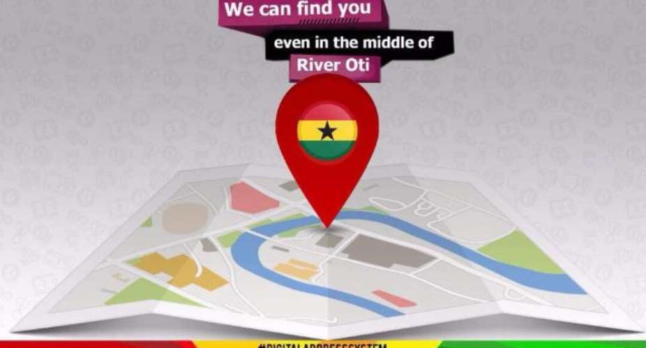
The Ghana Digital Address System is Ghana’s open gate to the world of digital surveillance. This article will seek to outline the process by which an accurate data could be obtained for Ghana and ensure the robust assimilation of this system on a global scale. The writer might take some liberty and swing some security concerns with respect to an understanding of intelligence and it’s interest in such a huge undertaking.
Let’s consider the system as it is currently: User’s are required to download the GPS app and enter name (1st and last names) and phone number for verification. Of course the location service on the phone must be turned on for access and accuracy. The system divides the Ghanaian landscape into a 5m*5m squares, each of which has a unique digital address in codes. This allows the system to identify ones location within 3m radius accuracy.
Therefore, in order for one to be located, they must first and foremost know their own digital address, acquired from their unique code on the app, and then share it with whomever requires directions to the former. The outline above is basically the general pseudocode of the GhanaPostGPS app though the algorithm might be a little more sophisticated.
Before anyone praises or apostrophizes the creation and launching of this app, kindly pull your phone, download google earth or apple map, waze or even google maps and see if such a digital code does not already exist on these apps with even better accuracy.
How would I have Designed this had I been the brain behind GhanaPostGPS?
1: All Properties, as a task of the Ghana Lands Commission and Surveyors or GIS engineers so employed, will be re-addressed in the following manner:
i: All Streets are accurately named, What used to be the block/plot numbering system (outdated as it is) will turn into Streets, Roads, Avenues, Courts, Lanes etc.
ii: Each street name must reflect the history of the community, absorbing the collective history of Ghana and leaders within those communities whose contribution to its growth are accurately documented.
iii: All allotted plots are given numbers beginning from the start of the street name and numbered till the end of that street.
iv: The streets and Properties thus named, A 3D digital camera, mounted on a vehicle can be used to take photographs of the properties and used for street views. Satellite images will supplement the global purview of the app.
2: This being done, the GhanaPostGPS app can now make more sense. Thus the 5m *5m square division of the landscape can now add an algorithm that accommodates the plot sizes of allocated properties. Each plot is therefore going to fall within 20 by 20 or so of the 5m*5m squares. Hence a plot say :Plot 18 Block C, Adenyase( Sawaba) Kumasi Ghana will now be say: 700 Sakafiya Lane, Adenyase, Kumasi, Ghana. Or the same address could otherwise be 700 Sakafiya Street, Adenyase, Kumasi. It can be interpreted as the 7th building on the Sakafiya Lane or Street, as named, and the “00” is just to accommodate any future possibilities of turning the current housing structure into apartments like is extant in global housing structures.
It must be mentioned as a matter of fact that the 5m*5m square landscape division is an unnecessary complication that was possibly used to evade the possible mention that there was plagiary in the design of the app. The global landscape is already marked and accurately so by longitudes and latitudes of which each stretch of land already falls points within such demarkations. All we needed to do was to appropriately name the streets and and number our plots and the rest would have been a historic leap.
Lets up our game as a nation. We can do better.
As promised, the writer would here put in a note on intelligence gathering of data under the guise of service to our people. There is no need for an app’s user to register his name and phone number for verification purposes unless a security need was required. What will the captured data be used for and by whom? For what and Why? How would such data be utilized by the developers of the app, the NCA and the National Security Agency? Intelligence is all about information gathering, synthesis, analysis and utilization.
The types of Data required for the creation of intelligent business environment and formal business economy for Ghana would not in anyway be feasible with the current app. To create such an environment, requires the capturing of the biometric data of every Ghanaian, unique personal identifiers: unique ID number marching biometrics and the physical address generated above.
How can the system help Ghana
With the New Addressing system so designed, Ghana Postal Services will be revitalized, commerce will be enhanced and business will have enough incentives trade globally and receive door-to-door mail service. It must be mentioned that the courier service is a multi-billion dollar industry if rightly structured. Banks and financial institutions will then have confidence to trust holdings and loans upon citizens without fear of losses. All other communicated benefits as mentioned by the Minister of communications will then be feasible.
The national Identification programs will also benefit immensely with this noble undertaken.
By Sadick Abubakar
United African Congress Inc.
USA
[email protected]
 Dumsor: Mathew Opoku Prempeh has been disrespectful, he should be fired – IES
 NPP prioritizing politics over power crisis solution — PR Strategist
 E/R: Gory accidents kills 3 persons at Aseseaso, several others critically injur...
 Nobody can come up with 'dumsor' timetable except Energy Minister – Osafo-Maafo
 Dumsor: You ‘the men’ find it difficult to draw timetable when ‘incompetent’ NDC...
 We’re working to restore supply after heavy rains caused outages in parts of Gre...
 NPP government plans to expand rail network to every region — Peter Amewu
 Dumsor must stop vigil part 2: We’ll choose how we demonstrate and who to partne...
 2024 elections: NDC stands on the side of morality, truth; NPP isn't an option —...
 Akufo-Addo has moved Ghana from 'Beyond Aid' to ‘Beyond Borrowing’ — Haruna Idri...
