
Ghana has won the case in which Cote d'Ivoire was seeking compensation whilst laying claim to portions of huge oil and gas reserves located around the maritime boundary between the two countries in the Western Region.
The five-member panel of eminent judges at the International Tribunal for the Law of the Sea (ITLOS) based in Hamburg, Germany was unanimous last Saturday in its judgement in respect of the dispute concerning delimitation of the maritime boundary in the Atlantic Ocean.
The decision of the Special Chamber of the ITLOS is expected to bring an end to any dispute over the maritime boundary between the two countries since the judgment is deemed final.
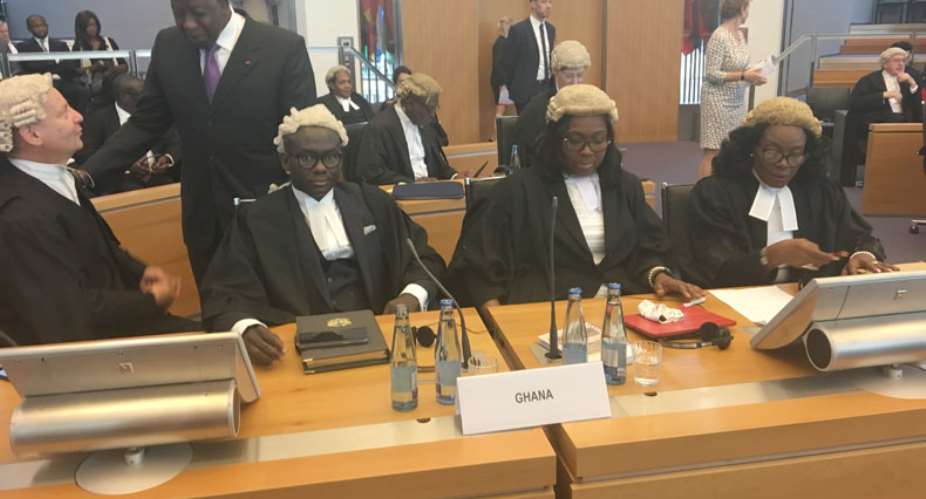
Attorney General Gloria Afua Akuffo, who led Ghana's legal team, introduced the members.
They included her Deputy, Godfred Yeboah Dame; Solicitor-General, Helen Awo Dziwu; Professor Phillipe Sands who is Ghana's lead International Lawyer and Fui Tsikata, among other top lawyers.
Final Boundary
The Special Chamber ruled that to delimit the new maritime boundary, it would use a new Land Boundary Terminus (LBT) that it had set at BP55plus, thus rejecting the different LBTs (geographical coordinates of BP55 in the case of Ghana and 168 degrees azimuth line in the case of Cote d'Ivoire), put forward by the two countries respectively in the course of the trial.
In effect, the court has generated a new base point with which to draw the final boundary, which it said is an Equidistance Line Boundary covering the Territorial Sea – the Exclusive Economic Zone in the area beyond 200 nautical miles – and experts have said it looks good for Ghana as far as exploration of oil and gas resources are concerned.
Per the judgement, Cote d'Ivoire has lost almost every claim against Ghana, except the order by the Special Tribunal for the two countries to re-demarcate the maritime boundary; but will be of no significance as far as the huge claims put forward by Ghana's neighbour is concerned.
“The new and final maritime boundary line protects Ghana's existing concessions,” an unnamed source told DAILY GUIDE immediately after the judgement, adding, “It protects all areas belonging to Ghana which go up to the 200 nautical miles limit in the area beyond 200 nautical miles up to 350 nautical miles.”
Tacit Agreement
Ghana appeared to have lost the argument of Tacit Agreement moved against Cote d'Ivoire, which it said confirmed the full scope of over 50 years of joint activities between the two countries regarding the maritime boundary.
Although Ghana lost that argument, it turned out that it was the display of the maps brought by Ghana that largely aided the Special Tribunal to come to the conclusion that the maritime boundary line should be drawn using the BP55plus coordinate.
Cote d'Ivoire, in its quest to get the maritime boundary re-demarcated, appeared to convince the court that Jomoro in the Jomoro District of the Western Region, is an island or a kind of a peninsula, but the court dismissed the claim saying the Ivoirians themselves had always recognized the fact that Jomoro has been Ghana's bonafide territory.
Consequential Orders
The Special Tribunal summed up the whole judgement in seven key points and in all of them it was unanimous in dismissing the case brought by Cote d'Ivoire.
It unanimously found that it has jurisdiction to delimit the maritime boundary between the parties in the territorial sea, in the exclusive economic zone and on the continental shelf – both within and beyond 200 nm.
The tribunal also unanimously found that there is no tacit agreement between the parties to delimit their territorial sea, exclusive economic zone and continental shelf both within and beyond 200 nm, and rejected Ghana's claim that Côte d'Ivoire was estopped from objecting to the customary equidistance boundary.
The tribunal further unanimously decided that “the single maritime boundary for the territorial sea, the exclusive economic zone and the continental shelf within and beyond 200 nm start at BP55+ with the coordinates 05° 05' 23.2” N; 03° 06' 21.2'' W in WGS 84 as a geodetic datum.”
It said that the geodetic datum should be defined “by turning points A, B, C, D, E, F with the following coordinates and connected by geodetic lines: A: 05° 01' 03.7” N 03° 07' 18.3” W,
B: 04° 57' 58.9” N 03° 08' 01.4” W, C: 04° 26' 41.6” N 03° 14' 56.9” W, D: 03° 12' 13.4” N 03° 29' 54.3” W, E: 02° 59' 04.8” N 03° 32' 40.2” W as well as F: 02° 40' 36.4” N 03° 36' 36.4” W.”
It held that “from turning point F, the single maritime boundary continues as a geodetic line starting at an azimuth of 191° 38' 06.7'' until it reaches the outer limits of the continental shelf.
International Responsibility
The court unanimously found that it has jurisdiction to decide on the claim of Côte d'Ivoire against Ghana on the alleged international responsibility of Ghana and unanimously found that Ghana did not violate the sovereign rights of Côte d'Ivoire.
The tribunal “unanimously, finds that Ghana did not violate Article 83, paragraphs 1 and 3, of the Convention,” adding it “unanimously finds that Ghana did not violate the provisional measures prescribed by the Special Chamber in its Order of 25 April 2015.”
Ghana's Submission
It was Ghana's submission that the two countries had mutually recognised, agreed, and applied an equidistance-based maritime boundary in the territorial sea, EEZ and continental shelf within 200 M and that the maritime boundary in the continental shelf beyond 200 M followed an extended equidistance boundary along the same azimuth as the boundary within 200 M, to the limit of national jurisdiction.
Ghana insisted that in accordance with international law, by reason of its representations and upon which Ghana has placed reliance, Côte d'Ivoire was estopped from objecting to the agreed maritime boundary and that the land boundary terminus and starting point for the agreed maritime boundary is at Boundary Pillar 55BP 55.
Cote d'Ivoire's Submission
In its final submission, Côte d'Ivoire requested the Special Chamber to reject all Ghana's requests and wanted a declaration that the sole maritime boundary between the two neighbours followed the 168.7º azimuth line, which it said, starts at boundary post 55 and extends to the outer limit of the Ivorian continental shelf.
It sought a further adjudication that the activities undertaken unilaterally by Ghana in the Ivorian maritime area constituted a violation of the exclusive sovereign rights of Côte d'Ivoire over its continental shelf, as delimited by the Chamber, as well as the obligation to negotiate in good faith, pursuant to Article 83, paragraph 1, of UNCLOS and customary law.
Cote d'Ivoire had insisted that Ghana did not respect the obligation not to jeopardize or hamper the conclusion of an agreement, as provided for by Article 83, paragraph 3, of UNCLOS and had wanted a declaration that Ghana violated the provisional measures prescribed by the Chamber per its Order of 25 April, 2015.
They also wanted the Special Tribunal to invite the parties to carry out negotiations in order to reach agreement on the terms of the reparation due to Côte d'Ivoire.
Case Chronology
The dispute was submitted to a special chamber formed in application of Article 15, paragraph 2, of the Statute of the Tribunal by way of a special agreement concluded between the two states concerned on 3 December, 2014 and on 25 April, 2015. The Special Chamber delivered its Order on a request for the prescription of provisional measures filed by Côte d'Ivoire.
Further to the closure of the written proceedings, hearings on the merits of the case took place from 6 to 16 February, 2017.
Case History
When Ghana discovered oil in commercial quantities in 2007, Cote d'Ivoire said Ghana was straying into its waters in the course of the exploration exercise in the West Cape Three Points.
Cote d'Ivoire came again with a renewed set of claims in 2010, including compensation from Ghana for entering into its territory when the Dzata-1 Deepwater Well was discovered by Vanco.
Ghana then constituted the Ghana Boundary Commission sometime in March 2010 after Cote d'Ivoire had petitioned the United Nations over the oil exploratory activities and requested for a demarcation of the maritime boundary.
After about 10 high-level negotiations between Ghana and Code d'Ivoire had yielded no dividends, Ghana filed a petition before ITLOS in 2014, asking the special tribunal to look into the matter and bring finality to the case.
Cote d'Ivoire responded, adding a counter-claim, including the payment of reparations from Ghana and appealed to the special tribunal to suspend all activities on the disputed area until the final determination of the case.
The first ruling given by ITLOS was in 2015 when it placed a moratorium on new projects that were being undertaken by Ghana, but said the old projects could continue.
The moratorium prevented Tullow Oil from drilling additional 13 wells. Tullow, thus, drilled 11 wells in Ghana's first oil field.
From William Yaw Owusu, Hamburg, Germany
 There’s nothing you can do for us; just give us electricity to save our collapsi...
 Ghanaian media failing in watchdog duties — Sulemana Braimah
 On any scale, Mahama can't match Bawumia — NPP Youth Organiser
 Never tag me as an NPP pastor; I'm 'pained' the 'Akyem Mafia' are still in charg...
 Your refusal to dedicate a project to Atta Mills means you never loved him — Kok...
 2024 elections: I'm competent, not just a dreamer; vote for me — Alan
 2024 elections: Forget NPP, NDC; I've the Holy Spirit backing me and nothing wil...
 2024 elections: We've no trust in judiciary; we'll ensure ballots are well secur...
 Performance tracker: Fire MCEs, DCEs who document Mahama's projects; they're not...
 Train crash: Railway ministry shares footage of incident
