
Regions
- Home
- Greater Accra
- Central Region
- Western Region
- Ashanti Region
- Ghana Districts
- Eastern Region
- Volta Region
- Brong Ahafo Region
- Northern Region
- Upper East Region
- Upper West Region

Relevant Links
Media Links
Ghana Western Region
Introduction
The Western Region covers an area of approximately 2,3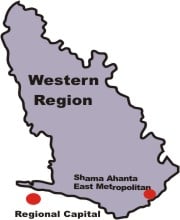 91 square kilometres, which is about 10 per cent of Ghana’s total land area. The region has about 75 per cent of its vegetation within the high forest zone of Ghana, and lies in the equatorial climatic zone that is characterized by moderate temperatures. It is also the wettest part of Ghana with an average rainfall of 1,600mm per annum. It is bordered on the east by the Central Region, to the west by the Ivory Coast (Côte d’Ivoire), to the north by Ashanti and Brong-Ahafo Regions, and to the south by the Gulf of Guinea. The southernmost part of Ghana lies in the region, at Cape Three Points near Busua, in the Ahanta West District.
Socio-demographic characteristics
The population of the region is 1,924,577, constituting about 10 per cent of the total population of the country. With a population growth rate of 3.2, the region’s population is expected to double by 2020. The population is relatively young, with over 40 per cent within the age group 0-14, and a dependency ratio of 88.3 per cent. The population density is 80.5 persons per square kilometre. Females constitute 49.2 per cent of the population, translating into a sex ratio of 103.4. The proportion of urban to total population is 36.3 per cent, with the three most urbanised districts being Shama-Ahanta East (100%), Bibiani-Anhwiaso-Bekwai (37.5%) and Wassa West (35.6%).
There are five major indigenous ethnic groups, namely, the Ahantas, who form 6.3 per cent of Ghanaians by birth in the region, Nzemas including the Evalue (10.6%), Wassa (11.7%), Sefwis (10.9%) and Aowins (2.5%). It is worth noting that 18.2 per cent of Ghanaians by birth in the region are Fantes, even though these are not indigenes of the region, but are settlers who migrated several years ago from the Central Region, and have subsequently totally integrated into the indigenous population.
There is freedom of religion in the region; however Christianity (81%) and Islam (8.5%) are the two major religious groups. The Pentecostals constitute the largest single Christian group (26.1%), followed by the Protestants (19.5%) and Catholics (19.4%). Other Christian groups constitute another 16.1 per cent. Islam (8.5%) is practised mainly in Aowin-Suaman (10.4%), Sefwi-Wiawso (10.1%) and Juabeso-Bia (12.4%), all three being districts with significant migrant populations from the mainly Islamic northern parts of the country, particularly the Mole-Dagbon areas. Traditional African religion is also practised by 1.5 per cent, while 8.2 per cent of the population profess no religion.
The level of literacy in the region is 58.2 percent, with females (47.9%) recording a lower proportion compared to males (68.0%). Nearly two-thirds (64.3%) of those currently in school are at the primary level, while 21.3 per cent are in junior secondary school. There is therefore a very high attrition rate between primary and junior secondary school levels. Several reasons account for the high dropout during the transition from primary to junior secondary. These include the unavailability of junior secondary schools within many rural localities, resulting in pupils having to travel 10 kilometres or more to the nearest junior secondary school. Other important factors are affordability and poor infra-structural facilities. In recent years, however, there has been a tremendous effort to improve both quality and quantity of infrastructural facilities of primary and junior secondary schools.
The number of houses in the region is 259,874 as at 2000. More than half of the houses belong to household members who either rent them out to paying tenants, or permit family members to live in them without any charge. Most houses, particularly in the rural areas, are constructed with sun-dried mud bricks with cemented floors and corrugated metal roofing materials.
There are 410,412 households in the region, which gives an average of 1.6 households per house. Of these 72 per cent are male-headed as against 28 per cent headed by females. The number of persons per household is 4.7 as compared to the national average of 5.1. Many households in the urban areas have access to electricity, while a relatively small but significant number of rural households are gradually gaining access through the rural electrification programme. Those without electricity use mainly kerosene as lighting fuel. Fuel for cooking is mainly charcoal and firewood, even though liquid petroleum gas and electricity are used by some urban dwellers. Potable water, either treated pipe-borne water or water from deep boreholes, is available mainly in urban areas. The rural areas obtain water mainly from rivers, streams, small lakes, springs and shallow hand-dug wells. Potable water is however gradually being made available to rural communities through the sinking of deep boreholes.
Marriages are either formal or informal unions. Those in such marriages constitute 52.8 per cent of the marriageable population (15 years and older), while 36.6 per cent have never married. There are more divorced and widowed females than males. The greater proportion of widowed females is due probably to females normally marrying older males who then die earlier and leave them widowed. Widowed females tend generally not to remarry while widowed males generally remarry.
Economic characteristics
The region is endowed with considerable natural resources, which give it a significant economic importance within the context of national development. It is the largest producer of cocoa, rubber and coconut, and one of the major producers of oil palm. The rich tropical forest makes it one of the largest producers of raw and sawn timber as well as processed wood products. A wide variety of minerals, including gold, bauxite, iron, diamonds and manganese are either being exploited or are potentially exploitable. The region’s total geological profile and mineral potential are yet to be fully determined.
The four major occupations in the region are agriculture including fishing, animal husbandry and hunting (58.1%), production and transport work (14.5%), sales work (10.2%) and professional and technical work (5.4%). The major industrial activities in the region are agriculture, excluding fishing but including forestry and hunting (58.1%), mining and quarrying (2.4%), manufacturing (10.2%) and wholesale and retail trade (10.3%). The working population in the private formal (13.5%) and the public (6.0%) sectors are mainly employees of private and public sector employers.
They constitute 17.0 per cent of the economically active population. Of those within the legally permissible working age group (15 years and older), self-employed persons (72.9%) make up the majority of the economically active; 68.3 per cent have no employees working for them while 4.6 per cent have employees.
Demographic characteristic of Districts
There are significant differences in the population densities of the various districts. The most densely populated district is Shama-Ahanta East (958.9 per sq km). It also has the largest share (19.2%) of the region’s total population of 1,924,577. Juabeso-Bia (12.7%), Wassa Amenfi (12.2%) and Wassa West (12.1%) also account for substantial proportions of the region’s population, but they are sparsely populated.
The regional capital, Sekondi, as well as the harbour and industrial city of Takoradi, constitute the twin city of Sekondi-Takoradi, and are located in the Shama-Ahanta East metropolis. Aside of the metropolis, districts with fairly large urban populations are Wassa West (35.6%) and Bibiani-Anhwiaso-Bekwai (37.5%). These two districts have major mining and manufacturing industries such as wood-processing and metalwork foundries, which require both intensive labour and technical personnel. The rest of the districts are predominantly rural. The road network of the region is relatively poor, making many of the rural districts rather inaccessible, especially during the rainy season when many of the areas including some important cocoa growing areas are inaccessible to vehicular traffic.
In 8 out of the 11 districts, there is a higher proportion of males than females. The three districts with higher proportions of females, Shama-Ahanta East (50.5%), Bibiani-Anhwiaso- Bekwai (50.9%) and Ahanta West (51.6%), also have high proportions of persons engaged in wholesale and retail trade, which is a major preserve of females all over the country. The age-structure of all the districts depicts the same pattern of a high proportion of persons between ages 0-10, reducing as age increases.
The migration pattern is basically internal. Inter-regional migration is relatively low. Female non-migrants out-number their male counterparts in all the districts except Ahanta West and Bibiani-Anhwiaso-Bekwai. The region, however, attracts many male migrants, mainly to the cocoa-growing and mining areas.
Social characteristics of Districts
Generally, children of the head of household constitute about 40 per cent or more of all households members. In all the districts, there are more male-headed households than female-headed households. In all the districts except Juabeso-Bia, 90 per cent or higher of the inhabitants are Ghanaians by birth. The Akans, who include the indigenous Wassas and Sefwis, and the migrant Fantes, constitute more than two-thirds of Ghanaians by birth in every district.
The Western Region has seen some improvements in educational attainment and enrolment rates at the basic level over the last two decades. For instance, the proportion that had attained basic education increased from 28 per cent in 1984 to 34 per cent in 2000. Over 70 per cent of the population in most districts have attained basic education (primary and junior secondary/middle school). Beyond junior secondary, enrolment and attainment levels are not very encouraging.
At the senior secondary school level, Shama-Ahanta East has the highest attainment level (13.6%) followed by Jomoro (10.5%), while the lowest (6.2%) is in Wassa West. The regional average is 12.1 percent, far below the national average of about 17 per cent. Attainment at post secondary level and beyond is also still very low. In terms of literacy, apart from Shama-Ahanta East (29.3%) and Wassa West (37.4%), which recorded relatively low levels of illiteracy, all the districts have levels much higher than the regional average of 45.7 per cent. The highest illiteracy levels are in Juabeso-Bia (58.7%) and Aowin-Suaman (57.7%).
Economic characteristics of Districts
The Western Region is one of the most economically active regions in the country. Both agriculture and industry feature prominently in the region’s economic activities, and influence the demographic complexities of the various districts. The economically active population in all the districts except the Shama-Ahanta East metropolitan area exceeds 70 per cent. The lower figure for Shama-Ahanta East may be due partly to the relatively high percentage of students in the district. The level of unemployment is generally low. The unemployment rate as observed is below 10 per cent in all the districts. The relatively high unemployment rate in the two industrialised urban districts of Wassa West and Shama- Ahanta East may be due to the large number of unemployed but unskilled school leavers who drift annually from the rural areas in search of non-existing jobs.
In general, male unemployment is higher than female unemployment. This is particularly so in the urbanised southern districts of Shama-Ahanta East and Wassa West, while the reverse is the case in some of the northern districts such as Bibiani-Anhwiaso-Bekwai, Sefwi-Wiawso, Aowin- Suaman and Juabeso-Bia. Agriculture is the principal occupation, engaging a large proportion of people (50% or more) in all districts, except Shama-Ahanta East (19.2%) and Wassa West (44.5%). People in Shama-Ahanta East and Wassa West are engaged mainly in production and transport work, sales and services.
More than two-thirds of the economically active population in all the districts of the region are made up of self-employed persons with no employees, except in Shama-Ahanta East (50%). The active population in Shama-Ahanta East consists mainly of employees who work for a public or private employer. Agriculture (excluding fishing) remains the biggest industrial activity in the region, employing more than 50 per cent of workers in all districts except Jomoro (46.4%), Shama-Ahanta East (14.5%) and Wassa West (45.8%). In all the districts, the private sector (both formal and informal), provides employment to more than 80 per cent of the working population
Housing Condition
The main construction material used for the walls of dwellings in most districts is mud/mud brick, with the exception of Shama-Ahanta East where 67.0 per cent of the dwellings are constructed with cement or concrete blocks. The corrugated metal sheet, the main material for roofing, is used extensively in 9 of 11 districts. Thatch/palm leaf roofs are however used extensively in Jomoro and Aowin-Suaman, where this type of material is cheap and abundant. A high proportion of people (42%), located mainly in six districts, stay in compound houses. Shama-Ahanta East, particularly Takoradi, has very huge compound houses with single rooms and shared toilet and bath facilities, which are rented out to several individuals or families, normally as single-room or sometimes up to three-room entities. Some of these houses can have as many as 40 rooms in the entire building, and there can be as many as 100 persons living in any one such building. This phenomenon contributes significantly to the very high households to house ratio in that district. There is therefore congestion in many houses, creating an inner-city slum situation.
In Shama-Ahanta East, 42.7 per cent of the population live in houses owned privately by other individuals (renting) while another third live in their own houses. Rural districts like Wassa Amenfi (71.7%), Juabeso-Bia (71.9%) Jomoro (69.5%) and Nzema East (68.7%) have higher owner-occupied houses than Shama-Ahanta East (33.6%). Bibiani-Anhwiaso-Bekwai (44.0%) and Wassa West (51.0%), which have lower proportions of owner occupied houses, probably due to the large numbers of migrants, who are likely to rent dwelling units rather than owning houses.
More than 60 per cent of all dwellings in every district have cement screeding as the main floor material, except Aowin-Suaman (48.9%) and Juabeso-Bia (43.7%). In Aowin-Suaman the commonest floor material is earth (50.1%), while 41.2 per cent of houses in Juabeso-Bia have earth floors. Shama-Ahanta East also has a few dwellings with wood (1.6%) or Terrazzo/ceramic tiles (2.4%) as the floor materials.
The main sources of lighting are kerosene lamp and electricity. Between them they provide lighting for about 99 per cent of households in the region. In the urban areas of Shama- Ahanta East (83.2%) and Wassa West (56.5%), the majority of households use electricity while in the rural districts, kerosene-fuelled lamp is the source of lighting for majority of households. About 1.0 per cent of dwellings in Juabeso-Bia use solar energy, which was introduced to the district on a pilot basis to study its feasibility in rural areas.
Source of water
In the region as a whole, only 32 per cent of houses have access to treated pipe-borne water with only 8.5 per cent having this available within the dwelling place. In Shama-Ahanta East about 88 per cent have access to pipe-borne water while another 9.0 per cent have access to wells or boreholes. Hence in this highly urbanized district, there is almost 100 per cent availability of, or accessibility to potable water. Although about 40 per cent of dwellings in Wassa West have access to pipe-borne water, about 25 per cent use rivers or streams as their source of water. The situation in these two highly urbanized districts is in sharp contrast to rural districts such as Aowin-Suaman where over 60 per cent of households use rivers, streams, dugouts, spring or rain water as their main source of water, with only 8.7 per cent having access to processed pipe-borne water. About 50 per cent of the dwellings in Bibiani- Anhwiaso-Bekwai, Sefwi-Wiawso, Juabeso-Bia, and Ahanta West use wells as their main source of water.
In Wassa Amenfi, Aowin-Suaman, Nzema East and Jomoro, about 60 per cent of households use natural sources or wells, whilst the remaining 10 per cent use pipeborne water located outside the dwelling places. Programmes to intensify provision of potable water, particularly in the rural areas, will need to be intensified to minimize the prevalence of water-borne diseases such as diarrhea diseases, filariasis, guinea worm, schistosomiasis, and typhoid, which are very common in the region.
Toilet facilities
The availability of toilet facilities seems to be a major problem in the region, as about 40.0 per cent of dwellings in the region have either no toilet facility or use a public toilet. Only four districts, namely Mpohor-Wassa East (57.9%), Aowin-Suaman (62.8%), Juabeso-Bia (67.5%) and Sefwi-Wiawso (52.7%), have most of the households with a toilet facility in the dwelling unit, in the form of a pit latrine, a KVIP, a bucket or pan or a water closet (WC). Even in these districts, most of these in-house toilet facilities are ordinary pit latrines, constituting about 50.0 per cent in each case. The remaining 40.0 per cent use public toilets, which may include KVIPs or pit latrines. On the other hand, Ahanta West and Jomoro districts have 40.0 per cent or more of households with no toilet facilities at all and normally use the beaches and outlying bushes for such purposes.
The pit latrine is also used extensively in the rural areas of Mpohor-Wassa East (44.5%), Wassa Amenfi (43.5%), Aowin-Suaman (57.9%), Juabeso-Bia (48.3%) and Sefwi-Wiawso (45.0%). Because of the unhygienic nature of the pit latrine and the bucket or pan system, these must be phased out and resources and education be directed to promotion of the KVIP for such rural areas. The W.C. is used by about 20 per cent of households in Shama-Ahanta East, followed by Juabeso-Bia (8.0%). It is rather surprising that Wassa West has only 4.7 per cent of houses with WC, and Shama-Ahanta East, with the Regional Capital, Sekondi-Takoradi, has only 23.0 per cent of the households using WCs and as high as 45.4 per cent using public toilets.
The common practice of the environs of these public toilets also serving as solid waste dumps is one of the most serious health hazards posed in many of the urban and peri-urban localities. The District Assemblies therefore need to tackle this problem in the entire region and ensure that all households resort to more efficient and hygienic methods of human and solid waste disposal.
Fuel for cooking
The main source of cooking fuel in the region is wood. The great majority of households in all the districts use wood for cooking, except Shama-Ahanta East, where charcoal is used by about 60.0 per cent of households. About 16 per cent of the households in Shama-Ahanta East also use wood. Liquid petroleum gas (LPG) is the third largest source of cooking fuel in Shama-Ahanta East (11.3%). Juabeso-Bia also has a significant level of LPG usage (6.3%) because of a special promotional exercise that was undertaken in the district sometime ago.
Disposal of solid waste
Dumping, either at specified dumping sites or indiscriminate, is the predominant mode of rubbish disposal in the region. About 60.0 per cent of all households in all the districts use a specified public dump while an additional 29.0 per cent use an unauthorized dumping place.
Only 2.2 per cent of households have their rubbish collected by local authorities and properly disposed of. Burning and burying of rubbish account for about a tenth of household solid disposal methods. Households in Shama-Ahanta East, more than any other district, use collection agencies and public dumping sites. Solid waste management seems to be more efficiently done in this district than the other districts.
Disposal of liquid waste
Liquid waste is disposed of by throwing it into gutters (24.0%), on the compound of the house (37.0%) or onto the street outside (35.0%). The same methods of disposal are used in all the districts, but with varying emphases. In Ahanta West, Mpohor-Wassa East, Wassa Amenfi, Aowin-Suaman and Juabeso-Bia, the most prevalent method of disposing of liquid waste is throwing it onto the compound.
Households in Shama-Ahanta East and Wassa West use the gutter more than the other means of disposal while in Jomoro, Nzema East, Sefwi-Wiawso, and Bibiani-Anhwiaso-Bekwai, more than 40.0 per cent of households throw their liquid waste onto the street or outside the house. Quite a few (10.0%) of households in Shama-Ahanta East use the sewerage system or septic tank to dispose of liquid waste
Community facilities
Post office
Except for Shama-Ahanta East, where households in 36.0 per cent of localities have access to a post office within the locality, the remaining districts have less than 1 per cent of localities having the facility within the locality. For Jomoro, inhabitants of about a quarter of its localities have to travel 6-10 kilometres to the nearest postal facility. In Nzema East, Mpohor-Wassa East and Juabeso-Bia, about 40.0 per cent of the localities are situated 31 kilometres or more from a postal facility. For Wassa Amenfi and Aowin-Suaman 20.0 per cent of localities are 31 kilometres or more from such facilities.
Telephone
The situation with access to telephones in the Western Region is not any better than that of post offices. Out of the 12,985 fixed lines in the region as at 2000, 11,046 or 86.0 per cent serve the Shama-Ahanta East metropolis. The ratio of telephones per population in all the districts, including even Shama-Ahanta East, is not encouraging. Apart from Shama-Ahanta East, the other districts have ratios higher than the regional average of 1:150. Teledensity in the region is 0.3 telephones per 100 persons, which is below the national average of 0.7. This is however the third highest in the country, an indication of the extremely low teledensity in the country as a whole. Greater Accra, with the highest teledensity, has only 3.2 telephones per 100 persons.
Households in 38 per cent of the 175 localities in Shama-Ahanta East have access to telephone facilities within the locality. An additional 32.0 per cent have access within 10 kilometres. Household members in 41.7 per cent of localities in Jomoro, Ahanta West (46.0%), Wassa West (46.0%) and Bibiani-Anhwiaso-Bekwai (44.2%) have to travel 6 to 15 kilometres to the nearest telephone facility.
In Nzema East, Mpohor-Wassa East, and Juabeso-Bia, inhabitants of more than half of their localities travel more than 30 kilometres before having access to telephone. For Wassa Amenfi and Aowin-Suaman, the corresponding figure is about 25.0 per cent of the localities. Residents in over 40.0 per cent of the localities in Wassa Amenfi and Aowin-Suaman have to travel 6-20 kilometres before having access to telephone. The region is however one of the most extensively covered by the various mobile telephone operators, probably due to the high usage by the mining and other industries in the region. The region has the second highest locality coverage by Scancom Ltd., operators of Spacefon, the largest mobile telephone system in the country.
Medical facilities
Various types of medical facilities and personnel provide primary health care in the region. These include hospitals and allopathic (orthodox) doctors and their support staff including nurses, pharmacists and public health personnel on the one hand, and traditional healing centres and traditional healers including herbalists, spiritualists, homeopaths and other nonconventional health service providers on the other hand. The official national norm is that no citizen should be more than 8 kilometres away from the nearest health facility.
Traditional healers are in almost every community in the region and in every district. Over 90.0 per cent of the population can reach them within a radius of 5 kilometers. Indeed, in all the districts, between 60 and 92 per cent of the localities have traditional healers within the locality. Hardly anybody in any district travels more than 10 kilometres to reach a traditional healer. Traditional healing facilities are therefore well within the official limits for the provision of primary health care.
On the other hand, not every community has easy access to a hospital. For instance, in Nzema East, Mpohor-Wassa East and Juabeso-Bia, 60.0 per cent of their localities are situated more than 31 kilometers from a hospital. The situation is particularly bad in the riverine areas of the Dwira traditional area of the Nzema East District, where the poor road network makes it even virtually impossible for inhabitants to travel the 31 kilometers to the nearest hospital.
There are only 106 doctors in the entire region3, 79 of them in the public sector. A large proportion (57.0%) of these are in the Shama-Ahanta East metropolis. In Juabeso-Bia, there is only 1 doctor for the entire population of about 250,000. With orthodox medical facilities already inaccessible to the rural communities, it is the herbal or traditional healers that generally ensure health care delivery. Most of the districts have doctor-patient ratios far above the regional figure (1:24,362) except Shama-Ahanta East and Nzema East. The nursepatient ratio is also not very encouraging, falling far below the national average in most of the districts.
Shama-Ahanta East has over 80.0 per cent of its localities, where households can have access to clinics within a 10-kilometre radius. Ahanta West has over 60.0 per cent of its localities having clinics within this same radius. Residents of less than 10 per cent of localities in these two districts have to travel 31 kilometres or more to the nearest clinic. This is in sharp contrast to Nzema East, where 61.3 per cent of localities are 31 kilometres or more from the nearest hospital, and 47.7 per cent of localities are 31 kilometres or more from the nearest clinic. Other districts where significant proportions of the localities have clinics located at considerable distances are Wassa West (13.9%), Wassa Amenfi (15.6%) and Aowin-Suaman (25.1%).
Access to education
Primary schools
There are 1,320 primary schools in the region, of which 1,240 are public and 80 private. Out of the eleven districts, 9 have less than 20 per cent of their localities having primary schools within the locality. The official policy of the Ministry of Education is that no child should travel more than 5 kilometres to the nearest basic school (primary or junior secondary). Only Shama-Ahanta East (52.0%) and Ahanta West (29.9%) have more than 20 per cent of the localities having schools within a kilometre. The districts with less than 10 per cent of 3 The Headquarters of the Ministry of Health gives a figure of 102 with 75 in the public sector as at 2002. The figure of 79 is from the Regional Office of the Ministry of Health
localities having primary schools within the locality are Jomoro (7.8%), Mpohor-Wassa East (7.6%) and Aowin-Suaman (9.5%). Seven of the 11 districts have 50 per cent or more of their localities having schools within 5 kilometres of the locality. The exceptions are Jomoro (30.1%), Nzema East (33%), Shama-Ahanta East (36.6%) and Ahanta West (48.1%). Except Jomoro where children in about 40 per cent of the localities have to travel 16 kilometres or more to the nearest school, in all the other districts children of over 80 per cent of localities do not have to travel more than 10 kilometres to attend the nearest school. Hence, even though most of the localities have not reached the ideal national norms, accessibility to primary schools in both the rural and urban localities of the region is fairly good, except in Jomoro, where the District Assembly will need to evolve policies to increase access and reduce distances to the nearest school.
Junior secondary school (JSS)
There are 694 junior secondary schools (JSSs) in the region, about half the number of primary schools, and this constitutes 10.9 per cent of the total number of JSSs in the country. That there are only half as many junior secondary schools as there are primary schools, means that access would be more difficult for some of the children, and children living in localities where schools are not within reasonable distances of the localities, are likely to drop out of school after primary school.
Shama-Ahanta East has about 40 per cent of communities with JSSs within the communities. A further 40 per cent of localities have JSSs within 5 kilometres. The next is Ahanta West, with 19.5 per cent of the localities having schools within the locality. The rest of the districts have only 3-7 per cent of localities having junior secondary schools within the locality. Most districts in the region however have JSSs within 5 kilometres. Except Jomoro (29.5%), Nzema East (32.9%), and Aowin-Suaman (40.5%), all the other districts have more than 50 per cent of their localities with junior secondary schools within 5 kilometres of the locality, ranging from 51 per cent in Wassa West to 84 per cent in Shama-Ahanta East.
Children in 29.9 per cent of localities in Jomoro and 24 per cent in Nzema East, however, have to travel 16 kilometres or more to the nearest junior secondary school. Hence, as far as access to basic education is concerned, Jomoro and Nzema East, are the most disadvantaged in the region.
Senior secondary school (SSS)
There are 42 senior secondary schools in the region and most of them are concentrated in Shama-Ahanta East, where 36 per cent of the localities in the metropolis have senior secondary schools. Ahanta West has 40 per cent and Wassa West 30 per cent of their communities having access to SSS within 10 kilometres. The situation is more serious in Jomoro, Nzema East and Mpohor-Wassa East, where more than 40 per cent of children in such communities have to travel 30 kilometres and more before attending SSS.
Some of these schools do not have boarding facilities, and even those which have, do not have adequate facilities to cater for all the qualified students. Many children, particularly those from the rural areas, are therefore unable to have access to senior secondary education in the region because of both distance and affordability. The Government’s official policy of deboardinisation will therefore need to be critically re-examined and modified to suit the requirements of different communities and districts.
Policy implications
The region’s 3.2 per cent inter-censual growth rate makes its population growth the third fastest after Greater Accra (4.4%) and Ashanti (3.4%). The growth rate is also higher than the national average of 2.7 per cent. The regional total fertility rate (TFR) of 4.4 is also higher than the national figure of 4.0 and is the fourth highest in the country. The total fertility rate of 6 of the 11 districts is higher than the regional average. These factors, coupled with the young age structure (high proportion of population less than 15 years) of the region, imply a rapidly growing population, which is estimated to double in 22 years.
An implication of the growth rate is the high proportion of the population aged 0-14 years, which affects the level of dependency, with fewer people working to cater for more people. New jobs also have to be created for an ever-increasing number of new entrants into the labour force, thus putting a severe strain on the economy, and the development of the region. Another source of concern is the impact a rapidly growing population has on the environment. In trying to cope with an ever-increasing number of people in the region, virgin forests in the Juabeso-Bia and Sefwi-Wiawso areas are being increasingly converted into agricultural lands, thus further depleting the already threatened forest cover of the region. Improper and unsustainable management of these forests therefore poses a serious threat to the country’s long-term economic growth. If therefore the country allows short-term economic interests to dictate mining and logging policies in the region, the long-term effects on the entire country could be more disastrous than any short-term economic gains the country might derive.
If exploitation of the forest resources is not managed efficiently and regulations strictly enforced, areas once covered by tropical forest could be converted into sparse grassland or even deserts in the near future. Scientific evidence should be carefully weighed and pitted against any economic considerations, and no matter what decisions are taken, the long-term effects of any activities should prevail, and the mistakes of the past, as well as the mistakes of other countries, should be completely avoided.
One of the very important indicators of social development is the level of literacy and educational attainment. The highest level of educational attainment for most women in the region is primary education. The level of fertility is generally inversely related to women’s educational attainment; with women of higher education bearing fewer children than those of lower education. Hence the relatively low level of educational attainment of the women in the region may be contributing to the relatively high fertility rate of 4.4, which is above the national average. For males, the highest level of attainment for most of them is middle/JSS. This has serious implications on the kind of job one does. Thus throughout the region, there are only a few people in the professional, technical, administrative and managerial positions, regarded as higher status occupations.
Houses in the region have mainly corrugated metal or thatch/palm leaves as roofing material, and sun-dried mud bricks for walls. There is the need for the region to evolve policies and take measures that will result in the provision of appropriate but affordable house construction and roofing materials that can withstand the severe rainfall patterns experienced in the region. In this regard, the use of concrete and ceramic tiles for roofing is likely to grow in the Shama-Ahanta East metropolis and other urban areas, but is not likely to make much of an impact on rural housing in the foreseeable future. In most districts the pit latrine and public toilet are used by majority of households. Human waste can pollute the natural sources of water used for drinking by many of the households. Polluted water can also alter marine, riverine and wetland life, killing fish, birds and other wildlife.
Electricity is also not widely distributed across the region; the rural districts are particularly affected. The government’s rural electrification programme has not made much impact on the region. With the region now expected to be the largest producer of electricity in the country, plans have to be developed to make the various districts benefit more widely from the electrification programme.
Other indicators of development are access to health, education and other community facilities. Inhabitants of more than 60 per cent of the communities in districts such as Nzema East and Mpohor-Wassa East may have to travel more than 30 kilometres before visiting a hospital. This has serious implications, since referral cases may need ambulance services, which are non-existent. With a very poor road network, most of which is unusable during the heavy rains of the major rainy season, many needless deaths, particularly maternal and child deaths may occur frequently. But for the services of traditional healers and traditional birth attendants, the situation could be really disastrous. There is therefore an urgent need to improve the road network and the primary health care facilities and make them more accessible.
Delivery of an ordinary letter to a recipient can take several weeks. This therefore affects every facet of economic and social life. The current communication and information situation in the region is therefore unacceptable. It also affects effective communication and dissemination of government policies and directives in the region. There is no alternative to finding long-term and lasting solutions to these problems. Rural development should be holistic, and should not be sacrificed for over-concentration on the urban localities.
Control of birth and fertility rates
The region’s total fertility rate (TFR) of 4.4 is higher than the national average of 4.0, and is the fourth highest in the country. It is as high as 7.1 in Mpohor-Wassa East. The districts with rates lower than the regional and national averages are Shama-Ahanta East (3.1) and Wassa West (3.8). It is known that lower fertility rates make money and other economic benefits more available to families and the community as a whole, and ensure better maternal and child health, as a result of proper spacing of births. Fertility rates therefore need to be reduced through deliberate policy interventions.
Poverty reduction and wealth creation
The main consequence of rapid population growth is poverty, which comes in the form of unemployment, environmental degradation, low standard of living, large family size, low income, etc. These may be reduced by the application of the following and other appropriate measures.
i. The economy of the region is largely linked to agricultural production. In order to improve soil fertility, farmers need to be encouraged to use improved highyielding crop varieties, which is a more viable option, to increase yield per acre and apply livestock or solid waste manure, which are cheaper and help to reduce soil erosion and check nutrient loss, rather than artificial chemicals, which lower crop productivity in the long term.
ii. More females in rural areas should be encouraged to go to school to improve their status, since studies have shown that educated females are economically more productive.
To achieve the objective of providing appropriate housing for people in all the districts, a. The Department of Rural Housing and Cottages should be properly resourced to provide affordable housing units in the rural areas using appropriate technology. Burnt mud bricks instead of sun-dried bricks, could be used.
b. The old system of building simple low cost houses, as exemplified by the State Housing Corporation’s housing estates at Tarkwa, Takoradi, as well as some of the housing units built by the Railway Mining companies at Tarkwa, Prestea, Nsuta and Takoradi for their workers during the pre-independence period, should be critically re-examined as a possible viable alternative for the provision of good housing for both the rural and urban communities.
C. In order to improve the durability and quality of rural housing there is the need for the region to evolve policies and take measures that will result in the provision of appropriate but affordable roofing materials that can withstand the severe rainfall patterns experienced in the region. Proper drainage systems should also be constructed to prevent the rapid destruction of small towns and villages through erosion. The shallow and weak foundations of many rural houses are destroyed by erosion as a result of the region’s heavy rainfall pattern.
d. The rural electrification programme should be intensified and extended to all districts. Other sources of energy, such as solar must be given more attention in such areas.
e. Households, particularly in the urban and peri-urban areas, should be encouraged to use gas as fuel for cooking to reduce the over-reliance on wood and charcoal. This could be done through development of more affordable forms of gas cookers. Several suitable prototypes and commercial products are already available. Organizations such as the Energy Commission, Tema Oil Refinery, energy-oriented NGOs such as KITE, and the oil marketing companies could assist in this regard.
f. Households in Jomoro and Ahanta West should be assisted by District Assemblies to construct their own places of convenience. Using the beaches and the bush as toilet facilities may kill the tourism industry in these districts.
g. The Community Water and Sanitation Agency (CWSA) should be resourced financially to provide more deep wells and bore-holes in the rural communities to save the streams and rivers from further pollution and degradation, and reduce the incidence of water-borne diseases in the rural areas.
h. The nature of the school buildings and lack of teachers in all the districts is a major problem. Although recent application of HIPC and other donor funds to the provision of school infrastructure facilities has improved the situation in some districts, a lot still remains to be done. Local authorities and NGOs could channel some resources in upgrading the educational infrastructure of the region.
i. For a region with several industrial establishments in Shama-Ahanta East, Wassa West and Mpohor-Wassa East, it is unacceptable that there are only 3 Government Technical and Vocational institutions. The region needs to tackle this issue to absorb the many junior secondary school leavers who do not enter senior secondary schools, to be trained to provide appropriate middle-level manpower for the region’s industries. With only about 20 per cent of those who complete junior secondary school moving on to the senior secondary school level, an expansion in technical and vocational education will be one of the best ways of absorbing those who do not move on to the senior secondary level, and preventing them from prematurely joining the job market with no marketable skills.
j. Employment levels could also be increased by seriously considering resuscitation of some of the abandoned industries in the region, such as the Bonsa tyre and Aboso glass factories, the Railway Location Mechanical workshop and Foundry near Sekondi, the Gold Refinery at Tarkwa, and the abandoned timber processing mills at Takoradi, Sefwi-Wiawso and Samreboi. Abandoned agricultural ventures such as the coffee plantations near Huni Valley and in the Aowin-Suaman districts should be re-examined.
k. Poor health facilities, particularly in the rural areas, could be addressed if the Ghana Poverty Reduction Strategy (GPRS) on health care is implemented fully by placing emphasis on district and community-based quality health care, which is essentially a programme for reaching a majority of the poor in the rural areas.
Since traditional healers are readily available to over 90 per cent of the population of all districts, the region should evolve deliberate policy measures within the framework of the new law on traditional medical practice, to strengthen and improve the quality of service provided by these healers, since they help to reduce the burden on the orthodox hospitals and medical practitioners, even if there are problems associated with their practice.
The number of medical personnel (doctors and nurses) who man hospitals and clinics is inadequate. This has created high doctor-patient and nurse-patient ratios in all the districts. Public education on primary health care, environmental sanitation and disease prevention will therefore need to be intensified while long-term plans for the provision of facilities and retention of personnel are evolved and executed.
INTRODUCTION
BACKGROUND INFORMATION ON THE REGION
The Analysis of District data has become necessary due to the ever-increasing demand for data at the district level for local government administration and planning. It is also of relevance because most interventions by non-governmental organizations (NGOs) and other international partners are at the local level and such a report would provide an in-depth knowledge of disaggregated data for each district in the Western Region for informed decision-making.
Region:
There are 10 administrative regions in Ghana, the same as in 1984
District:
Ghana changed from the local authorities system of administration to the district assembly system in 1988. The country was demarcated into 138 districts out of the existing 140 local authorities. The boundaries of the districts do not necessarily conform to the boundaries of the local authorities but are coterminous with regional boundaries.
Urban/rural:
The rural/urban classification of localities is population based, with a population size of 5,000 or more being urban and less than 5,000 being rural
Physical features
The Western Region covers an area of 23,921 square kilometres, which is about 10 per cent of Ghana’s total land surface. It is located in the south-western part of Ghana, bordered by Ivory Coast on the west, Central Region on the east, Ashanti and Brong-Ahafo Regions on the north and on the south by 192 km of coastline of the Atlantic Ocean. The southernmost part of Ghana, Cape Three Points, near Busua, is in the Ahanta West District of the region.
The region has about 75 per cent of its vegetation within the high forest zone of Ghana. The south-western areas of the region are noted for their rain forest, interspersed with patches of mangrove forest along the coast and coastal wetlands, while a large expanse of high tropical forest and semi-deciduous forest is also found in the northern part of the region. The Western Region has 24 forest reserves, which account for about 40 per cent of the forest reserves in the country. Prominent among them are the Bia Reserve, Cape Three Points National Park, and the Ankasa/Nini Suhyien Forest and Game Reserve.
The Western Region lies in the equatorial climatic zone that is characterised by moderate temperatures, ranging from 22°C at nightfall to 34°C during the day. The Region is the wettest part of Ghana, with a double maxima rainfall pattern averaging 1,600 mm per annum. The two rainfall peaks fall between May-July and September/October. In addition to the two major rainy seasons, the region also experiences intermittent minor rains all the year round. This high rainfall regime creates much moisture culminating in high relative humidity, ranging from 70 to 90 per cent in most parts of the region.
Political and administrative structure
The Western Region was one vast province covering the present Western and Central Regions, and known as the Western Province, with its capital in Cape Coast, until the country achieved republican status in 1960. The Region, as presently constituted, became a separate administration in July 1960, with Sekondi as its capital, when the Central Region was carved out of the erstwhile province. Present day urbanised settings have made Sekondi and Takoradi one big metropolis.
The Regional Co-ordinating Council (RCC), which is the highest decision-making body, comprises the Regional Minister who is also its Chairperson, District Chief Executives, Presiding Members of the various District Assemblies and two Paramount Chiefs nominated by the Regional House of Chiefs. There is also a Regional Coordinating Director, who is the Secretary to the RCC and the head of the civil administration of the region. The Region is divided into 11 districts.
Each of the districts has a District Assembly headed by the District Chief Executive. The District Chief Executive is appointed by the President, but has to be endorsed by a two-thirds majority of members of the Assembly. Meetings of the Assembly are chaired by a Presiding Member elected by members of the Assembly. Majority of members of the District Assembly are elected by secret ballot on a non-partisan basis. In addition to the elected members, there are also members nominated to represent various specified stakeholders, in accordance with the constitution.
The Region has 19 Parliamentarians representing the people at the constituency level at the National Assembly. The Members of Parliament are also members of the various district assemblies in the districts in which their parliamentary constituencies are located. At the community level, there are two urban councils, thirty town councils and several unit committees under the jurisdiction of the district assemblies. These local authorities complement the functions of the district assemblies.
Cultural and social structure
The Western Region comprises five major indigenous ethnic groups. Oral tradition has it that early ancestors of these people migrated from the source of the River Nile in search of fertile land and also to escape from political and social conflict. These groupings exhibit a high degree of cultural homogeneity, especially in the areas of lineage, inheritance and succession, marriage and religion.
The location occupied by the five major ethnic groups in the region cannot be clearly and unambiguously defined, as their boundaries overlap. The Ahantas, who form about 6 percent, and the Nzemas (including the Evalues) 11 per cent of Ghanaians by birth in the region, occupy the entire coastline from Shama on the east to the western border of Ghana. Both the Ahanta and Nzema celebrate the ‘Kundum’ festival in remembrance of their ancestors. Since after, and on the basis of the results of the 2000 Census, new districts have been created. These are Bia, with its capital at Essam-Debiso and Amenfi East with its capital at Wassa Akropong.
The Wassa people, who form about 12 per cent of Ghanaians by birth in the region, can be found further inland off the coast into the interior. Their annual ‘Eddie’ festival is celebrated to coincide with the harvest period of farm produce. The Sefwis who represent about 11 per cent and Aowins who constitute about 3 per cent of Ghanaians by birth in the region are in the northern part of the region and share a boundary with the Brong Ahafo Region. Both groups celebrate the annual Alluolie (Yam) festival.5 The languages/dialects of the Sefwis and Aowins are very similar to each other, and to the Ahanta and Nzema languages. The four groups can converse with each other in their own peculiar dialects or languages and still understand each other.
There are other indigenous minorities such as the Pepesa. The Wassa are divided into various sub-ethnic groups, namely the Wassa Fiase/Mpohor and Wassa Amenfi. The Pepesa, who are located within the Fiase Traditional area at Dompim, Simpa and the surrounding villages, south of Tarkwa, have their own peculiar dialect more akin to, and understood by the Nzemas, Ahantas, Aowins and Sefwis. The Nzemas are divided into the Evalue, Dwira, Ellembelle and Jomoro. Their various versions of the Nzema language differ only very slightly in very few insignificant ways. There is however only one standard written Nzema language.
It is worth noting that although Ahanta, Nzema, Wassa, Sefwi and Brossa (Aowin) are the languages spoken by the indigenes of this region, Fante is widely spoken as a second language in the southern part of the region. It is the school language and medium of instruction in lower primary classes in many of the basic schools. Twi is more widely spoken in the Sefwi and Bibiani areas even though Fante is also widely spoken in the same areas. The only other language used as a school language/medium of instruction is Nzema, even though Ahanta is now a written language.
About 18 per cent of Ghanaians by birth in the region are Fantes. Apart from the Fantes, other ethnic groups who have migrated into the region are the Asantes (7.3%), Ewes (5.9%), Brongs (3.4%) and Kusasis (2.9%). Most of the region’s inhabitants are either Ghanaians by birth (92.2%) or by naturalisation (4.1%), with a few immigrants from other neighbouring West African countries. There is complete freedom of religious belief in the region; however, Christianity (81.0%) and Islam (8.5%) are dominant. Traditional religion is also practised by 1.5 per cent of the region’s population, while as many as 8 per cent reported no religious affiliation.
The level of literacy in the region is 58.2 percent, compared to the national average of 57.9 per cent. The level of literacy for females (47.9%) in the region is low as compared to males (68.0%). This low literacy level for females could be linked to the low level of educational attainment in the region. The highest educational attainment level by females (42.4%) in the region is primary, while for males (42.4%) it is middle/junior secondary school (JSS). These figures are unacceptable, and access to education should be linked with parity in basic school enrolment, if there should be any improvement in literacy levels. Nearly two-thirds (64.3%) of those currently in school in the region are at the primary level while only 21.3 per cent are in JSS.
The composition and structure of the Ghanaian household are a general reflection of the social structure of the Ghanaian society. The Western Region is no exception, and most households in the region follow the traditional household setting of a man, wife and children, with an extended family composition comprising of other relations. A good proportion of females (61.4%) in the region are in some form of co-habitation as against 56.6 per cent of males. Co-habitation includes formal unions that are customary or religious as well as informal unions for persons 15 years and older. For the region as a whole, 58.9 per cent are in such unions, while 29.3 per cent have never married. Children in the region constitute about 40.0 per cent of the average household composition, mostly headed by males.
The head of the household is the one who is identified as the head by members of the household and not necessarily the one who maintains the household. For the region, 72 per cent male-headed households as against 28 per cent female-headed households. Other relatives and grandchildren, who are an extension of the nuclear family, make up 26 per cent of the household structure. According to the 2000 Census, there are 410,412 households in the region, occupying 259,874 housing units, which give an average of 1.6 households per house. Comparable past averages are 2.2 for 1970 and 2.0 for 1984. This may be the result of increases in supply of houses or a slow-down in the formation of new households.
The average household size, that is, the average number of persons in a household, has been on the increase since 1960, when 3.8 was recorded. This increased to 4.0 in 1970 and to 4.4 in 1984. The average number of persons per household for 2000 is 4.7. Notwithstanding the constant increase over the years, the household size in the region is still below the national average of 5.1. The observed large household sizes over the years may be the result of the high fertility rate (4.4 per woman) prevailing in the region and the practice of adult children with offspring, staying with their parents.
The number of houses in the region increased from 61,103 in 1960 to 127,427 in 1984, and further to 259,874 in 2000. This constitutes a percentage increase in housing stock of about 103.9 during the 16-year period. Increase in housing stock has lagged behind population growth as reflected in the number of people per house in the region, which is still considered too high, notwithstanding its steady decline from 10.2 in 1970 to 9.0 in 1984, and further to 7.4 in 2000. Household members or relatives own more than half of the houses in the region; and generally make them available to other relatives either for a token rent or free of charge. Most of the houses, particularly in the rural areas, are constructed with sun-dried mud bricks with cemented floors and corrugated metal roofing materials.
Households in the urban areas have access to electricity, while a large number of peri-urban and rural households are also gradually gaining access to electricity through the rural electrification programme, even though this programme has a very long way to go and has touched only a few communities which are fairly close to urban centres. Those without electricity use mainly kerosene as lighting fuel. Fuel for cooking is mainly charcoal and firewood, even for quite a sizeable number of urban dwellers, even though liquid petroleum gas and electricity are used for cooking in some homes, particularly in the big cities and towns. Treated pipe-borne water is available mainly in the urban areas while the rural areas rely mainly on surface waters such as rivers, streams small lakes and springs. A few have access to deep boreholes and relatively shallow but clean water wells.
Demographic characteristics
The population of the region has increased over the years, from 626,155 in 1960 to 1, 924, 577 in 2000, representing about 10 per cent of the total population of the country.In effect, population growth in the region has accelerated over the past forty years. Between 1960 and 1970, the population grew by 23 percent, more than doubled between 1970 and 1984, while between 1984 and 2000, it increased by 66.2 per cent. From 2.1 in 1970 to 3.2 in 2000, the region’s intercensal growth rate has been faster than the national average, which has remained fairly constant between 2.4 and 2.7 over the same period. The 1984-2000 inter-censual growth rate (3.2%) is one of the highest in the country, after Greater Accra (4.4%) and Ashanti (3.4%) regions.
The phenomenal growth in population is attributable to several factors. Apart from an increase in birth rate and decrease in mortality rate over the period, one major factor has been in-migration as a result of increased economic activity, particularly between 1984 and 2000 when the region experienced a boom in both the mining and the cocoa industries. If the factors that have promoted this relatively high population growth rate in the region continue, the region’s population is likely to double by the year 2020. Planners therefore have to plan well ahead to meet the challenges of these factors that promote rapid urbanisation.
The population density for the region has also been increasing steadily over the years, another factor of rapid urbanization and increased economic activity. The rate of growth of the population density has been of the same magnitude as the population growth rate. The biggest growth of 67.7 per cent was experienced between 1984 and 2000, when the population density increased from 48.4 to 80.5 per square kilometre, which is now the sixth highest in the country. This rapid increase in population density has both economic and social implications, particularly for the provision of housing and health facilities, as well as land acquisition for economic activities.
The age structure of the region follows the known trend of a developing economy with a broad base that gradually tapers off with increasing age. In the Western Region, the birth rate is far higher than the death rate, resulting in a more rapid increase in the size of the younger population. Fewer economically active people therefore support a large dependent population. With a general increase in life expectancy, the growth is more likely to be due to higher birth rate than a high mortality rate of the young.
The distribution of children (15 years), the aged (64 years) and the working-age population (15-64 years) yields a dependency ratio of 88.3 per cent for the region for the year 2000; the dependency ratio for 1984 was 90.9 per cent. Although there is a decline from the 1984 proportion, the present ratio is still high and this means more funds need to be provided by workers for health, education and consumption needs of their dependents.
Females constitute 49.2 per cent of the region’s population, translating into a high sex ratio (males to 100 females) of 103.4, which has not changed much from the 1984 (102.6) and 1970 (104.7) ratios. The high level of male migration into the region in search of jobs in the agriculture and mining sectors could explain this excess of males over females. While there are more males in the farming and mining areas of Sefwi and Wassa, there are more females in the Sekondi-Takoradi metropolitan area, a totally urban district, and this could be due to trading and other commercial activities, in which activity females are known to constitute the majority nationwide.
Migration (both in and out) in the region has been affected by geographical and economic factors over the years. The region has the highest rainfall in the country, with the Axim area and the Ankobra and lower Tano river basins having the highest rainfall in the whole country. The high rainfall makes the region suitable for the cultivation of rain-fed forest area cash crops such as cocoa, coconut palm, oil palm, rubber, and a small amount of coffee. The region has the highest production figures for all these four economic crops. This might have attracted people from other regions, notably Brong Ahafo and Ashanti, to the farming areas. In 1970, 35 per cent of the inhabitants of the region were born outside the region. This figure declined to 28.4 per cent in 1984 and recovered to 29.3 per cent in 2000.
The in-migration into Sekondi-Takoradi has resulted in a large increase in population density of the city to about 960 per square kilometre. The population share of the region, which increased over the years from 9.0 per cent in 1970 to 10.0 per cent in 2000, is also partly an indication of net in-migration to the region. The proportion of urban population for the region rose from 24.7 per cent in 1960 to 26.9 in 1970 before declining to 22.6 in 1984. 36.3 per cent of the region’s population now lives in urban areas. The sharp increase may be partly due to a steady drift of rural migrants to the urban areas, and partly due to the growth of previously rural communities into urban centres. Of the 20 largest localities, 9 have grown from rural localities to urban status since 1984. These are Elubo, Agona Nkwanta, Aiynase, Dadieso, Mpohor, Aboadze, Sefwi Bekwai and Apowa. The most phenomenal has been in Elubo, growing from a population of 1,317 in 1970 to 1, 984 in 1984 and to 10,428 in 2000.
This is most probably the result of the construction of the bridge across the Tano River, and the shift of border activities from Jewi Wharf near Half Assini, to Elubo. The region’s decline in urban population between 1970 and 1984 could be attributed to the depression in economic activities, particularly cocoa and mining, during the same period. Despite the increased urbanisation, the region remains largely rural. Out of the total number of 8,933 communities, about 500 (6%) have a population of more than 5,000.
Natural resources
The Western Region is the largest producer of cocoa and timber, the second highest producer of gold, with the potential to become the highest producer of this commodity. There are five major gold mines, namely Teberebie and Iduaprem goldfields, both now owned by Ashanti goldfields, Prestea/Bogoso mines now owned by a South African company, Tarkwa goldfields, and Aboso goldfields located at Damang near Huni Valley. There are other proven but as yet unexploited ore deposits at Tarkwa, Aboso, Bondaye, and the forest reserve areas of Jomoro and Nzema East, Aowin-Suaman, Amenfi and Mpohor-Wassa-East districts.
The region has the largest and only economically viable rubber plantation in the country, stretching from Agona Junction to Bonsa on the Tarkwa road, from Agona Junction to Dadwen on the Axim road, and Baamiangor in the Dwira traditional area on the Esaaman to Dominase/Enibil road. The plantations used to support the erstwhile but still potentially viable Firestone tyre factory at Bonsa, but now support only the rubber-processing factory at Agona Junction, which processes rubber into semi-finished material for export. The only commercially viable manganese mine in the country, located at Nsuta, which has been exploited for over seventy years, is still operating.
Commercial productions of vegetable oil palms such as coconut and palm oil, both of which have the potential of rivalling cocoa, are most actively pursued in this region. The Benso Oil Palm Plantation, owned by Unilever Ghana Limited, is one of the largest in the country. The country’s only bauxite mine currently in production is at Awaso in the Sefwi District. Other potential areas of deposits in this region are yet to be fully explored for exploitation. It is scientifically proven that the large but as yet unexploited iron deposits at Oppong Manso also have about 25 per cent of exploitable bauxite that can be a valuable by-product if ever the iron deposits are exploited. The region used to have commercially viable deposits of alluvial diamond in the Bonsa River Basin, which was actively exploited by small-scale miners in the 1940s and the 1950s, but exploitation of these deposits declined and finally stopped in the early 1970s. It is however believed that the river basin could still be prospected for diamonds.
The largest potential deposits of gas and crude oil that are nearest to possible economic exploitation can be found in the Tano Basin and offshore in the Jomoro (Western Nzema) District. The same district has high quality limestone and fine sand deposits upon which the country’s cement and glass industries can rely. Major timber and wood-processing factories are found in Takoradi, Sefwi-Wiawso, Samreboi and Bibiani. Following the deterioration in capacity of the hydroelectric generation at Akosombo and Akuse, the Western Region now supplies the whole country with the largest single quantity of electricity with the three thermal plants at Aboadze near Sekondi. Current share of the Aboadze plant is estimated at between 50 and 70 per cent of national output. Another gas-fired thermal plant is expected to be operational soon at Effasu in the Jomoro district. It is expected that both plants will eventually make use of the region’s own gas deposits, as well as gas from Nigeria when the West African Gas Pipeline project comes on stream.
Tourism in the region has been described as the country’s sleeping giant. Even though the Central Region often comes to mind when tourism is discussed, the sheer mass of the tourism potential of the Western Region is yet to be properly assessed and exploited. The region has the second largest concentration of forts and castles in the country6, accounting for seven out of the country’s fifteen selected tourist forts under the Museums and Monuments Board. Central Region also has seven of these. (Anquandah, 1999). Fort St. Anthony in Axim is the second oldest Fort and European settlement in Ghana. The University of Ghana and the University of Pisa in Italy are now mapping out the slave routes from Fort Apollonia in Beyin to northern Ghana. Other forts and castles are Fort St. Sebastian at Shama, where the famous Ghanaian Philosopher Dr. Anton Amo of Axim, (who was captured and sent to Germany as a slave boy in the early 18th century, and who is reputed to have lectured in the University of Halle-Wittemberg in Germany), is buried. Others are Fort Orange in Sekondi, Fort Batenstein at Butre, Fort Gross-Friedrichsburg at Princestown, the only German Fort in the country, and Fort Metal Cross at Dixcove.
The southernmost part of Ghana, and perhaps the whole of West Africa, is Cape Three Points near Busua. The very substantial eco-tourism potential of the region is yet to be fully exploited. The famous Nzulezo village built on stilts on water, and the Amanzule wetlands, which include the internationally recognised bird sanctuary, are located in Nzema East. In the same district can be found the sea turtle conservation area at Krisan near Eikwe. There are clean and still unspoilt coconut palm-lined beaches, well-preserved wildlife parks and forest and game reserves such as Ankasa and Nini-Suhyien, full of forest elephants and other very rare plant and animal species.
The unexplored caves of Mpohor-Wassa-East, including the Rock Shrines of Wassa Domaa, can attract many visitors if exploited. The region has some good moderately priced hotels dotted around the beaches and the industrial areas of Sekondi-Takoradi and Tarkwa. Indeed, economists have predicted that the economic survival of Ghana will depend on what Governments will do to, and how they will treat, the Western Region.In all Ghana has about 80 castles and fortifications built over a period of 300 years, with many of these now in ruins or disuse, and dotted along the coast from Keta to Half Assini.
Economic infrastructure
Notwithstanding the great economic potential of the region, the economic infrastructure development of the region, which would increase economic activity and bring progress, is lagging behind the two other industrial regions of Greater Accra and Ashanti. The region’s road network is one of the worst in the country, and the road system to the rich mining and cocoa growing areas is in a terrible state7. Very often, during the rainy season, cocoa and food crops are locked up in the interior of the region because of inaccessible roads. Rail transport used to play a very important role in the region’s development by facilitating transportation of goods and people, export of bauxite, manganese, timber and timber products and cocoa through the port at Takoradi. It also kept the mining industries running, and made commerce and trade functional. But this is now in a very bad state.
The line from Takoradi to Kumasi and Awaso, known as the Western Line, is however still the only long-distance section of Ghana’s railway system which still functions, though rather inefficiently. The deep-water port at Takoradi handles about 75 per cent of Ghana’s export trade of timber, cocoa, manganese and bauxite. The present state of the harbour necessitates major rehabilitation and expansion to enable it handle the increase in exportable commodities from the region, and also take the pressure off the Tema Port for some imports. Its waterways need to be deepened to be able to handle larger container ships, to support the level of industrialisation needed to accelerate the economic development of the region and the country. This, when linked with the Export Free Zone (EPZ) enclave and the Aboadze Thermal Station would increase industrial activity and create more employment opportunities.
The economic activities of the region also developed around these important resources, namely cocoa, timber and minerals. The region is now the country’s largest producer of cocoa, and has the highest concentration of individual gold mines in the country. Only Ashanti Goldfields in Obuasi surpasses the mines in the region in both size of operations and quantity of gold production. The region also has the country’s only active bauxite and manganese mines. The manufacturing of cocoa products at a factory in Takoradi, timber processing in Sekondi-Takoradi, the Sefwi and Bibiani areas and the Amenfi and Aowin areas around Samreboi and Enchi and gold and manganese mining in the Wassa areas, have attracted migrants in search of jobs to the region, including the commercial sea port of Takoradi.
The only rubber-processing factory in the country is also located at Agona Junction, and with plans to revive the former Firestone tyre factory at Bonsa still theoretically on the drawing board, the region may soon have two rubber processing factories to fully utilise the vast raw material base found in the large rubber plantations of the region. The country’s only glass factory, which has unfortunately collapsed after being divested to a private investor, was also located at Aboso in the Wassa West district. There are large deposits of good silica sand and lime deposits as raw materials in the Jomoro district that could feed the factory. It therefore still has a good chance of possible revival with good planning and a more efficient investment programme. The lime deposits could also be exploited as raw material to feed the cement factory at Takoradi, but this has not yet happened.
Economic characteristics
The relatively young age structure of the region’s population has both social and economic implications for the region’s manpower supply and level of participation in economic activity. Legally, persons 15 years and older are allowed to engage in any economic activity in Ghana. According to the Ghana Child Labour Survey (GCLS, 2001), however, about 40.8 per cent of children aged between 5 and 17 years in the region were engaged in some economic activity. For those who are not economically active, students (67.9%) and homemakers (14.2%) form the majority. The proportions of economically active persons aged between 7 and 14 years (outside the legal age limits), and 15 and 64 years (within the legal age limits) will be discussed in later chapters.
The four major occupations in the region are not different from the national trend. Agriculture is the predominant occupation of the economically active population in the region, accounting for about 60 per cent of the regional GDP and employs about 57 per cent of the total labour force. There are more females (59.5%) than males (56.7%) in Agriculture (including hunting and fishing). Production and transport work (14.5%), sales work (10.2%) and professional and technical work (5.0%) follow in that order. This is however, not true for both sexes. In the case of males, agriculture and related work (56.7%), production and transportation equipment (17.0%), professional and technical (6.6%), clerical work (6.3%) and sales (5.5%) follow in that order while the females exhibit an order quite different: agriculture (59.5%), sales (15.2%), production and transportation equipment (11.6%) and service (6.2%).
The major industrial activities in the region differ slightly from the national trend. At the national level, agriculture (52.1%), mining and quarrying (1.5%), and manufacturing (11.0%) follow in that order. In the region, out of the total number of employed persons (that is, 90.3% of the economically active), 61.2 per cent are in the agriculture sector. The others are in the manufacturing (11.9%), wholesale and retail trade (10.3%) and mining and quarrying (2.9%) sector. The hotel and restaurant industry also accounts for about 2.0 per cent of the working population.
The employment status of the economically active population in the region also follows the national trend; self- employed workers with no employees (68.3%) make up the majority of the economically active. They are mainly found in the private informal sector of commerce and agriculture, which constitute about 81.5 per cent of the labour force in the region. This trend is also true for all the districts and for both sexes. District and local authorities should therefore formulate policies aimed at raising revenues through such persons, since those in the formal sectors are in the minority.
Persons in the informal sector should also be encouraged to go into partnership with other colleagues in order to access credit facilities and also to boost sales and production levels. The working population in the private formal (13.5%) and the public (5.8%) sectors are mainly those with employee status (those who work for someone else). They form only 16.5 per cent of the economically active population.
Population distribution
The population distribution of the region is influenced by various factors including vegetation, type of economic activity, infrastructure, cultural, political and administrative policies.
Shama-Ahanta East has the largest proportion of persons (19.2%) in the region. The district capital, Sekondi, and its twin city Takoradi, have the infrastructure and economic influence to attract migrants and retain usual residents. Juabeso-Bia (12.7%), Wassa Amenfi (12.2%) and Wassa West (12.1%) also account for a substantial proportion of the regional population. These districts may have attracted migrants because of their rich soils suitable for agriculture (Wassa Amenfi and Juabeso-Bia) and mining (Wassa West) activities. Jomoro, with a low population share of 5.8 per cent may have lost some of its inhabitants to neighbouring Ivory Coast with which it shares a common border. It also lacks the sort of industry that attracts migrant labour, being mainly agricultural with coconut production the major agricultural activity.
The distribution of the population in the region is uneven. This is reflected in the difference between the percentage distribution of population and land area. The Shama-Ahanta East metropolitan area is highly densely populated (958.9 persons per sq. km). With only 1.6 per cent of the total land area, it accounts for nearly 20 per cent of the region’s population. On the other hand, Juabeso-Bia, Aowin-Suaman, Mpohor-Wassa East and Wassa Amenfi are sparsely populated, with most of their localities being rural and not easily accessible. Ahanta West has the lowest share of the region’s population (4.9%) but it is quite dense (161.0 persons/sq. km). This may be due to its small land area, most of which has been cultivated with rubber and oil palm plantations. It is the smallest district in terms of both population and land area, but with a number of peri-urban towns such as Apowa, Agona Nkwanta and Dixcove, hence the high population density. Aowin-Suaman, the most sparsely settled district, with a density of 38.5 persons per square kilometre, together with Wassa Amenfi and Juabeso-Bia, account for more than half (51.5%) of the total land area of the region, but only about 31 per cent of the population.
In most of the districts (8 out 11), there are more males than females. The three districts with higher proportions of females are Shama-Ahanta East (50.5%), Bibiani-Anhwiaso-Bekwai (50.9%) and Ahanta West (51.6%). Shama-Ahanta East and Ahanta West are two districts where trading, which is undertaken mainly by women, is very intense.
The Shama-Ahanta-East Metropolitan Area, which hosts the capital of the region, is wholly urban. The fairly large urban population in Wassa West (35.6%) and Bibiani-Anhwiaso-Bekwai (37.5%) may be due to the high influx of migrants in response to the old and newly established gold mines around these areas. Tarkwa, Prestea, Bogoso and Aboso, with active large mining operations as well as factories and a University College at Tarkwa, account for the urbanized nature of the Wassa West District. Juabeso-Bia, with an urban population of 7.1 per cent has only three towns namely Essam, Oseikojokrom and Bodi with populations of more than 5,000. Juabeso, in spite of being the district capital, is largely rural and has not grown appreciably in size for the past 20 years. In 1970 it had a population of 1,132, which increased to 1,199 in 1984 and further to 3,639 in year 2000. The other districts are also quite rural and much of their population are scattered in farm settlements
Age-sex distribution
It is observed that with a few exceptions in age 0 to 4, all the districts depict the same pattern of reducing population as age increases, which indicates the effect of mortality. Shama-Ahanta East has the lowest significant proportion (37.8%) for the young dependent age group (0-14 years), compared with the other districts with figures ranging from 42 to 44 per cent. The high proportion of children in this age group would put much burden on district assemblies in the area of providing educational facilities and other social amenities needed by children in their development to adulthood.
On the other hand, Shama-Ahanta East has the largest proportion (57.6%) in the working age group of 15-64 years in the region. Wassa West (54.6%) and Jomoro (53.4%) also have a substantial proportion of this population category. These fairly large proportions could be due to the effect of migration of young adults to the commercial and mining towns in these districts. The rest of the districts, with more than half of their population in the working age group have proportions lower than the regional average of 53.1 per cent. The low proportion of the aged population ranges from 2.8 per cent in Aowin-Suaman to 6.0 per cent in Mpohor- Wassa East.
The population distribution of all the districts for both males and females follows a similar pattern. The base population for both sexes is large, and with a very high growth rate (3.2%) for the region, this would lead to rapid population increase. Generally, for all districts, as age increases the population for both sexes decreases. Under the broad age groups of children, (0-14), working force (15-64) and the aged (65+), each district shows a different characteristic.
Districts around the southwestern part of the region, (Jomoro, Nzema East, Ahanta West) as well as Bibiani-Anhwiaso-Bekwai have fewer female children than males. As age increases, however, to the working age group, this pattern changes and there are more females than males.
The main economic activity in each district may help to explain sex differences in proportion for the working age group. For instance, in Wassa West the significantly large proportion of males may be the result of the mining activity in that area. Similarly, Aowin-Suaman, Juabeso-Bia and Sefwi-Wiawso have a higher proportion of males due to the intensive cocoa farming.
Dependency ratio and other age characteristics
The dependency ratio (the ratio of persons under 15 years of age plus persons aged 65 and older to adults aged 15-64 years) for all the districts is very high, although some districts (Jomoro, Wassa West and Bibiani-Anhwiaso-Bekwai) show lower ratios than the regional average of 88.3. This should be of concern to the districts, since every adult person in the productive age group has to support at least one dependant. Considering the fact that a large proportion of persons aged 15-64 is either unemployed or not economically active (i.e., homemakers, students, the disabled, etc), the actual burden on the employed in the districts would also be more serious, leading to a low standard of living.
Fertility rate
The total fertility rate is lower than the national rate of 4.0 in two districts, Shama-Ahanta East (3.1) and Wassa West (3.8). Of the remaining nine it is higher than the regional rate of 4.4 in six districts. The highest total fertility rate is in Mpohor-Wassa East (7.1), almost 3 more children per woman than the regional rate. The region’s population growth rate is 3.2, higher than the national average of 2.7. The high fertility and population growth rates, coupled with the young age structure (high proportion of population less than 15 years) of the region, implies a rapidly-growing population, which is estimated to double in 22 years.
It is known also that lower fertility rates make money and other economic benefits more available to families and the community as a whole, and ensures better maternal and child health, as a result of proper spacing of births. Fertility rates therefore need to be reduced through deliberate policy interventions.
Birthplace and migratory patterns
People constantly move from one place to another for varied reasons. Such movements, either internally (within the country) or internationally (outside the country), may be influenced by social, economic, political and situational factors. The migratory movement of people in the region is basically internal. Although there has been a considerable level of migration in the region, the majority of the enumerated population of all districts are indigenes or non-migrants. It must be emphasised, however, that the mere fact that a person was enumerated at his or her place of birth does not necessarily imply that he/she had never migrated. People may move from their place of birth to work in another region or district for a long period of time and then retire back home, or may have found themselves at home on census night. Place of birth and place of enumeration are therefore crude methods of estimating the extent of in or out-migration.
The apparent immobility of the inhabitants in the districts may be due to the predominance of agriculture, the extended family system and lack of education among others. Most of the migrants in the region either moved from other regions (28.3%) or were born in another locality (10.0%) in the region. The Central Region accounts for most persons in the southern districts born outside the region, while persons born outside the region but resident in the northern districts are mostly from Ashanti and Brong Ahafo. This is reflected in the predominance of the Fante language in the southern districts and the Twi language in the northern districts. Those born outside Ghana make up only a small proportion of about 1.0 per cent.
The in-migrants to the region are mostly from the Central (7.2%) and Ashanti (5.1%) Regions. As has already been mentioned, one feature of this movement is that migrants from the Central Region are found mostly in the southern part of the region, notably in the coastal towns of Shama, Sekondi-Takoradi, Axim and Half Assini. Those from Ashanti, found mainly in the northern part of the forest areas of the region, are cocoa and other cash crop farmers. The migrants into Mpohor-Wassa East (14.6%), Shama-Ahanta East (11.9%) and Wassa West (10.5%) are from the Central Region, partly because of the region’s proximity to these three districts, and partly because of better job opportunities. Similarly, migrants into Sefwi-Wiawso (7.9%) and Wassa Amenfi (7.8%) are mainly from Ashanti, while 13.8 per cent of the population of Juabeso-Bia are migrants from Brong Ahafo, with which the district shares a common boundary.
Shama-Ahanta East, Nzema East, Ahanta West and Jomoro also have about 1.0 per cent each of the population being migrants from other ECOWAS States, notably Cote d’Ivoire. Nzema East, Jomoro and Ahanta West share similar ethnic connections with the people of southern Ivory Coast, while those in Shama-Ahanta East may have migrated for economic or political reasons. Surprisingly Mpohor-Wassa East has the highest proportion of migrants from outside Africa (0.4%). These may be foreign nationals from outside Africa prospecting for gold, or working in agro-industrial projects in the district.
The general pattern of developing economies, where non-migrants outnumber migrants is observed for both sexes in all the districts. It must however be noted that the mere fact that people are enumerated in their place of birth does not necessarily imply that they have never migrated. They may have migrated to work in other places and retired back to their birthplace, or may have been visiting their birthplace on census night. The place of enumeration is therefore only a crude indication of the migration pattern.
SOCIAL CHARACTERISTICS
For all districts, there is no departure from the traditional Ghanaian household setting consisting of a head, with his/her spouse, children and other family relations. Generally, children (including grandchildren) form more than 40.0 per cent of all households in each district except Mpohor-Wassa East (35.5%). The forest areas of Sefwi-Wiawso, Juabeso-Bia, Aowin-Suaman and Wassa Amenfi have more children per household than the coastal districts. In all the districts, there are more male-headed households than female-headed households; males are seldom recorded as spouses. On the other hand, females are recorded more as spouses than as heads of household. Female-headed households are very prominent in Shama-Ahanta East (14.8%) and Ahanta West (16.0%). This may be due to delay in marriage or young adult females with children living independently. Indeed, the fact that there is not a one-to-one correspondence between male heads and female spouses and between female heads and male spouses means that many heads of households may be single parent or single person households. This appears more the case for female heads than it is for male heads. The cultural phenomenon of normally deferring to the male in a sort of patriarchal relationship even if that male is himself dependent on the female of the household, cannot also be discounted in accounting for the high percentage of male heads of household. Marital status Marriage in the region includes formal unions by ordinance, traditional or religious rites and informal co-habiting unions. More than half of the marriageable population (15 years and older) in all districts were living together either on formal or informal basis except in Shama- Ahanta East (45.4%). A variety of social and economic conditions might discourage marriage in the metropolis, which may explain why about two-fifths (43.3%) of persons 15 years and older have never married. The societal expectation that a man should be able to provide economic support for his family even in the face of economic hardship tends to delay marriage in such urban settings. It is also noted that a large proportion of people in the Shama-Ahanta East metropolis contract formal marriage, as compared to districts such as Mpohor-Wassa-East, Wassa Amenfi, and Juabeso-Bia, which have relatively high proportions of informal unions. Ahanta West has a much higher proportion of both divorced (7.8%) and widowed (5.3%) persons as compared to the other districts, while Aowin-Suaman has the lowest rates for divorced (3.8%) and widowed (1.7%) persons. In all the districts, there are more males than females who have never been married. In contrast, larger proportions of females than males are married. This may be because men, who normally have to bear the cost of getting married, have to ensure that they are adequately prepared before marriage. In each of the 11 districts, the percentage of females in both formal and informal unions is higher than males. In the Shama-Ahanta East Metropolitan Area, the percentage of women in both formal (47.1%) and informal (4.6%) unions is the lowest in each case, compared with the predominantly rural districts. Aowin-Suaman has the highest percentage of married females (62.5%) while Mpohor-Wassa East has the second highest percentage of females (11.6%) in informal union. The highest percentage of married males (54.8%) is found in Aowin-Suaman, followed by Juabeso-Bia, while the highest percentage of males in informal union (9.2%) is also found in Mpohor-Wassa East. These observations about the rural districts may be due to a greater proportion of polygamous marriages, which allow more females to be married to fewer males. Larger proportions of females than males are separated, divorced, or widowed in all the districts. This may also be due to the fact that females are less likely than males to remarry after a break. In the case of widowed females, it could also be due to females being married to much older males, who then die earlier and leave them widowed for longer periods. Nationality In all the districts except Juabeso-Bia, 90 per cent or higher of the inhabitants are Ghanaians by birth. Juabeso-Bia has the highest proportion of Ghanaians by naturalization, followed by Sefwi-Wiawso and Wassa Amenfi. Juabeso-Bia and Mpohor-Wassa East have over 2.0 per cent of their nationals from ECOWAS countries. Mpohor-Wassa East again has more non- ECOWAS Africans (2.7%) and non-Africans (1.6%) than any other district. In the case of Juabeso-Bia, the ECOWAS nationals could mostly be from the Ivory Coast, which shares a common border, and hence ethnic similarities, with the district. It is known that there are citizens of the Ivory Coast who owe allegiance to, and rights of succession of chiefs in some of these border districts such as Aowin-Suaman, Juabeso-Bia, Sefwi-Wiawso and Jomoro, and vice versa. The relatively high percentage of non-Ghanaians in Mpohor-Wassa East may be due to the foreign nationals who, at the time of the census, were in the district working to revamp the plantations of the Subri Industrial Paper Limited (SIPL) in Daboase, as well as the expatriate staff of the Benso Oil Palm Plantation and oil mill (BOPP). Ethnicity In Ghana, ethnicity is characterized by one’s language or mother tongue, which sets the inhabitants apart from each other. Nationwide, the Akans constitute the largest ethnic group, representing 49.1 per cent of the population of Ghanaians by birth and this is reflected in the ethnic composition of district populations in the Western Region. The Akan groups constitute more than two-thirds of Ghanaians by birth in every district with Juabeso-Bia having the least (64.9%) and Ahanta West the highest (93.0%) Other significant ethnic minority groupings are the Mole-Dagbon (7.6%), Ewe (5.9%) and the Ga-Dangme (3.5%). The Mole-Dagbon are found mostly in the northern districts of Juabeso-Bia (17.9%), Aowin-Suaman (14.3%) and Sefwi-Wiawso (11.3%). Many of them are involved in farming. The Ewes are predominantly found along the Pra River in Mpohor- Wassa East (12.0%), Aowin-Suaman (7.5%) and Shama-Ahanta East (7.2%). Many of them are involved in fishing around the estuary of the Pra River at Shama, and in farming. The Ga-Dangmes, mostly Krobos from the Eastern Region, are found mostly in Aowin-Suaman (6.3%) and to some extent Mpohor-Wassa East (5.1%) and Sefwi-Wiawso (5.3%). They are also mostly farmers. Religious affiliation In Ghana, there is religious pluralism, in which a wide variety of religious preferences exist side by side. The Western Region depicts this phenomenon of freedom of worship. Christianity is the largest religion in all the districts. Within the Christian religion, Catholics predominate in Jomoro (32.8%) compared with the other districts. Protestants are found mainly in Shama-Ahanta East (25.9%) and Bibiani (22.6%). The Pentecostals, comprising the Pentecosts and Charismatics form more than one-fifth of all religious groups in each district. Spiritualists, ‘Healing Centers’, Prayer Camps, etc classified as ‘Other Christians’ are found mainly in Mpohor-Wassa East (22.3%), Ahanta West (22.2%), and Nzema East (20.8%). Islam is practised mostly in Aowin-Suaman (10.4%), Sefwi-Wiawso (10.1%), and Juabeso- Bia (12.4%). Many of these may belong to the relatively large group of Mole-Dagbon inmigrants found in these districts. For those who profess no religion, Ahanta West recorded the highest of 16.1 per cent. Mpohor-Wassa East (10.0%) and Nzema East (9.4%) follow in that order. Educational attainment Education is the engine that drives much of economic development, so becoming educated is probably the most significant means for personal success. In a number of urban areas of the country, education starts as early as three years in the pre-school; however, school-going age for the 6-year primary education level is pegged at six years, even though many children start a year earlier at five, particularly among the urban middle class, or a year later at seven or more, particularly among the rural farming community. Primary education is of a six-year duration. This is followed by a 3-year junior secondary school (JSS), after which the more academically inclined would continue through another 3 years of senior secondary school (SSS), and then to the university or polytechnic or other post-secondary institutions such as teacher and nursing training institutions. Those who do not make it to the SSS may proceed to commercial, technical or vocational Schools. On the average, of a cohort of 100 Ghanaian children of school-going age, only 70 begin primary one, even though basic education is supposed to be free and compulsory. By the time these children reach junior secondary, only 50 of the original eligible 100 in the cohort remain, an indication that 30 per cent of children of school-going age do not even begin to have any education at all, while another 20 per cent of the original cohort do not go beyond primary school. By the end of junior secondary school, another 30 of the original 100 would have dropped out of the secondary school system, leaving only 20 who eventually make it to senior secondary school. As has been stated earlier, the Western Region is potentially one of the richest regions of the country. Yet in terms of infrastructure and educational facilities, the region faces many difficulties. In this section we shall examine various aspects of education in the region, the challenges the region faces and make recommendations. General educational attainment The Western Region has seen some improvement in educational attainment over the last decade. For instance, in 1984, 28.0 per cent of persons in the region received some basic education (JSS/Middle); this figure increased to 34.0 per cent by 2000. Improved enrolment rates at the primary level since 1984 (87.0%) may account for the noticeable improvement in education attainment in the region (GSS, 1998). For persons aged 6 years and older, 2.2 per cent had attained pre-school level, 37.8 per cent had attained primary school level, 40.9 per cent middle school/junior secondary school, 9.1 per cent with senior secondary school education, 4.1 per cent with vocational or technical education, 2.9 per cent with post secondary (teachers and nurses colleges, etc), and 3.1 with tertiary education. In all the districts, including the rural districts, over 70.0 per cent had attained basic education level (primary and middle/junior secondary). The proportion of persons with only primary education is almost equal to those with up to middle/junior secondary education in all the districts. In Jomoro (40.1% primary and 36.3% middle/JSS) and Shama-Ahanta East (28.8% primary and 40.7% middle/JSS), the relatively low attainments at the basic level are compensated for by relatively high attainments at the senior secondary and tertiary level. Jomoro has 11.0 per cent attainment level for senior secondary school and 3.1 per cent attainment at the tertiary level, while Shama-Ahanta East has 13.4 per cent senior secondary attainment and 4.9 per cent tertiary attainment. Shama-Ahanta East recorded the highest proportion (13.4%), which is understandable in view of its urban and social composition and the concentration of educational institutions and industrial establishments. Jomoro (11.0%), Nzema East (9.1%) Aowin-Suaman (7.3%) and Juabeso-Bia (6.9%) follow in that order. Such high proportions of persons with senior secondary school attainment in such relatively rural districts cannot be readily explained since these districts also have relatively few senior secondary schools, compared to the other districts. Since most of the senior secondary schools are boarding institutions, absence or presence of a school in a locality does not really make a difference to availability. The factors that determine access to schools are the quality of the junior secondary school which determines the capacity of the pupils to pass the entrance examination, and affordability of the senior secondary school to the prospective student, as well as the quality of the senior secondary school into which admission is being sought. Granted that students from districts without secondary schools, or with relatively poor schools, tend to travel to the better-endowed districts to attend boarding schools, these students from such poor rural communities cannot be expected to remain in those communities if the job opportunities for such levels of education do not exist. Although the level of attainment of vocational, technical and commercial education is very low in the entire region, Juabeso-Bia and Aowin-Suaman, in particular, lag behind the rest of the districts, with 2.0 and 1.9 per cent respectively of the population having attained this level of education. Vocational and technical education (VOTEC) is an area to which District Assemblies could devote much more resources as a way of checking rural-urban migration of the youth, as they are more likely to move in the absence of further education after basic education. In all the districts, at the primary and junior secondary level, there is not much difference in educational attainment of males and females. At the primary level, females seem to outnumber males in most districts. The trend however begins to change as one climbs up the educational ladder. At the tertiary level, however, there is a higher achievement level of females at the tertiary level in Mpohor-Wassa East (4.1%), which is below the male figure of 4.3 per cent. Jomoro and Shama-Ahanta East have high proportions of both males and females with senior secondary education. The case of Jomoro could be explained by the presence of large numbers of customs and security personnel at the borders, all of whom are expected to have at least a senior secondary school certificate before they can be recruited into these services. Access to and performance in education There are 12,326 primary schools in the whole country. As at 1997/1998, the Western Region had 1,340 of these, made up of 1,258 public and 82 private schools. By year 1999/2000, this number had reduced to 1,320, made up of 1,240 public and 80 private schools, as a result of the closure of some non-viable private and public schools. With an inter-censual population growth rate of 3.2 percent, the third highest in the country, one would have expected to see a corresponding increase in the number of schools. As at 1998/1999, the country had 6,020 junior secondary schools, of which the Western Region had 655 (10.9%), made up of 622 public and 33 private schools. By year 2000 the number of JSSs in the region had risen to 694. School enrolment at the regional level, 1996/1997 to 1999/2000 In the Ghana Education Service, from where the figures were obtained, enrolment and school attendance appear to be used interchangeably. The figures may therefore be regarded as those who were actually attending school at the time the headcount in the various schools was taken and the returns sent to the Regional Office of the Ghana Education Service. Considering the fact that for 1998 and 1999 the region presented 3,568 and 3,544 candidates respectively for the Senior Secondary School Certificate Examination, which should be about a third of the total attendance for those two years (SSS is a three-year programme), one may be inclined to regard the Ministry’s figures to be a more plausible reflection of the true situation. Even if it is assumed that the Ministry’s figures are for public schools only, which is not the case anyway, these huge differences cannot be accounted for by enrolment or attendance at private schools, since these are very few and have very low enrolments, especially at the post primary levels. But there could be other reasons for the higher figures . For example, persons who were pursuing courses that are not normally recognized as secondary or basic school courses, or who were not even in school at all, may have indicated that they were at one level or the other of schooling, but does not reflect in official Ministry of Education statistics. Whether this is the case or not, and whether such cases could introduce such significant differences in data, it is possible that this situation might be revealing the existence of a major demand for school places than what is actually available. The GSS and the Ministry therefore need to undertake some reconciliation of figures to ensure that any differences for school attendance, whether real or apparent, are rectified for use by policy makers and implementers, as well as researchers. Technical and vocational education have not received the sort of attention that should be given to them in a region where there are mining and other industries that will require appropriate middle level manpower. This is however a reflection of what obtains at the national level, where there are only about 23 public vocational and technical institutions. With only about 20 per cent of those who complete junior secondary school moving on to the senior secondary school level, an expansion in technical and vocational education will be one of the best ways of absorbing those who do not move on to the senior secondary level, and preventing them from prematurely joining the job market with no marketable skills. Current school attendance The Ministry of Education data, the two sets of data, in percentage terms, tell virtually the same story. Whereas pre-school and primary school enrolments in all the districts are at high levels for both males and females, and in some cases with even higher female attendance than male, the situation changes from the junior secondary school level, and female enrolment in all the districts drop off drastically. Shama-Ahanta East has 3.6 per cent enrolment at pre-school while in Aowin-Suaman and Jomoro, it is 2.9 per cent and 4.3 per cent respectively. At the primary school level also, the rural districts have higher percentages of school attendance than the regional average. For example Wassa Amenfi (68.2%), Aowin-Suaman (68.3%) and Sefwi-Wiawso (67.0%), all have significantly higher attendance rates than the regional average (64.3%) and the fully urban Shama-Ahanta East (56.3%). The situation however drastically changes at the junior secondary level. Shama-Ahanta East (23.6%) and Wassa West (23.1%), the two most urbanized districts have levels of attendance at junior secondary above the regional average of 21.3 per cent. Four of the more rural districts with very high primary school attendance, have junior secondary enrolments below the regional average. These are Aowin-Suaman (19.2%), Wassa Amenfi (20.1%) and Mpohor-Wassa East (20.3%). This implies that in the rural areas, children enroll significantly at pre-school and are able to sustain their attendance up to the end of the primary school, but then drop out after that. Many of them do not go beyond primary school. This may be due to several factors, including lack of junior secondary schools to complement the primary schools, long distances that children have to travel to attend junior secondary school or lack of teachers, all major disincentives for children to stay in school. Performance at the basic education certificate examination The Basic Education Certificate Examination (BECE) is terminal and determines achievement at the basic level. It is also used to select candidates for the post-basic level. It is therefore a good measure of how a region is performing, or its achievement level, at the basic level. Analysis of such results can also assist policy makers to determine whether basic schools are performing well or deteriorating, in order to institute measures to improve upon facilities in schools in the various districts. This section therefore assesses performance of the various districts at this examination in the Western Region since 1999. Of the 22,229 candidates who sat for the BECE in 1999 in the region, only 624 obtained aggregate 6, constituting 2.8 per cent of all candidates. Of this number, 568 (91%) per cent were from schools in Shama-Ahanta East and Wassa West, where Sekondi-Takoradi, the Regional Capital, and Tarkwa, a gold and manganese mining town, are located. Tarkwa also hosts the Mining Engineering College of the Kwame Nkrumah University of Science and Technology. Most of the good quality private and even public junior secondary schools in the region are located in these two districts. An additional 1,958 candidates (8.8%) obtained aggregate 7-15. These two categories of candidates are those who were likely to have made it into any reasonably good senior secondary school, from where they could eventually make it to the tertiary level, or would be equipped with the requisite educational tools for their future social advancement. 54.8 per cent of the region’s urban population of 668,836 live in Shama-Ahanta East and a further 11.6 per cent live in Wassa West, mostly Tarkwa, Prestea and Aboso. These two districts account for nearly two-thirds (66.4%) of the urban population, and make up 31.6 per cent of the total population. Yet the two districts produce over 90 per cent of those BECE candidates who are likely to make it to the next level of the education ladder. Juabeso-Bia, on the other hand, has the second largest population in the region (245,035, with 227,689 being rural) but has a very poor educational achievement record. There is a gross rural-urban imbalance in educational opportunities in the region that need to be seriously addressed. Research findings have demonstrated that ability and intelligence are generally evenly distributed in any society, and achievement is the result of the opportunity to develop this ability. The key to improvement in educational standards at all levels in the country therefore lies in the quality of the basic education given to children. Things can be considerably improved with even modest improvements in pedagogy and basic facilities. This has been clearly demonstrated through a case study of the Ahanta West District (Addae- Mensah, 2000). Senior secondary and tertiary education At the senior secondary school level, candidates are not limited to attending schools located in the locality, district or region in which they live. All candidates nationwide are free to choose whatever school they wish to attend, and are admitted provided they meet the minimum entry requirement set by the school of their choice. In order to measure the quality of the senior secondary schools in the Western region, one needs to compare their enrolments as well as performance with schools in other regions, and the extent to which candidates from schools in the region are able to compete nationally and qualify to enter the tertiary and postsecondary institutions. Levels of enrolment are partly a reflection of the ability of the schools to attract adequate qualified candidates nationwide, and this is in turn a reflection of the quality of the school; hence the presentation of tables indicating senior secondary school attendances at the regional and national levels. The Western Region has 42 senior secondary schools, or 8.3 per cent of the 504 senior secondary schools in the country. This puts the region in the 7th position, coming only better than the three northern regions in the number of senior secondary schools. The region in addition has 3 Teacher Training Colleges, 2 Technical/Vocational Schools, a Polytechnic, and the College of Mining and Mineral Engineering of the Kwame Nkrumah University of Science and Technology. The 1999/2000 Ministry of Education data and the Ministry of Education data for 1996/1997, though not totally comparable because of different population bases, seems to suggest that the situation in the region has not improved much since 1996. In terms of the population aged 15-19, which ought to be in senior secondary school, the region comes equal at the bottom with Brong Ahafo, with only 7 per cent of that population group being in secondary school in 1996/97. In terms of actual enrolment, the region again comes out equal third from the bottom with Brong Ahafo, accounting for only 6.6 per cent of the total national secondary school enrolment, better than only Upper West (3.4%) and Upper East (4.6%). In Ghana, as noted earlier, students normally travel from one region to another to attend secondary school, so enrolment in a particular region is not necessarily a reflection of enrolment of youth living permanently in that region. The fact that schools in the region record such low enrolment rates in relation to the population, however, may be a reflection of the quality of schools in the region, which do not therefore attract many students from other parts of the country. The causes of the low enrolment rates in secondary schools in the region have been attributed to several factors. In addition to the region having very few quality schools, the situation has also been blamed on early dropout from school by the youth to engage in “galamsey” or illegal gold mining activities. Apart from the methods adopted in this illegal mining being a serious potential health hazard, the future of these young men, with no education and no long-term skills, is uncertain, because they soon become unemployable when their youthful strengths can no longer cope with the demands of “galamsey”. One criterion that is used to measure the performance of secondary schools is the number of students who qualify for admission to a tertiary institution such as the University, by obtaining an aggregate score of 24 or better in six subjects including core English language and core mathematics. Obtaining this aggregate is however no guarantee that one will gain admission into a university, since the competition is so keen that for competitive courses such as administration, medicine, the sciences and engineering, an aggregate score of 12 or better is what is likely to get a student considered for admission in the first place. The ability of students from senior secondary schools in the region to qualify for, and gain admission to, the country’s Universities is also not very encouraging. The 28 schools whose students qualified for consideration for admission to universities were from 8 of the 11 districts. Nine of the schools are located in Shama-Ahanta East and 4 in Wassa West. Nzema East and Ahanta West have 3 schools each. Of the 13,000 students who were pursuing undergraduate studies at the University of Ghana in the 2001/2002 academic year, 9,435 were admitted directly from senior secondary schools. Of this number, the Western Region accounted for only 331 students, or about 3.5 per cent of the total, drawn from only 19 out of the 42 secondary schools located in 7 of the 11 districts. Twenty-three (23) secondary schools in the region were not even represented at the University of Ghana. Even more significant is the fact that 282 or 85 per cent of the 331 students from schools in the region at Legon, were from only eight schools, with Archbishop Porter (16.9%), Fijai (19.0%), GSTS (12.4%) and St. Johns (9.4%) accounting for almost 60 per cent. Just one girls’ secondary school in another region has over 350 students in the University, more than the whole of the Western Region. The situation in the Kwame Nkrumah University of Science and Technology (KNUST) is no different. The University of Ghana admitted 2,176 students in 1998/1999 and 3,186 in 1999/2000 from 338 educational institutions. For those two academic years, the Western Region schools accounted for only 84 students in 1999 and 97 in 2000. The Kwame Nkrumah University of Science and Technology, including its School of Mines at Tarkwa, admitted 1,210 students in 1998/1999 and 3,766 in 1999/2000 from 226 institutions, and only 65 in 1998/1999 and 164 in 1999/2000 came from schools in the Western Region. In effect, only 20 of the 42 schools in seven districts in the region were able to contribute students to the two universities, with only 14 schools in seven districts contributing students to both universities each year. They contributed 3.8 per cent in 1999 and 3.0 per cent in 2000 of the total national intake to Legon, and 5.4 per cent in 1999 and 4.4 per cent in 2000 of the total national intake to KNUST. Eight schools, namely, Archbishop Porter, Fijai, GSTS, Nkroful, Nsein, Sekondi College, St. Johns and Tarkwa Secondary schools, produced the bulk of the students from the region to these universities. These 8 schools, between them, contributed 70 (83%) of the 84 students to Legon in 1999 and 78 (80%) of the 97 students in 2000. For the KNUST, the 8 schools provided 56 (86%) of the 65 students in 1999 and 149 (91%) of the 164 students in 2000. The region has to take appropriate steps to ensure that education is given all the priority attention it deserves, to avoid being denied its fair share of the natural resources of the region. Investors who come to the region expect to find the requisite manpower to employ in the enterprises they establish. Traditional rulers, opinion leaders, the district assemblies and educational authorities in the region will have to coordinate their efforts to ensure that there is long-lasting, sustainable qualitative change in the educational fortunes of the region. Literacy Apart from Shama-Ahanta East (26.5%) and Wassa West (33.3%), which recorded relatively low levels of illiteracy, most of the districts have levels much higher than the regional average of 41.8 per cent. Literacy is an important indicator of social development and such high levels of illiteracy across the districts indicate under-development in most parts of the region. More than half of the districts (7 out of 11) in the region (Jomoro, Wassa Amenfi, Juabeso-Bia, Aowin-Suaman, Sefwi-Wiawso and Bibiani) have less than 20 per cent of persons above 15 years literate in the English language only, while all the districts have between 1.3 and 2.9 per cent of persons literate in only a Ghanaian language. Literacy in English and a Ghanaian language is however widespread. More than one-quarter of all persons above 15 years throughout the districts are literate in both languages, with the highest being in Shama-Ahanta East (42.3%) and the lowest in Ahanta west (29.0%). The high proportions of persons literate in only English in all the districts, particularly Shama-Ahanta East (29.0%), Wassa West (27.0%), and Mpohor-Wassa East (25.4%), gives cause for concern. These high percentages cannot be accounted for by the relatively low percentage (less than 1.0%) of foreigners in these districts. If it is indeed a manifestation of the fact that both parents and teachers are not giving the local languages the attention they deserve, both at home and at school, then there is an urgent need for a policy reappraisal.
ECONOMIC CHARACTERISTICS OF DISTRICTS Occupation The basis of occupational classification is the trade, professional or type of work performed by the individual during the reference period of the census. The figures highlights the large proportion of people (more than 50.0%), in all districts who principally engaged in agricultural occupations including fishing, except Shama-Ahanta East (19.2%) and Wassa West (44.5%). People in Shama-Ahanta East are engaged mainly in professional and technical work (9.6%), managerial (0.6%), clerical (9.2%), sales (23.4%), and service (9.1%); a reflection of the highly urbanized nature of the district. Production workers, transport operators and labourers are found mostly in Shama-Ahanta East (25.5%), Wassa West (22.0%) and Jomoro, (18.8%). For Wassa West, these may include casual labourers, technicians and heavy duty drivers working in the mines whereas in the case of Jomoro, they may be mainly commercial drivers plying between Ghana and Côte d’Ivoire. Both Wassa West and Shama-Ahanta East have high proportions of sales workers, being highly urbanized and relatively more industrialized. Jomoro, sharing a border with Côte d’Ivoire, also has a high percentage of the population in this field due mainly to cross-border trade, mainly in merchandise such as coconut oil, textiles and clothing, and aluminium cooking utensils. Elubo, the fast-growing border town in the Jomoro District, has rapidly become urbanized and a bustling commercial centre, with greater human and economic activity than even the district capital Half Assini. It has grown from a small town with a population of only 1,317 in 1970 and 1,984 in 1984, to 10,428 in 2000. It has taken a lot of trade and customs and excise activities from the older border town and customs post of Jewi Wharf near Half Assini, since the construction of the bridge across the Tano River and the asphalted Mpataba to Elubo road. These have facilitated travel across the border into Côte d’Ivoire, with travellers no longer having to travel by boat across the lagoon. Agriculture predominates in all districts, accounting for over 70 per cent of occupation in four districts, Aowin-Suaman (79.2%), Juabeso-Bia (79.0%), Wassa Amenfi (78.3%) and Sefwi-Wiawso (73.8%). Wassa West (44.5%) and Shama-Ahanta East (19.2%) have the lowest percentages in this occupation. Production and transport workers (25.5%) and sales workers (23.4%), are the two largest occupations in Shama-Ahanta East district. Administrative and managerial workers constitute the smallest occupation group, accounting for less than 1 per cent of occupations in most districts. Female workers in agriculture, as well as sales, are more than the male counterparts in all the 11 districts. Males however constitute the majority in production, transport and labourer work, as well as in professional and technical work. Shama-Ahanta East, being an industrialized urban centre, has the highest percentage of service workers (9.1%). Females (10.6%) are more than males (7.7%) in this category. This may be due to the fact that more females work in the hotel and tourist industries and domestic work than males. Employment status It is observed that apart from Shama Ahanta-East (51.0%), more than twothirds of the economically active population in all the districts is self-employed workers with no employees, with Aowin-Suaman (76.1%) having the largest group. Employees who work for a public or private employer constitute 32.3 per cent of workers in Shama-Ahanta East, which is the highest, and 9.5 per cent in Wassa Amenfi, which is the lowest. Wassa West has 20.7 per cent of such persons. Shama-Ahanta East has about 6.8 per cent of persons, the highest in the region, who operate their own businesses and hire others whom they pay. Female self-employed without employees (75.3%) outnumber males in that category (62.0%) in the region. Indeed, except Sefwi-Wiawso where males and females constitute 70 per cent each, females outnumber male self-employed without employees in most districts, with Mpohor-Wassa East (81.6%) and Jomoro (80.7%) having the highest. In both districts these must be mainly those engaged in palm oil and coconut oil processing. Another category of workers is persons who help in the running of an economic enterprise operated by a member of the family without payment of wages or salary. In effect, they work for family gain, and obtain some benefits, usually in the form of free food, free accommodation and sometimes, free clothing. They also have a share in the produce if they happen to do such work on a farm and are adults. Such persons are found mostly in Sefwi- Wiawso (11.3%), Juabeso-Bia (8.0%) and Bibiani (8.4%), all of them being major cocoa growing areas. On the other hand, there are only a few (2.1%) of unpaid family workers in Shama-Ahanta East; instead, the metropolis has a relatively high percentage (6.2%) of apprentices learning a trade (carpentry, masonry, dressmaking, hairdressing), the highest in the region. Among the unpaid family workers there are more females than males in all districts except Shama-Ahanta East, where males and females are almost of the same proportion (2.2% and 2.0% respectively). The 2000 Census also collected data on persons between age 7 and 14, who were in employment though they were expected to be in school. This was to give an indication of the extent of under-age (child) employment in the country, to determine whether child labour is a major problem. In Ghana, it is unlawful to employ persons who are less than 15 years. Of all the 913,792 persons employed in the region, those between 7 and 14 numbered only 56,962 or 6.2 percent, far below the national figure of 18.7 per cent from the recent child labour survey (GSS, 2003). Juabeso-Bia has the highest number of 10,652. Employment of persons below the legal age for employment (15 years and above) is below 10 per cent in all the districts. Employment of under-aged persons is relatively low in the urban districts such as Shama-Ahanta East (4.4%), Bibiani-Anhwiaso- Bekwai (4.2%) and Wassa West (3.8%) while rural districts such as Wassa Amenfi (7.6%), Juabeso-Bia (8.5%) and Mpohor-Wassa East (9.2%) have relatively high proportions of children between ages 7 and 14 in active employment. Notwithstanding these low figures of child labour, the problem still needs to be tackled vigorously, particularly in the rural areas where the problem may be due to relatively early drop-out from primary school or nonenrolment at school even at the initial school-going age of 6 years. The proportion of employed persons who are between 7 and 14 years, and their employment status. Most of the working children, (45.5%) are self-employed without employees, meaning that they must be doing menial jobs such as pushing carts, selling by the road side, doing small-scale farming, or applying their basic skills to carry out odd-jobs such as shoe repair, shoe-shining, car washing etc. In Shama-Ahanta East there is a substantial Industry Agriculture (excluding fishing) remains the biggest industrial activity in the region employing more than 50 per cent of workers in all the districts except Jomoro (46.4%), Shama-Ahanta East (14.5%) and Wassa West (45.8%). Fishing, obviously, is an important activity in the coastal districts of Shama-Ahanta East (6.5%), Ahanta West (8.5%), Nzema East (9.6%) and Jomoro (8.3%), while mining, which is significant for Wassa West, has 12.4 per cent of the district’s workers in that sector. Manufacturing is important in Shama-Ahanta East (19.0%), Ahanta West (12.8%), Nzema East (10.8%), Jomoro (15.5%) and Mpohor-Wassa East (9.1%). Whereas those in Jomoro and Nzema East may be due mainly to small scale processing of coconut oil, manufacturing in Mpohor-Wassa East is accounted for mainly by the location of the Benso Oil Palm Plantation and processing plant in that district, as well as the Subri Pulp and Paper industry, which is however yet to take off fully. Rubber processing and wood processing account for most manufacturing activities in Ahanta West. Shama-Ahanta East has most of the regions industries including cigarette, cement, household utilities, paper conversion, cocoa processing and wood processing. Manufacturing ranks second after agriculture in all districts except Shama-Ahanta East (23.9%) and Wassa West (14.5%) where wholesale and retail trade is an activity drawing more than manufacturing activities. There are more females than males in wholesale and retail trade in both districts; 32.4 per cent in Shama-Ahanta East and 22.7 per cent in Wassa West, as opposed to 15.7 per cent males in Shama-Ahanta East and 7.5 per cent males in Wassa West. Indeed for Shama-Ahanta East, trading is the predominant activity. Institutional sector of employment For all districts, the private sector (both formal and informal) provides employment to more than 70 per cent of the working population. It is only in Shama-Ahanta East that about a tenth of the working population is in the public sector. The metropolis also has a larger proportion of workers in the private formal sector than other districts. This is not surprising because the metropolis provides a home to major establishments and government offices. The trend for each institutional sector does not change much for both sexes. The private informal sector is still dominant for both sexes across the districts, though the proportion of females in the sector is higher than it is for males in all districts. On the other hand, the proportion of males engaged in the public and private formal sectors is higher than it is for females, for all districts. Shama-Ahanta East (24.1%) and Wassa West (22.2%) have the highest percentage of male workers in the private formal sector. The corresponding female shares are 13.7 and 14.5 per cent respectively. This is mainly because the Shama-Ahanta East has several private and joint venture manufacturing industries such as the cement, cocoa processing, household utilities, the tobacco (cigarette) industry, distilleries, private hotels and catering establishments, the shipping industry and related enterprises such as stevedoring, and wood processing industries to name a few. All the gold and manganese mining industries in Wassa West are either fully privately owned or substantially private with minor public shares. |
|
Introduction
Housing Stock
For the Western Region there are 410,142 households in 259,874 houses, which give an average of 1.6 households per house for the region. The number of households per house is similar to the regional figure for all the districts, except Shama-Ahanta East, where it is 2.4. The high figure in Shama-Ahanta East may be due to the many single-person households and pressure on residential accommodation.
Shama-Ahanta East, particularly Takoradi, also has very huge compound houses with single rooms and shared toilet and bath facilities, which are rented out to several individuals or families, either in single room or two or maximum three-room entities. Most were built in the cocoa and timber economic boom years of the late 1950s and early 1960s. The lowincome group or single household members normally rent them. Some of these houses can have as many as 40 rooms in the entire building, and there can be as many as 100 persons living in any one such building. This phenomenon contributes significantly to the very high households per house ratio in that district.
There is therefore congestion in many houses, creating an inner-city slum situation. The high population per house of 10.2 in the metropolis also confirms this. In recent times, some of these houses have been converted into low class hotels and restaurants or office buildings due to high maintenance costs, which cannot be met from the meagre rents paid by the low-income tenants.
A high proportion of the total housing stock is in Shama-Ahanta East (13.9%) and Wassa West (13.2%). Wassa Amenfi (14.1%) and Juabeso-Bia (13.9%) also have sizeable proportions of the housing stock. These high figures for such rural districts like Mpohor- Wassa East, Wassa-Amenfi, Aowin-Suaman, Juabeso-Bia may be due to ease of acquiring land and building a house in these districts.
The average household size is fairly even for all districts, ranging from 4.1 in Ahanta West to 5.2 in Juabeso-Bia. The relatively low figures in the urban areas of Shama-Ahanta East (4.2), Ahanta West (4.1), and Wassa West (4.4) may suggest a high percentage of single-person households in these districts.
Type of dwelling .
Thus in Shama-Ahanta East, about a third of the population live in houses owned privately by other individuals (renting) while another third live in their own houses. It can therefore be observed that rural districts like Wassa Amenfi (71.7%), Juabeso- Bia (71.9%) Jomoro (69.5%) and Nzema East (68.7%) have higher owner-occupied houses than Shama-Ahanta East (33.6%), Bibiani-Anhwiaso-Bekwai (44%) and Wassa West (49.8%). These districts have high migrant labour that is likely to rent dwelling units and not possess houses.
The old system of the Government building housing estates in the peri-urban and urban districts such as Sekondi-Takoradi, Tarkwa and Aboso, and the workers estates constructed by the mining and railway companies used to provide a good stock of housing in the region. This practice unfortunately has stopped, leaving provision of housing in the hands of individuals, with no proper planning. This has led to haphazard development, particularly in the cities and major towns. Government should consider reviving this system of housing provision to cater for workers who cannot afford to build their own houses in the cities in which they work. The private employers such as the mining companies, the cement factory and other industries are rather doing better in this regard, compared to the Government, in providing housing for workers.
Tenure
As discussed earlier, over a half of households own their dwelling. About a fifth each rent their dwelling for a charge. Rent-free housing is common, because of the extended family system. The owners of these houses may have moved to live in the city to work and may give rooms to relatives to stay in for free, with the implicit understanding that the occupants have no rights of ownership of their dwelling units and could be asked to vacate or relocate by the wishes of the owner, though this rarely happens.
Rooms
There are 409,282 occupied dwelling units in 259,874 houses, giving an average of 1.6 occupied dwelling units per house. Most households (80.0%) in the region use one or two rooms as living quarters. Since most housing units or dwellings in the rural districts are built of mud bricks and not well ventilated, overcrowding can result in serious health and environmental problems.
The population per sleeping room is higher than the national average of 2.3, in nine of the 11 districts, with the highest being in Mpohor-Wassa East (3.1) and the lowest in Juabeso-Bia (1.8). Only Jomoro (2.3) and Juabeso-Bia (1.8) have populations per sleeping room lower than the regional average of 2.5, which is itself higher than the national average. Generally, the more urbanized a district, the higher the population per sleeping room. Any density per sleeping room above 2.0 can be considered to be on the threshold of over-crowding.
The number of people sleeping “on the street” (7,322) is 12.1 per cent of the national figure, and 0.4 per cent of the region’s population. They constitute 860 (0.2%) of the households in the region. These are high, and require urgent measures to address. The problem, however, seems to be concentrated in Shama-Ahanta East, with 44.3 per cent of the “homeless” households, and Juabeso-Bia (43.1%), even though Juabeso-Bia has the lowest population per sleeping room in the entire region.
Walls of dwellings
The main construction materials used for the walls of dwellings. The main construction material used in most districts is mud/mud brick. More than 40 per cent of all dwellings in almost all the districts, except Shama-Ahanta East, are constructed with mud. In Shama-Ahanta East, about 67 per cent of the dwellings have cement or concrete block walls. Wood is used to some extent in Wassa Amenfi, more than the other districts. Whether this is a direct manifestation of the availability of raw or sawn timber in the district, or in the adjoining districts of Aowin-Suaman, Sefwi-Wiawso and Juabeso-Bia which also have fairly high proportions of wooden buildings, is not immediately clear.
A large proportion of the dwellings in Jomoro (23.2%) and Nzema East (7.9%) are built with the midrib of the raffia palm leaf as walls and the entire leaf, or coconut palm leaves, are used as thatch for the roofs. This material is abundant and cheap in the wetlands and forests of these two districts. The use of burnt bricks or stones for house construction is still relatively rare in the region.
Floor of dwellings
More than 60 per cent of all dwellings in every district have cement screeding as the main floor material, except Aowin-Suaman (48.9%) and Juabeso-Bia (43.7%). In Aowin-Suaman the commonest floor material is earth (50.1%), while 41.2 per cent of houses in Juabeso-Bia have earth floors. Shama-Ahanta East also has some few dwellings with wood (1.6%) or Terrazzo/ceramic tiles (2.4%) as the floor materials. Despite the relative abundance of timber products in the region, wooden floors are not very common because they are prone to termite attacks.
Roof of dwellings
In the case of main roofing material, corrugated metal is very popular in the region. Except in Jomoro (26.9%) and Nzema East (31.5%), dwelling units in all other districts have 41 per cent or more of roofs made of corrugated metal sheets. More than 40 per cent of the dwellings in Jomoro and Aowin-Suaman have thatch/palm leaf as roofing materials. Nzema East, Mpohor-Wassa East, Juabeso-Bia and Sefwi-Wiawso have about 30 per cent of their dwellings roofed with thatch/palm leaves.
Thatched roofs are therefore mainly a rural phenomenon, notwithstanding the fact that they keep rooms much cooler than metal roofs. About 33 per cent of dwellings in Shama-Ahanta East also have asbestos/slate and 20 per cent cement/concrete tiles or screeds as roofing materials. Many buildings with concrete roofs are uncompleted multiple storey buildings with at least one completed and occupied floor, for the remaining floors to be built later. Others are deliberately designed to have concrete roofs, but they are becoming less and less common due to the structural problems they create later.
Bamboo is also used to some extent as roofing material in Ahanta West, Mpohor-Wassa East, Nzema East and Wassa Amenfi, all of which have large natural forests of bamboo.
Housing condition
Lighting
The main sources of lighting are kerosene lamp and electricity. Between them they provide lighting for about 99 per cent of households in the region. In the urban areas of Shama- Ahanta East (83.2%) and Wassa West (56.5%), electricity is used by the majority of households while in the rural districts, kerosene is the source of lighting for majority of households. The semi-urban areas of Bibiani, Jomoro and Nzema East have about half of their dwellings with electricity. About 1.0 per cent of dwellings in Juabeso-Bia use solar energy on a pilot basis to study its feasibility in rural areas.
Source of water
The sources of drinking water may be grouped into three categories: pipe-borne water (inside, outside, tanker supply), well (well, borehole) and natural (spring, river, stream, lakes, rain water, dugout). About 50 per cent of the dwellings in Bibiani, Sefwi- Wiawso, Juabeso-Bia, and Ahanta West use wells as their main source of water. In Wassa Amenfi, Aowin-Suaman, Nzema East and Jomoro, about 60 per cent of households use natural sources or wells, whilst the remaining 10 per cent use pipe-borne water located outside the dwelling places.
In Shama-Ahanta East about 88 per cent have access to pipe borne water while another 9 per cent have access to wells or bore holes. Hence in this highly urbanized district, there is almost 100 per cent availability of, or accessibility to, potable water. The problem is with efficiency of supply either as a result of poor maintenance of infra-structure, or drastic reduction of the volume of water in the reservoir at Inchaban during the dry season, which leads to frequent water shortage in parts of the city.
Although residents of about 40 per cent of dwellings in Wassa West have access to pipeborne water, residents of about 25 per cent use rivers or streams as their source of water. The situation in these two highly urbanized districts is in sharp contrast to rural districts such as Aowin-Suaman where over 60 per cent use rivers, streams, dugouts or spring or rain water as their main source of water, with only 8.7 per cent having access to processed pipe-borne water.
In the region as a whole, only 32 per cent of houses have access to treated pipe-borne water with only 8.5 per cent having this available within the dwelling place. This situation is not satisfactory, and programmes to provide potable water, particularly in the rural areas, need to be intensified to minimize the prevalence of water-borne diseases such as diarrhea diseases including cholera, filariasis, guinea worm, schistosomiasis, and typhoid, which are all very common in the region.
Toilet facilities
The availability of toilet facilities seems to be a major problem in the region, as about 40 per cent of dwellings in the region have either no toilet facility or use a public toilet. Only four districts, namely Mpohor-Wassa East (57.9%), Aowin-Suaman (62.8%), Juabeso-Bia (67.5%) and Sefwi-Wiawso (52.7%), have most of the households with a toilet facility in the housing unit, in the form of a pit latrine, a KVIP, a bucket or pan or a water closet (WC).
Even in these districts, most of these in-house toilet facilities are ordinary pit latrines, constituting about 50 per cent in each case. The remaining 40 per cent use public toilets which may include KVIPs or pit latrines. On the other hand, Ahanta West and Jomoro
This is a most disturbing situation indeed, especially considering that these are two districts with a great tourist potential. The District Assemblies will need to address this situation very urgently by enforcing byelaws and also providing more hygienic facilities for human waste disposal.
The most common form of toilet facility in the region is the public toilet, which may be a KVIP, a pit latrine or a bucket/pan system, with its usage quite prevalent among households in Shama-Ahanta East (45.9%), Wassa-West (41.9%), and Bibiani (45.9%). The pit latrine is also used extensively in the rural areas of Mpohor-Wassa East (44.5%), Wassa Amenfi (43.5%), Aowin-Suaman (57.9%), Juabeso-Bia (48.3%) and Sefwi-Wiawso (45.0%). Because of the unhygienic nature of the pit latrine and the bucket or pan system, these must be phased out and resources and education be directed to the promotion of KVIPs for such rural areas.
The W.C. is also used by about 23 per cent of households in Shama-Ahanta East, followed by Juabeso-Bia (8%). It is rather surprising that Wassa West has only 4.7 per cent of houses with WC. A rich mining and cocoa-growing district of its kind, with towns such as Tarkwa, Nsuta, Aboso, Prestea, Bogoso, Nsuaem and Huni Valley, cannot be left with such poor toilet facilities in the various households. Indeed, it is a fact that for a very long time, Tarkwa, the third largest urban centre in the region, had a vast majority of its inhabitants using the bucketpan toilet system, a most unhygienic and unsatisfactory method of human waste disposal.
It still has 8.7 per cent of households in the district using this system, the highest in the whole region. It is also unacceptable that Shama-Ahanta East, with the regional capital, Sekondi- Takoradi, has only 22.9 per cent of the households using water closets (WCs) and as high as 45.4 per cent using public toilets. It is rather surprising that Shama-Ahanta East, which has 27.3 per cent of households having in-house pipe-borne water, does not use the water closet system of human waste disposal more extensively.
The common practice of the environs of public toilets also serving as solid waste dumps is one of the most serious health hazards posed in many of the urban and peri-urban localities. The District Assemblies therefore need to tackle this problem in the entire region and ensure that all households resort to more efficient and hygienic methods of human and solid waste disposal.
Bathing facilities
A bathroom may not necessarily be located inside the house. It may be a small walled enclosure or cubicle built either with cement or wood, normally without a roof but with a door that can be locked both from inside and outside, and located outside the house. In the typical forest areas of Wassa Amenfi, Aowin-Suaman, Juabeso-Bia and Sefwi-Wiawso, about a quarter of all households in these districts share bathrooms while the rest of the districts have about 30 per cent of households sharing bathrooms. About 20 per cent of all households in all the districts have their own bathrooms except Juabeso-Bia where a third own bathrooms.
Public bathrooms are common in Shama-Ahanta East, while open spaces are used in Nzema East, Jomoro, Amenfi and Aowin-Suaman Districts. Cubicles, whether private or shared, are also commonly used as bathrooms in all the districts. It is significant that rivers and lakes/ponds are not that commonly used as bath places. In many districts, even those who use river water prefer to go and fetch the water from the riverside and bring it home. It is encouraging to note that in many communities, having a bath is still regarded as a private matter that ought not to be exposed to public attention. This used to be the case for urination and defecation as well, but are unfortunately no longer the case, even in some of the urban areas.
Children however have the freedom to have their bath anywhere, including rivers, lakes and streams. This practice exposes them to diseases such as bilharzia (schistosomiasis), forest area onchocerciasis and guinea worm. It is a practice that district assemblies will need to effectively discourage and educate the general public on if these diseases are to be controlled and eventually eliminated from the various communities.
Fuel for cooking
The main source of cooking fuel in the region is wood. The great majority of households in all the districts use wood for cooking, except Shama-Ahanta East, where charcoal is used by about 60 per cent of households. About 16 per cent of the households in Shama-Ahanta East also use wood. Other districts where charcoal is used fairly intensively are Ahanta West (25%), Wassa West (38.3%), Nzema East (20.0%), Jomoro (16.5%), and Bibiani (14%).
Liquid petroleum gas (LPG) ranks as the third largest source of cooking fuel in Shama- Ahanta East (11.3%). It is also used in Juabeso-Bia (6.3%), Wassa West (3.7%) and Jomoro (1.6%). It is understood that there has recently been a deliberate promotional exercise of the single-ring small cylinder LPG cooker in Juabeso-Bia, hence the unusually high usage of this fuel in such a relatively rural area. This means that it is possible to promote this fuel even in the rural areas, so as to save the forests from over-exploitation as fuel-wood and for making charcoal.
Coconut husks are also used in Jomoro (6.1%) Juabeso-Bia (4.0%) and Nzema East (0.6%) as a source of fuel for cooking. The relatively low use of this fuel source in Nzema East is rather surprising, and may be due to the recent devastating effect of the Cape Saint Paul Wilt Disease, which has destroyed many coconut plantations in the district, particularly between Ankobra and Aiyinasie. (The plantations are in the process of being rehabilitated with disease resistant strains). The use of electricity for cooking is minimal, with Shama-Ahanta East (2.9%) and Wassa West (2.7%) being the most significant.
Disposal of solid waste
Solid waste refers to rubbish generated by members of a household or occupants of a living quarter. Dumping either at specified dumping sites or indiscriminate, is the predominant mode of rubbish disposal in the region. About 60 per cent of all households in all the districts use a specified public dump while an additional 29 per cent use an unauthorised dumping place. Only 2.2 per cent of households have their rubbish collected by local authorities and properly disposed of.
Burning and burying of rubbish account for about a tenth of household solid disposal methods. Households in Shama-Ahanta East, more than any other districts, use collection agencies and public dumping sites. Solid waste management seems to be more efficiently done in this district than the other districts. It is worth noting that dumping waste elsewhere is the least practised by households in this district (9.4%), compared with 52.5 per cent in
Disposal of liquid waste
Liquid waste refers to water from kitchens, bathrooms and washing of clothes and dishes. Liquid waste is disposed of in the region by throwing it into gutters (24%), on the compound of the house (37%) or onto the street outside (35%). The same methods of disposal are used in all the districts, but with varying emphases.
In Ahanta West, Mpohor-Wassa East, Wassa Amenfi, Aowin-Suaman and Juabeso-Bia, the most prevalent method of disposing of liquid waste is throwing it onto the compound. Households in Shama-Ahanta East and Wassa West use the gutter more than the other means of disposal while in Jomoro, Nzema East, Sefwi-Wiawso, and Bibiani-Anhwiaso-Bekwai, more than 40 per cent of households throw their liquid waste onto the street or outside the house. Quite a few (10%) of households in Shama-Ahanta East use the sewerage system or septic tank to dispose of liquid waste
Post office
Households in 36.0 per cent of localities in Shama-Ahanta East metropolis have access to a post office within the locality, while an additional 30.3 per cent access one within 10 kilometres. For Jomoro, inhabitants of about a quarter of its localities
Telephone
Two types of telephone systems are in operation in the country. These are the fixed line telephones and the mobile telephone systems. Over 95 per cent of the fixed line telephones in the country are operated by the Ghana Telecom Company (GT) while the largest mobile telephone operator is Scancom, which operates the spacefon mobile telephone facility. Of the 7 telephone companies operating in the country, only two, Westel and Ghana Telecom operate fixed line systems. Five others including Ghana Telecom operate mobile systems, while Capital Telecom operates wireless, radio telephone and satellite communications systems.
The various telecommunication companies operating in Ghana and their current and projected subscriber/customer market performances as obtained from the National Communications Authority come up to 718,831 1,123,945.
The total number of subscribers as at January 2003 was 718,831, expected to rise to about 1.1 million by January 2004. The estimated market size in Ghana is 2.5 subscribers. This implies that as at 2003, there was a gap of about 1.8 million subscribers yet to be filled, expected to narrow to about 1.4 million by January 2004, and this leaves a lot of room for service expansion.
The situation with access to telephones in the Western Region is not any better than that of post offices. Of the 12,850 fixed lines in the region as at 2000, 11,046 or 86.0 per cent serve the Shama-Ahanta East metropolis. Of the 11 districts, only 6 have fixed line telephone transmission facilities provided by Ghana Telecom. These are Aowin-Suaman (Enchi), Wassa Amenfi (Samreboi and Asankragua), Jomoro (Elubo), Shama-Ahanta East (Sekondi and Takoradi), Wassa West (Tarkwa), and Nzema East (Axim).
Some of the other districts are served by radio telephone and other systems by private companies such as Capital Telecommunications. For example, Mpohor-Wassa East and Ahanta West are served by wireless telephone (WILL) systems while Sefwi-Wiawso, Awaso in the Bibiani-Anhwiaso-Bekwai, and Juabeso-Bia are served by radio links. Tarkwa and Awaso are served by Capital Telecommunications, the smallest telecommunications operator in the country. Indeed it appears as if Tarkwa is about the only town which is very well served by all the telecommunications systems in the country, perhaps because of the mining companies which require several different types of communications systems for efficient operation.
The ratio of telephones per population is not encouraging. Apart from Shama-Ahanta East, the other districts have ratios lower than the regional average of 1:148. Teledensity in the region is 0.3 telephones per 100 persons, which is below the national average of 0.7. This is however the third highest in the country, an indication of the extremely low teledensity in the country as a whole. Greater Accra has the highest teledensity of 3.2 telephones per 100 persons.
An additional 32 per cent have access within 10 kilometres. Household members in a large proportion of localities in Jomoro (41.7%), Ahanta West (46.0%), Wassa West (41.0%) and Bibiani-Anhwiaso-Bekwai (44.2%) have to travel 6 to 15 kilometres to reach the nearest telephone facility. In more than half of the localities in Nzema East, Mpohor-Wassa East, and Juabeso-Bia one has to travel more than 30 kilometres before having access to telephone. For Wassa Amenfi and Aowin-Suaman, the corresponding figure is about 30 and 25 per cent of the localities, respectively. Residents in over 40 per cent of the localities in Wassa Amenfi and Aowin- Suaman also have to travel 6-20 kilometres to have access to a telephone.
A new but very significant phenomenon that has assumed considerable importance in telecommunication in Ghana in recent times is the mobile or cell phone. This, and internet facilities in a rapidly growing number of internet cafes all over the country, are beginning to have a modest but significant impact on information and communications technology (ICT) in Ghana. The Western region is one of the regions where cell or mobile phones are beginning to impact telecommunications significantly The region is one of the most extensively covered by the various mobile telephone operators, probably due to the high usage by the mining and other industries in the region. The region has the second highest location coverage by Scancom Ltd., operators of Spacefon, the largest mobile telephone system in the country.
The company covers all the ten regions of the country. Millicom, operators of the Mobitel mobile telephone system, also covers the Western Region and five other regions of the country. Of the 76 transmission locations used by Spacefon to cover various regions of the country, 15 are in the Western Region (19.7%), second to the Eastern Region which is covered through 19 locations (25%). The locations in the Western Region are Apimanim, Bawdia, Bibiani, Bogoso, Bosomoiso, Elubo, Mpohor, Prestea, Sefwi Anhwiaso, Sefwi Awaso, Sefwi-Wiawso, Sekondi, Ituma, Takoradi and Tarkwa.
With a coverage radius of between 10 and 50 kilometres per location depending on the transmitter system in use, this is quite a wide coverage for the region. Mobitel covers Sekondi-Takoradi, Tarkwa and Damang, while Ghana Telecom’s One Touch system covers Sekondi-Takoradi, Tarkwa and Prestea. In all, 7 of the 11 districts have locations from where the mobile telephone system covers the region.
,b>Medical facilities
Various types of medical facilities and personnel provide primary health care in the region. These include hospitals and allopathic (orthodox) doctors and their support staff including nurses, pharmacists and public health personnel on the one hand, and traditional healing facilities and traditional healers including herbalists, spiritualists, homeopaths and other nonconventional health service providers on the other hand. The official national norm is that no citizen should be more than 8 kilometres away from the nearest health facility. The following discussion reveals the extent to which the region has been able to meet these national norms for the various types of health delivery systems.
a) Traditional healers and traditional healing facilities
Traditional healers are mainly health practitioners who use mainly herbs and herbal preparations in the treatment of ailments. In the country as a whole, it is estimated that between 60 and 80 per cent of the population rely mainly on these healers for primary health care. Traditional healers are in almost every community in the region and in every district. Over 90 per cent of the population can reach them within a radius of 5 kilometers. Indeed, in all the districts, between 60 and 92 per cent of the localities have traditional healers within the locality. Even in a fully urbanized district such as Shama-Ahanta East, 92 per cent of the localities have traditional healers within the locality, the highest in the region.
The lowest is in Jomoro, where 60.2 per cent of localities have the facility in the locality and 30.9 per cent are within a 5-kilometre radius. In Juabeso-Bia, where there is only one doctor for the entire population of about 250,000, 87.4 per cent of the localities have traditional healers within the locality while another 11.3 per cent have them within 5 kilometres. The same applies to Jomoro, where there is only one doctor for the entire population of over 110,000, but there are over 90 per cent of localities with traditional healers within 5 kilometres.
Obviously, without these healers, primary health care in these and many other districts would be an unmitigated disaster. Hardly anybody in any district travels more than 10 kilometres to reach a traditional healer. Traditional healing facilities are therefore well within the official limits for the provision of primary health care. The regional traditional healer to patient ratio is estimated at about 1 to 370, which compares favourably with the national average of about 1 to 400.
The ratio of registered traditional medical practitioners to the population for the region is 1 to 1,127. Jomoro has the lowest ratio of 1 to 502, while Juabeso-Bia has the highest ratio of 1 to 2,694. Since there are many other practitioners who may not be registered with the Ministry of Health, it is estimated that the true number of traditional medical practitioners in the region is about twice the number of registered practitioners, with a regional ratio of about 1 practitioner to 500 people.
In a region where hospitals are very few, and where the doctor to patient ratio is currently estimated at about 1 to 18,500, the importance of these healers to health care delivery can bear repeating. There is therefore the need for them to be properly organized and their talents and services properly coordinated as an officially recognised integral part of the health care delivery system.
b) Hospitals < The population per publicly owned health facility of 10,140 as at 2001 is slightly below the national average of 11,289, and is the third lowest in the country, coming after the Volta Region (6,984) and Greater Accra (8,605). The ratio for the region is about two-thirds that of the Eastern Region, (16,706), which is the highest in the country.
Notwithstanding these seemingly encouraging figures, not every community has easy access to a hospital. For instance, in Nzema East, Mpohor-Wassa East and Juabeso-Bia, about 60 per cent of their localities are situated more than 30 kilometers from a hospital. The situation is particularly bad in the riverine areas of the Dwira traditional area of Nzema East, where the poor road network makes it even virtually impossible for inhabitants to travel more than 30 kilometers to the nearest hospital. They have to travel by canoe on the Ankobra River either to Axim or to Enimbil-Dominase or Prestea before they can get a vehicle to Axim, Tarkwa or Prestea hospital. Substantial proportions of localities in Jomoro (43%), Wassa Amenfi (32%) and Aowin-Suaman (24%) are also more than 30 kilometres away from a hospital.
Districts with substantial proportions of their localities within 6-20 kilometres of a hospital are Ahanta West (69%), Bibiani-Anhwiaso-Bekwai (68%) and Wassa West (57%). Shama- Ahanta East has 36 per cent of its localities enjoying hospital facilities within the locality, and 9.7 per cent within 5 kilometres. Only 0.8 per cent of localities in Wassa West, the second most urbanized district in the region, have hospitals within the locality, and 18.4 per cent are within 5 kilometres of the facility. Even though mining companies such as Tarkwa Goldfields, Nsuta Manganese Company and Prestea/Bogoso Goldfields have fully-fledged hospitals in this district, these are by and large restricted to only the employees and their dependants, meaning that physical accessibility is further out of reach of many households.
c) Clinics . Shama-Ahanta East has over 80 per cent of its localities, where households can have access to such a facility within a 10 kilometre radius. Ahanta West has over 60 per cent of its localities having clinics within this same radius. Residents of less than 10 per cent of localities in these two districts are located more than 30 kilometres from the nearest clinic. This is in sharp contrast to Nzema East, where 47.7 per cent of localities are more than 30 kilometres from the nearest clinic. Other districts where significant proportions of the localities have clinics located at considerable distances are Wassa West (13.9%), Wassa Amenfi (15.6%) and Aowin-Suaman (25.1%).
Staffing
Generally, the staffing situation in health facilities in the region is very critical and needs serious attention. There are only 104 doctors in the entire region, made up of 77 in the public sector and 27 in the private sector, with a large proportion (61.5%) in Shama-Ahanta East metropolis alone. The total number of doctors in the whole country as at November 2003 is 2,008 (Human Resource Division, Ministry of Health, 2002, and the Ghana Medical Association 2003). Western Region therefore has only 5.2 per cent of the total number of doctors in the country. In Juabeso-Bia, there is only 1 doctor for the entire population of 245,035, while in Jomoro there is only one doctor for the entire population of 111,348.
With orthodox medical facilities largely inaccessible to the rural communities, herbal or traditional healers are the main providers of health care. Charlatans and other drug peddlers also use the situation to their advantage by selling fake or counterfeit drugs, or parading the rural areas as qualified medical practitioners and administering all sorts of dangerous drugs to patients, thereby creating more complications.
Most of the districts have doctor-population ratios far above the regional figure (1:24,362) except Shama-Ahanta East and Nzema East. The nurse-population ratio is also not very encouraging, falling far below the national average in most of the districts. There are 13,743 professional and auxilliary nurses in the public sector in the country, with 1,077 of them in the Western Region, in both the public and private sector. It is not immediately clear how many of these form part of the public sector nursing corps, but with the number of private hospitals and clinics catering for various organizations in the region, quite a substantial number of these nurses must be in the private sector.
Access to education
One of the most important factors that determine whether children of school-going age will actually enrol in a school is how easily accessible educational facilities are to them. Among factors that determine accessibility are distance from the nearest facility, affordability and the available facilities in a given school. Access to the various levels of education in various districts is discussed.
Primary schools
Primary education is a necessary input for the development of any child between the ages of 6 and 12. Easy access should therefore be of concern to all districts. Ghana’s official policy on primary education is that all children of school-going age should have free compulsory universal basic education. Basic education consists of primary and junior secondary education. Free compulsory universal basic education implies that not only should there be enough schools to absorb all children, but that these schools should also be within easy reach of the children at no tuition cost.
The official policy of the Ministry of Education is that no child should travel more than 5 kilometres to the nearest basic school (primary or junior secondary). There are 1,320 primary schools in the region, of which 1,240 are public and 80 private. 9 of the 11 districts have less than 20 per cent of their localities having primary schools within the locality. Only Shama-Ahanta East (52.0%) and Ahanta West (29.9%) have more than 20 per cent of the localities having schools within less than a kilometre.
The districts with less than 10 per cent of localities having primary schools within the locality are Jomoro (7.8%), Mpohor-Wassa East (7.6%) and Aowin-Suaman (9.5%). In accordance with the policy, therefore, 9 of the 11 districts have the majority (more than 60%) of their localities within 5 kilometres of a primary school. The exceptions are Jomoro (37.9%), Nzema East (44.7%).
Hence, even though many of the localities have not reached the ideal national norms, accessibility to primary schools in both the rural and urban localities of the region is fairly good. Except Jomoro where children in about 30 per cent of the localities are16 kilometres or more from the nearest school, in all the other districts children of over 80 per cent of localities do not have to travel more than 10 kilometres to attend the nearest school. The District Assembly will need to evolve policies to increase access and reduce distances to the nearest primary school.
Pupil to teacher ratio
A low pupil-to teacher ratio is usually regarded as a good thing, as it enables the teacher to pay closer attention to the pupils. In the Western Region, the average pupil to teacher ratio for the primary school is about 1: 33, the same as the national average. The official Ministry of Education policy is that no class should have more than 35 pupils at the primary level and 45 pupils at the junior secondary level, to a teacher.
Under normal circumstances, therefore, one could say that the region is doing very well in this regard, if this low pupil to teacher ratio had been brought about by the provision of adequate infrastructure and other facilities in all communities. This however does not appear to be the situation. In the case of the primary school level, enrolment is relatively high (86%), hence the pupilteacher ratio that is close to the official standard.
At the junior secondary level, the low ratio appears to be a reflection of the relatively low enrolment rates in some districts, where the actual enrolment is less than 50 per cent of the potential enrolment of all eligible children of school-going age. Even at the primary level, there are some districts where enrolment is far below the regional average. The low enrolment is due mainly to lack of school buildings, inadequate textbooks and the inability of parents to pay the fees charged by schools (both private and public).
Access to junior secondary school (JSS)
The type of junior secondary school (JSS) that a child attends determines to a very a large extent, whether the child would progress to a senior secondary school (SSS) and, for that matter, to a tertiary or post-secondary level. There are 694 junior secondary schools in the region, about half the number of primary schools, and this constitutes 10.9 per cent of the total number of JSSs in the country. Since basic education is supposed to be free and compulsory, one would have expected that every primary school will have a corresponding junior secondary school.
That there are only half as many junior secondary schools as there are primary schools means that access would be more difficult for some of the children, and children living in localities where junior secondary schools are not within reasonable distances of the localities, are likely to drop out of school after primary school. Shama-Ahanta East has about 40 per cent of communities that have JSSs within them; and an additional 40 per cent of localities have JSSs within 1-5 kilometres. Ahanta West is the next best, with 19.8 per cent of the localities having schools within the locality and 55.6 per cent within 5 kilometres. While the rest of the districts have limited JSS facilities within the communities, the majority of communities in eight districts are within 5 kilometres of a JSS.
As already indicated, enrolment in junior secondary schools in the region is generally low compared to primary. This indicates a high drop-out between the primary and junior secondary level. This may partly account for the low pupil to teacher ratio, which ranges from 11.9 in Ahanta West to 21.7 pupils in Wassa West. The official standard is 1 to 45, but the ideal figure for a junior secondary school would be about 1 to 30.
Access to senior secondary school (SSS)
Access to senior secondary school (SSS) in the region is very poor compared to the primary and JSS. There are 42 senior secondary schools in the region and most of them are concentrated in Shama-Ahanta East, where 36 per cent of the localities in the metropolis have senior secondary schools, with an additional 9.7 per cent being within 5 kilometres of an SSS. In three other districts, Ahanta West (21.9%), Wassa West (12.1%) and Bibiani-Anhwiaso- Bekwai (11.5%), more than a tenth of communities are within a 5 kilometre radius of an SSS.
In Jomoro, Nzema East and Mpohor-Wassa East, children in more than 40 per cent of the communities have to travel over 30 kilometres before attending SSS. Some of these schools do not have boarding facilities, and even those which have, do not have adequate facilities to cater for all the qualified students. If all the schools had adequate boarding facilities, distance would not have been a factor in determining access, as students from the rural areas could be accommodated in school during term time. In such cases, affordability becomes a more important determinant of access.
Many children, particularly those from the rural areas, are therefore unable to have access to senior secondary education in the region because of both distance and affordability. The Government’s official policy of de-boardinisation will therefore need to be critically re-examined and modified to suit the requirements of different communities and districts.
At the senior secondary level, the enrolment of students further reduces, indicating a high drop-out rate from junior to senior secondary levels. There is the need to expand the availability of senior secondary schools in the region. Also, since not all children who complete junior secondary school may wish to, or are capable of pursuing an academic programme, facilities for vocational and technical education should be expanded to absorb the large number of junior secondary school leavers who do not enter senior secondary school.
The Government’s policy of a model Senior Secondary School in each district should be supported and expedited to improve the low level of enrolment. The low level of enrolment also translates into a low student to teacher ratio, the highest ratios being in Ahanta West (29.7) and Sefwi-Wiawso (33.9), while Jomoro (13.5) and Aowin-Suaman (19.1) have very low ratios.
SUMMARY >
Policy implications
The 3.2 per cent inter-censal growth rate makes the region’s population growth the third fastest after Greater Accra (4.4%) and Ashanti (3.4%). It is also very high compared to the national average of 2.7 per cent. This, coupled with the young age structure (high proportion of population less than 15 years) of the region, implies a rapidly growing population, which is estimated to double in 20 years. This high proportion of the population aged 15 years or younger would affect the level of dependency, with less people working to cater for more people, thereby reducing savings amongst the population. Also, new jobs have to be created for an ever-increasing number of new entrants into the labour force, thus putting a severe strain on the economy, and the development of the region.
The regional total fertility rate (TFR) of 4.4 is higher than the national average (4.0), and is the fourth highest in the country after Ashanti (4.8) Northern (4.9) and Upper West (4.9). Although the total fertility rate is lower than the national rate (4.0) in two districts, Shama- Ahanta East (3.1) and Wassa West (3.8), in 6 out of the 11 districts, the TFR is higher than the regional rate, which itself is high. The highest total fertility rate is in Mpohor-Wassa East (7.1), which is 3 children per woman higher than the national average. It is known that a lower fertility rate enhances the availability of economic and social benefits to families and the community as a whole, and ensures better maternal and child health, as a result of proper spacing of births. Fertility rates therefore need to be reduced through deliberate policy interventions.
Another source of concern is the impact a rapidly growing population has on the environment. In trying to cope with an ever-increasing number of people in the region by feeding and raising their standard of living, virgin forests in the Juabeso-Bia and Sefwi- Wiawso areas are being increasingly converted into agricultural lands, thus further depleting the already threatened forest cover of the region. There are also plans to enter some of these precious forests for gold and other mineral prospecting and mining activities, a decision that has resulted in considerable public debate as to its wisdom or viability.
The region has the largest share of the country’s rainforest reserves, rich in primary tropical hardwood and very rare species of flora and fauna, which could be threatened with extinction if not properly managed and preserved.
It has been argued by scientists, conservationists and environmentalists that the region’s forest cover and wetlands are extremely important in maintaining the climatic and ecological balance, not only of the region, but also of the country as a whole. Improper and unsustainable management of these forests therefore poses a serious threat to the country’s long-term economic growth. Such conversion of land to agricultural and mining activities alters the entire ecosystem, resulting in actual destruction of the land and diminishing of soil fertility needed for future productivity. If therefore the country allows short-term economic interests to dictate mining and logging policies in the region, the long-term effects on the entire country would be more disastrous than any short-term economic gains the country might derive. People in the region, including traditional rulers and the youth, have also argued that mining activities in the past have not benefited their communities in any way.
They have rather enriched others and resulted in other regions being more developed both economically and infra-structurally, while farmlands have been destroyed and water bodies polluted with mining waste and effluent. Virgin forest, once destroyed, can never be reclaimed to its original self. Rare species of flora and fauna, once made extinct, can also never be reclaimed. It has also been argued that timber and logging operations in such areas have led to deforestation, which invariably has altered the rainfall pattern in these areas, and probably the entire country, affecting natural water bodies in the form of rivers, lakes, springs, and streams used as the main source of drinking water, and the groundwater table. The highly valuable and delicately balanced mangrove and other wetlands of the region are also under threat by persons seeking short-term and uncontrolled economic gains, including illegal gold and diamond mining.
If exploitation of the forest resources is not managed efficiently and regulations strictly enforced, areas once covered by tropical forest would be converted into sparse grassland or even deserts in the near future. This has already happened in the once lush tropical rainforest areas of Ashanti and Brong Ahafo, and it could easily happen to the Western Region, with probably the last bastion of a true rain forest belt in Ghana. The recent frequent drying of the Brong Ahafo section of the Tano River, which also drains a substantial portion of the Western Region before entering the sea in Côte d’Ivoire, has been attributed to the indiscriminate and uncontrolled exploitation of the forest cover of Brong Ahafo and efforts should be made to avoid the same fate befalling the Western Region.
The contrary view, as articulated by the business community and the Government, is that the forest reserves designated for mining activities are already degraded through illegal logging activities over the years, and that with rigidly enforced regulations for potential miners to reclaim every forest area mined, these degraded forests will rather be resuscitated after the mining. Regulations will also be put in place to ensure that the communities in which such mining or logging activities take place benefit economically and socially from these activities. This is therefore a very important and delicate issue that will need to be carefully handled to avoid possible social unrest as happened in parts of Wassa West recently. Scientific evidence should be carefully weighed and pitted against any economic considerations, and no matter what decisions are taken, the long-term effects of any activities should be paramount, and the mistakes of the past, as well as the mistakes of other countries, should be completely avoided.
One of the very important indicators of social development is the level of literacy and educational attainment, a high level of which is considered to be an important factor in the process of development. Education is known to bear a direct relationship with fertility rate. Normally, the higher the level of education of a woman, the lower her fertility rate. The highest level of education attainment for most females in the region is primary education. Hence the relatively low level of educational attainment of females in the region may be contributing to the relatively high fertility rate of 4.4 of the region, which is higher than the national average. For males in the region, the highest level of attainment for most of them is middle/JSS. This has serious implications on the kind of job one does. Thus throughout the region, there are only a few people in the professional, technical, administrative and managerial positions, regarded as higher status occupations.
Housing is one of the social indicators advocated by the United Nations for developmental goals, and a good housing unit must consist of strong walls of dwelling which can withstand normal adverse weather conditions, good materials of roofing, and a proper floor, to be considered as fit for human habitation. Houses in the region have mainly corrugated metal or thatch/palm leaves as roofing material. Thatch/palm-leaf roofing materials are used extensively in Jomoro and Aowin-Suaman. If well made, these thatch roofs are believed to be very suitable for the hot tropical weather, because they are very cool, since they do not radiate heat as metal sheets do. Badly made thatch, however, cannot adequately protect the users from bad weather.
Though the corrugated metal sheet (usually aluminium or galvanised iron) can be said to be a good material for protection from storms, there have been several instances nationwide where during very heavy storms it is the corrugated roofing sheets that are usually blown off by strong winds while the thatch roofs normally survive. This is mainly due to poor and outdated techniques of construction of these roofs, and the absence of tree covers around buildings as wind breakers.
The problem with the thatch and palm roofs is that they need to be frequently renewed or patched to prevent leakage or rot; corrugated metal sheets also develop leaks through rusting or other forms of corrosion. There is therefore the need for the region to evolve policies and take measures that will result in the provision of appropriate but affordable roofing materials that can withstand the severe rainfall patterns experienced in the region. In this regard, the use of concrete and ceramic tiles is likely to grow in the Shama-Ahanta East metropolis and other urban areas, but is not likely to make much of an impact on rural housing in the foreseeable future.
The average household size for the region is 4.7. Though lower than the national average, this is still quite high, since most households live in only one or two rooms. This creates overcrowding, which can expose members of the household to communicable diseases, and put undue pressure on social amenities such the availability of potable water, waste (liquid, human and solid) disposal, and toilet facilities. In most districts the pit latrine and public toilet are used by majority of households. Human waste can pollute the natural sources of water used for drinking by many of the households in the region. Polluted water can also alter marine, riverine and wetland life, killing fish, birds and other wildlife.
Electricity is also not widely distributed in the region. The rural districts are particularly affected. The government’s rural electrification programme has apparently not made much impact on the region. With the region now expected to be the largest producer of electricity in the country, the necessary infrastructure needs to be developed to make the region benefit more widely from the electrification programme. The situation, where a region or area produces facilities but does not benefit commensurately from the facilities, needs to be redressed.
Other indicators of development are access to health, education and other community facilities. There are hospitals in all the districts, except Juabeso-Bia, although these are situated mainly in the district capitals. The situation where people from more than 60 per cent of the communities in Nzema East and Mpohor-Wassa East have to travel more than 30 kilometres before visiting a hospital is not the best. This has serious implications, since referral cases may need ambulance services, which are non-existent. With a very poor road network most of which is unusable during the heavy rains of the major rainy season, many needless deaths, particularly maternal and child deaths occur frequently in the region. But for the services of traditional healers and traditional birth attendants, the situation could be really disastrous. There is therefore an urgent need to improve primary health care facilities and make them more accessible.
Access to basic education in the region is relatively high, but there is dissatisfaction with the quality of education in the region (CWIQ 1997). This is attributed to poor quality of school facilities and the lack of teachers. Communications facilities are a luxury to the people of the region. Most households have to travel more than 15 kilometres before they can post a letter or make a telephone call. In the case of telephone facilities, the region seems to have benefited considerably from mobile telephone operations, coming close after Eastern and Greater Accra in the extent of coverage, though not in the number of telephones per head of population.
Delivery of an ordinary letter to a recipient can take several weeks. This therefore affects every facet of economic and social life. For example, delayed or non-delivery of mails could cause a successful candidate to miss out on school admission or a job interview or even the job itself, especially if they do not take the risk of travelling to look for school places or check on the job application themselves. Ironically, in the pre-and immediate postindependence eras, it was possible for a person in a remote area school or workplace to receive a letter from a school or government organisation in the district, regional or national capital within a maximum of one week, and intact too.
The current communication and information situation in the region is therefore unacceptable in this age of information and communication technology (ICT). It also affects effective communication and dissemination of government policies and directives in the region. As a temporary measure, district assemblies and other local government authorities could channel their civic education programmes through Christian, Islamic and other religious bodies. There is no alternative to finding long-term and lasting solutions to these problems, so rural development should be holistic, and should not be sacrificed in favour of over-concentration on the urban localities.
Interventions
Control of birth and fertility rates
It is known that lower fertility rates make it possible for money and other economic benefits to become more available to families and the community as a whole, and ensures better maternal and child health, as a result of proper spacing of births. Fertility rates therefore need to be reduced through deliberate policy interventions. District Assemblies and local government authorities can do this by initiating and implementing policies such as the following:
1. Even though there is evidence that even the rural population is beginning to accept certain artificial birth control methods such as contraceptives and voluntary sterilisation, making contraceptive and other birth control methods available at all health centres and through community pharmacies is likely to impact only the small urban population. In the rural areas, the best form of contraception to reduce fertility, short of total abstinence, is known to be breast-feeding for a longer period, at least nine months. Breast feeding also increases both child and maternal survival, as it gives the child natural immunity to certain diseases and reduces the risk of diseases such as breast cancer in the mother.
2. The capacity of the National Population Council (NPC) will need to be strengthened to enable them undertake effective public campaigns to promote knowledge and usage of birth control, child survival and good maternal and child health practices. Through such measures, the population growth rate of the region could be reduced or controlled at manageable limits, even if the considerable in-migration for economic reasons continues.
Poverty reduction and wealth creation
The main consequence of rapid population growth is poverty, which comes in the form of unemployment, environmental degradation, low standard of living, large family size, low income, and so on. These may be reduced by the application of the following and other appropriate measures.
i. The economy of the region is largely linked to agricultural production. In order to improve soil fertility, farmers should be encouraged to use improved highyielding crop varieties, which is a more viable option, to increase yield per acre, and apply livestock or solid waste manure, which are cheaper and help to reduce soil erosion and check nutrient loss, rather than artificial chemicals, which lower crop productivity in the long term.
ii. More females need to be encouraged to go to school to improve their status in society, since studies have shown that educated females tend to be economically more productive. The region should collaborate with Parliament and the Ministry of Women and Children’s Affairs to undertake intervention measures to improve the status of women in the region, which will positively impact the economic and social advancement of the region.
To achieve the objective of providing appropriate housing for people in all the districts,
a. The Department of Rural Housing and Cottages should be properly resourced to provide affordable housing units in the rural areas using appropriate technology. Burnt mud bricks instead of sun-dried bricks, could be used.
b. The old system of building simple low cost houses, as exemplified by the State Housing Corporation’s housing estates at Tarkwa, Takoradi, as well as some of the housing units built by the Railway Mining companies at Tarkwa, Prestea, Nsuta and Takoradi for their workers during the pre-independence period, should be critically re-examined as a possible viable alternative for the provision of good housing for both the rural and urban communities.
c. In order to improve the durability and quality of rural housing there is the need for the region to evolve policies and take measures that will result in the provision of appropriate but affordable roofing materials that can withstand the severe rainfall patterns experienced in the region. Proper drainage systems should also be constructed to prevent the rapid destruction of small towns and villages through erosion. The shallow and weak foundations of many rural houses are destroyed by erosion as a result of the region’s heavy rainfall pattern.
d. The rural electrification programme should be intensified and extended to all districts. Other sources of energy, such as solar, must be given more attention in such areas.
e. Households, particularly in the urban and peri-urban areas, should be encouraged to use gas as fuel for cooking to reduce the over-reliance on wood and charcoal. This could be done through development of more affordable forms of gas cookers. Several suitable prototypes and commercial products are already available. Organizations such as the Energy Commission, Tema Oil Refinery, energy-oriented NGOs such as KITE, and the oil marketing companies could assist in this regard.
f. Sanitation is a major problem in many districts. Waste disposal, particularly human waste disposal, is yet to be holistically tackled by the various district assemblies. As an immediate urgent measure, households in Jomoro and Ahanta West should be assisted by District Assemblies to construct their own places of convenience. Using the beaches and bushes as toilet facilities may kill the tourism industry in these districts not to mention the health hazard it poses to the local inhabitants themselves. Simple, relatively inexpensive but very hygienic methods are available for adoption.
g. The Community Water and Sanitation Agency (CWSA) should be resourced financially to provide more deep wells and bore-holes in the rural communities to save the streams and rivers from further pollution and degradation, and reduce the incidence of water-borne diseases in the rural areas.
h. The nature of school buildings and the lack of teachers in all the districts is a major problem. Although recent application of HIPC and other donor funds to the provision of school infrastructure facilities has improved the situation in some districts, a lot still remains to be done. Local authorities and NGOs could channel some resources in upgrading the educational infrastructure of the region.
i. For a region with several industrial establishments in Shama-Ahanta East, Wassa West and Mpohor-Wassa East, it is unacceptable that there are only 3 Government Technical and Vocational institutions. The region needs to tackle this issue to absorb the many junior secondary school leavers who do not enter senior secondary schools, to be trained to provide appropriate middle-level manpower for the region’s industries. With only about 20 per cent of those who complete junior secondary school moving on to the senior secondary school level, an expansion in technical and vocational education will be one of the best ways of absorbing those who do not move on to the senior secondary level, and preventing them from prematurely joining the job market with no marketable skills.
j. Employment levels could also be increased by seriously considering resuscitation of some of the abandoned industries in the region, such as the Bonsa tyre and Aboso glass factories, the Railway Location Mechanical Workshop and Foundry near Sekondi, the Gold Refinery at Tarkwa, and the abandoned or run-down timber processing mills at Takoradi, Sefwi-Wiawso and Samreboi. Abandoned agricultural ventures such as the coffee plantations near Huni Valley and in the Aowin-Suaman districts should be re-examined and resuscitated if found viable.
k. Poor health facilities in the rural areas could be addressed if the Ghana Poverty Reduction Strategy (GPRS) provisions on health care are implemented fully by placing emphasis on district and community-based quality health care, which is essentially a programme for reaching a majority of the poor in the rural areas. Since traditional healers are readily available to over 90 per cent of the population of all districts, the region should evolve deliberate policy measures within the framework of the new law on traditional medical practice, to strengthen and improve the quality of service provided by these healers, who help to reduce the burden on the orthodox hospitals and medical practitioners, even if there are problems associated with their practice. Improving the quality of their services should therefore enhance the general health profile of the population.
The number of medical personnel (doctors and nurses) who man hospitals and clinics is inadequate. This has created high doctor-patient and nurse-patient ratios in all the districts. Public education on primary health care, environmental sanitation and disease prevention will therefore need to be intensified while long-term plans for the provision of facilities and retention of personnel are evolved and executed.
l. In the region as a whole, only 32 per cent of houses have access to treated pipe-borne water with only 8.5 per cent having this available within the dwelling place. This is not good enough, and programmes to intensify provision of potable water, particularly in the rural areas, will need to be intensified to minimise the prevalence of water-borne diseases such as diarrhoeal diseases including cholera, filariasis, guinea worm, schistosomiasis, and typhoid, which are all very common in the region. It will in the long run cost a lot less to institute environmental health programmes and disease prevention measures than to spend huge sums of money on curative health measures.
