
Regions
- Home
- Greater Accra
- Central Region
- Western Region
- Ashanti Region
- Ghana Districts
- Eastern Region
- Volta Region
- Brong Ahafo Region
- Northern Region
- Upper East Region
- Upper West Region

Relevant Links
Media Links
Ghana Brong Ahafo Region
The Brong Ahafo Region, formerly a part of the Ashanti Region, was created in April 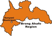 1959. It covers an area of 39,557 square kilometres and shares boundaries with the Northern Region to the north, the Ashanti and Western Regions to the south, the Volta Region to the east, the Eastern Region to the southeast and La Cote d’Ivoire to the west.
It has 19 administrative districts, with Sunyani as the regional capital. The region lies in the forest zone and is a major cocoa and timber producing area. The northern part of the region lies in the savannah zone and is a major grain- and tuber-producing region. The region has a population of 1,815,408, indicating an intercensal growth rate of 2.5 per cent over the 1984 population figure. Enumeration covered all the 17,546 localities in the region .
There are 19 districts headed by District Chief Executives who, in turn, are under the political and administrative jurisdiction of the Regional Minister.
Socio-demographic characteristics
The dependency ratio (i.e. the ratio of the non-economically active age groups of 0-14 and 65 and older to the active age group 15-64) for the region is 90.8 in 2000, a reduction from the 1984 figure of 100.8. While the Asunafo, Kintampo and Sene Districts each has a dependency ratio of more than 100, the Sunyani District has the lowest dependency ratio of 73.3.The sex distribution gives a sex ratio of 100.8 males to 100 females, that is, number of males is almost the same as that of females. There are more females than males for children under five years, except in the Tano District while males outnumber females in six districts, Tano, Sunyani, Dormaa, Jaman, Berekum and Techiman.
Fertility:
The total fertility rate (TFR) for the region is 4.2, which is higher than the national level of 4.0. The Asunafo (5.3), Asutifi (5.1) and Sene Districts (5.6) have TFRs higher than 5.0, while the Sunyani (2.8) is the only District with a TFR below 3.0. The mean number of children ever born for the region is 5.8, which is slightly above the figure captured (5.7) in the GDHS 1998 .
Social characteristics:
The urban population constitutes 37.4 per cent of the total population of the region. Sunyani, Techiman and Berekum are the only Districts with more than 50.0 per cent of the population in urban settlements. The Sene District has the lowest urban population of 8.6 per cent. Out of the 342,808 households in the regionfemales head 34.3 per cent.
The average household size is 5.3, slightly higher than the national average of 5.1. The Sene (6.0), Jaman (6.0) and Atebubu (6.0) Districts have the largest household sizes compared with the Sunyani District, which has the lowest (4.7) in the region. A little more than half (51.3%) of persons aged 12 years and older are in marital unions, and every two out of five are never married. More females than males in all the districts are in marital unions. The proportion married or in a consensual union is 57.6 per cent for the population aged 15 years and older.
The Akan constitute the predominant ethnic group in the region, and in all the districts, except Sene, where the Guan constitutes the largest ethnic group. The Mole Dagbon constitutes the second largest ethnic group in the region and in all districts, except Sene and Atebubu. Three out of every five Akans in the region are Brong. Non-Ghanaians constitute less than 3.0 per cent of the population. Christians (70.8%) outnumber all other religious groups in the region. Islam, mostly practised in the Kintampo and Atebubu Districts, has the second largest following. The largest following of traditional religion, as well as those who profess no religion, are in the Sene District. More females (73.5%) than males (68.2%), profess the Christian faith but the opposite is true for Islam (17.0% males, 15.3% females), traditional (4.9% and 4.4%) and no religion (9.2% and 6.4%).
The proportion of the population who have never been to school is 42.4 per cent (37.2% males and 47.7% females). The Sene (64.4%), Atebubu (60.8%) and Kintampo (56%) districts have the highest proportions of persons who have never been to school, while the Sunyani (72.2%), Dormaa (69.1%), and Berekum (68.3%), have the highest percentage of those who have ever attended school. The proportion of illiterates in the region is higher than the national average, by almost 6 percentage points. As with the educational attainment, the level of illiteracy is higher for females than males in all districts in the region.
Economic characteristics:
819,190 persons, representing 79.2 per cent of the population, are economically active, two-thirds (66.4%) of whom are in Agriculture/Forestry/Hunting. With the exception of the Sunyani District, agriculture is the major source of income for households in all the districts.
Majority of the economically active are self-employed with or without employees (74.7%), followed by employees (9.7%). Over four fifths (83.0%) of the economically active population work in the informal sector. The phenomenon of children under 15 years engaging in economic activity, is pronounced in the Kintampo, Atebubu and Sene Districts, with activity rates between 18.0 and 22.0 per cent for the age group 7-9 years, and between 34.0 and 45.0 per cent for the age group 10-14 years.
Housing and community facilities
Housing facilities:
The region has 9.9 per cent of the total housing stock of the country. The Jaman District has the highest population per house ratio and the Sene District has the lowest. Compound houses (48.1%) predominate in all districts, with the Jaman (63.6%) and Berekum (61.4%) districts having the highest proportions.
Corrugated metal sheets for roofing and cement/concrete for walls and floors are the main construction materials used in the region. The Sene, Kintampo and Atebubu Districts, however, have more than half of the houses roofed with thatch, which is the second main roofing material in all the other districts.
The river/stream (31.8%) is the main source of drinking water in most of the Districts, followed by the borehole (25.3%) and pipe-borne water (23.5%). The Sunyani District has the highest proportion (55.0%) of households using pipe-borne water, even though the supply is very erratic because of the gradual drying up of the Tano River, which feeds the reservoir of the treatment plant. Modern methods of liquid and solid waste disposal are not practised by majority of the households in the region.
The pit latrine and public toilets are the commonest facilities in the region, and liquid waste is mostly thrown onto the street or anywhere outside the house.
Community facilities:
There are only 24 hospitals in the region, six of which are government-owned, with one quasi-public and 17 privately-owned. Sene is the only district that has no hospital. Other health facilities are health centres (35), rural clinics (106) and maternity homes (54). Traditional healers and healing facilities are wide spread throughout the region and are most accessible to the population than all the other facilities.
Telecommunication facilities are poorly and inadequately distributed. The Sene District has no post office but has 2 postal agencies. In addition to the fixed telephone lines of Ghana Telecom, a few localities have access to mobile phone services. Junior secondary schools (769) are less than half the number of primary schools (1619). Senior secondary schools (60) are even fewer compared to junior secondary schools.
INTRODUCTION
Background of the region
Creation of the region
The Brong Ahafo Region was created on 4th April 1959 (by the Brong Ahafo Region Act No. 18 of 1959). The Act defined the area of the Brong Ahafo Region to consist of the northern and the western part of the then Ashanti Region and included the Prang and Yeji areas that before the enactment of the Act formed part of the Northern Region. Before the Ashanti Empire was conquered by the British in 1900, the Brong and Ahafo states to the north and northwest of Kumasi (the capital of Ashanti empire and the present Ashanti Region) were within the empire.
Nana Akumfi Ameyaw III traces his ancestry to King Akumfi Ameyaw I (1328-63), under whose reign the Brong Kingdom with its capital at Bono Manso grew to become the most powerful kingdom of its time. Indeed oral tradition has it that nearly all the different groups of the Akans, including the Asante, trace their origins to Bono after migrating from the “north”.
The first remembered King of the Bono Kingdom is King Asaman, who is credit with leading his Akan people from what may be present day Burkina Faso or even further north, to Bonoland (Buah, 1998). Later migrations led to the Asantes, Fantes, Denkyira and other Akans settling in their present locations.
Nana Akumfi Ameyaw is credited with the creation of gold dust as a currency and gold weights as a measure, later developed and adopted by all the other Akan groups, particularly the Asante. Legend has it that he even supported his yam shoots with sticks made of pure gold.
It was when King Opoku Ware of Asante defeated Bono in 1723 and destroyed Bono Manso that the capital moved to Techiman (Takyiman). Techiman and other Bono states therefore came under the Asante Empire until 1948 when Akumfi Ameyaw III led the secession of Bono from Asante, supported by other Bono states such as Dormaa.
The most significant change the British administration in Ashanti brought to the people of the Brong and Ahafo states until 1935 was that it made them independent of Kumasi clan chiefs (Busia, 1951, pp. 165-166). The British administration worked out a strategy that severed the interference of the Kumasi clan chiefs with the internal affairs of the Brong and Ahafo states.
When the Ashanti Confederacy was restored in 1935 by the British administration, however, most of the Brong and Ahafo states saw that their independence from Ashanti was being threatened, because by restoring the Ashanti Confederacy, they were to revert to their former overlords in Kumasi. Though the Brong states joined the Ashanti Confederacy, most of them were not happy with the re-union because they felt their long historical association with Ashanti had brought them nothing.
The opportune time came when in 1948 Nana Akumfi Ameyaw III, the Omanhene (paramount chief) of Techiman led Techiman to secede from the Ashanti confederacy (Austin, 1964, p. 294). The secession of Techiman was supported by some of the Brong states and this led to the formation of the dynamic Brong political movement, Brong Kyempem Federation. The movement was formed in April 1951 at Dormaa Ahenkro under the auspices of the Dormaa State.3 The main objective of the movement was to struggle for a separate traditional council and a separate region for the Brong Ahafo states.
The name of the movement was later changed to the Brong Kyempem Council. In March 1955, the Prime Minister informed the National Assembly that the government was considering “the possibility of setting up a Brong Kyempem Council” to fulfil the desire of the Brongs for the establishment of a development committee for their area and that the government would “examine the case for the establishment of two administrative regions for Ashanti”.
In March 1959, the Brong Ahafo Bill was passed under a certificate of urgency by Parliament. The Brong Ahafo Region Act was enacted after receiving the Governor General’s assent. Sunyani was made the capital of the new region
Physical features
Area
Brong Ahafo, with a territorial size of 39,557 square kilometres, is the second largest region in the country (16.6%). The region shares boundaries with the Northern Region to the north, the Volta and Eastern Regions to the south-east, Ashanti and Western Regions to the south, and Cote d’Ivoire to the west. The central point of the landmass of Ghana is in the region, at Kintampo.
Climate
The region has a tropical climate, with high temperatures averaging 23.9oC (750F) and a double maxima rainfall pattern. Rainfall ranges, from an average of 1000mm millimetres in the northern parts to 1400 millimetres in the southern parts.
Vegetation
The region has two main vegetation types, the moist semi-deciduous forest, mostly in the southern and southeastern parts, and the guinea savannah woodland, which is predominant in the northern and northeastern parts of the region. The level of development and variations in economic activity are largely due to these two vegetation types.
For example, the moist semi-deciduous forest zone is conducive for the production of cash crops, such as cocoa and cashew. Brong Ahafo is one of the three largest cocoa producing areas in the country, mainly in the Ahafo area, which shares common border with western Ashanti. A lot of the cashew in Ghana is produced in Brong Ahafo, some of which are processed into brandy and cashew wine at Nsawkaw in Wenchi.
Timber is also an important forest product, produced mainly in the Ahafo area around Mim, Goaso and Acherensua. Other cash crops grown in the forest area are coffee, rubber and tobacco. The main food crops are maize, cassava, plantain, yam, cocoyam, rice and tomatoes. Yam production is very high in the guinea savannah zone, around Techiman, Kintampo, Nkoranza, Yeji, Prang and Kwame Danso.
Tourist attraction sites
The ecology of the region has produced lots of tourist attractions. Some rivers create beautiful tourist sites as they flow on rocky landscapes. The Pumpum River falls 70 metres down some beautiful rocky steps to form the Kintampo Falls, as it continues its journey towards the Black Volta. The Fuller Falls, 7 kilometres west of Kintampo, (the centre point of the country), also provides a scenic beauty as River Oyoko gently flows over a series of cascades towards the Black Volta.
Another scenic site is the River Tano Pool which houses sacred fish that are jealously protected by the local community who live along the river near Techiman. There is also a pool on the Atweredaa River, which runs through the Techiman market.
Another type of tourist attractions are caves, sanctuaries and groves. The Buabeng-Fiema Monkey sanctuary, located 22 kilometres north of Nkoranza, covers a forest area of 4.4 square kilometres. It serves as home for black and white colobus and mona monkeys. The forest also provides a natural habitat for different species of butterfly. Buoyem caves, which are hidden in a dry semi-deciduous forest, house a large colony of rosetta fruit bats. The Pinihini Amovi caves are also historic underground caves near Fiema
The tourist attraction sites in the region cannot be complete without mention of the Tanoboase Sacred Grove. It is believed that the grove is the cradle of Brong civilization.
The grove served as a hideout to the Brongs during the 18th century Brong-Ashanti wars.
It is currently used for hiking and rock climbing. The Bui National Park, stretching from Atebubu through Banda to the proposed site of the Bui Dam, is home to many rare wildlife and vegetation. Part of the Volta Lake flows through the region and Yeji, Prang, and Kwame Danso are important towns along the banks of the lake, which can serve as growth poles for tourism development in the region.
Political and administrative structure
Brong Ahafo has 19 administrative districts, with District Chief Executives (DCEs) as the political heads. The DCEs are assisted by District Co-ordinating Directors (DCDs) who are responsible for the day to day running of the districts.
The DCEs work under the Regional Minister (the political head of the region), while the DCDs are under the Regional Coordinating Director. Sunyani is the administrative headquarters of the region, where the Regional Minister resides.
The legislative wing of the political and administrative structure is the District Assembly. One third of its membership is appointed by Government in consultation with local leaders, while the remaining are elected on non-party lines. The District Assembly elects its own Presiding Member.
The District Assemblies are divided into Town and Area Councils, depending on the population and land area of the district. A compact settlement or town with a population of 5,000 or more qualifies to have a Town Council status. An Area Council is made up of 2 or more towns which when pulled together has a population of 5,000 or more. The region has 37 Town Councils and 106 Area Councils. Eight of the districts bear the name of the district capital, with the remaining five (Asunafo, Asutifi, Tano, Jaman and Sene) named after geographical land marks or historical events.
Another aspect of the political and administrative structure relates to constituencies and areas for electoral purposes. The region is divided into 21 constituencies, which are further subdivided into 582 electoral areas or electoral units. These electoral areas consist of 2,292 basic units called polling stations.
Each of eight districts has two constituencies with the remaining five having one constituency each. Wenchi, one of the districts with two constituencies has the highest number of electoral areas (54), electoral units (214) and polling stations (223). Seven districts have 48 electoral areas each. The Sene district has the least number of electoral areas (30) and polling stations (98). There has been the need for the creation of six new districts.
Cultural and social structure
Nationality
Ghanaians by birth and parenthood constitute 94.0 per cent of the population of the region. This is higher than the national proportion of 92.2 per cent. Naturalized Ghanaians constitute an additional 3.4 per cent, while other ECOWAS nationals make up 1.9 per cent with other Africans and non-Africans being 0.8 per cent.
The sex-composition of Ghanaians by birth indicates that there are more female Ghanaians by birth than males, while there are male non-Ghanaians than females.
Migration
Nearly 71 per cent of the population are born in the localities where they were enumerated, with a further 7.5 per cent born in another locality within the region. The rest of the population originate from outside the region, with most of them from the regions which share border with the region. Favourable climatic conditions, abundance of arable land and proximity may be factors that attract people from the north.
Ethnicity
The predominant ethnic group is the Akan, (62.7%) followed by the Mole-Dagbon (15.4%) and Grusi (4.2%), as shown in Figure 1.1. Within the Akan group, the Brong (Bono, including Banda) are the largest subgroup (61.4%), followed by the Asante (13.3%) and Ahafo (9.5%). Among constituents of the Mole-Dagbon group, the Dagaaba are the largest (44%) subgroup.
Religious affiliation
Christianity has the largest following (71.0%), followed by Islam (16.1%) and traditional religion (4.6%). A significant proportion (7.8%) reported affiliation with no religion.
Catholics are the largest denomination of the Christian faith (22.6%), followed by Pentecostal/ Charismatic (20.8%) and Protestant (17.0%). More females (73.5%) than males (68.2%) profess the Christian faith. The reverse is true for Islam, traditional religion and those with no religion.
Literacy
Education forms an important determinant of the quality of manpower. As such, the educational level of the population, to some extent, reflects the level of social and economic development of a country or a community. It is also well known that education constitutes one of the most important factors influencing demographic behaviour and the level of fertility of a population. Statistics on literacy provide a measure of progress in the educational development and are necessary in planning for the promotion of adult literacy. Literacy is defined as the ability to read and write in any language and relates to those aged 15 years and older.
48.5 per cent of the population of the region, aged 15 years and older, are not literate. This picture is only better than that of the three Northern Regions where the illiteracy level is more than 70.0 per cent. Since much information is written and transmitted in English, effective literacy level is based on those literate in English and a Ghanaian language.
This means that effective literacy level for the region is 49.0 per cent, which is lower than the national average of 54.5 per cent. Information flow in terms of posters, brochures, and written adverts will seriously be hampered because of the low literacy level.
The differences between male and female literacy levels. There are significant differences between the sexes in the not literate and the literate in English and Ghanaian Language groups. Among the males, 41.1 per cent are illiterates, which is far lower than that of females (56.0%).
Educational attainment
A little over two fifths of the population (42.0%) aged six and older, have never been to school, as shown in Fig 1.4. The proportion of the population that has attained primary (22.3%) and middle/JSS (23.3%) is almost the same; only 11.2 per cent have attained a level above the middle/JSS. The education attainment is the same for males and females at the pre-school level (1.2% each) and the primary school level, (22.5% males and 22.0% females). Above these two attainment levels, male attainment is higher than that of females at each subsequent level. This low attainment level for females has implication for the economic characteristics of the population as well as fertility behaviour.
A higher percentage of females (68.5%) than males (63.9%) are currently in pre-school and primary school. The percentage of males (60.2%) is lower than that of females (64.3%) at the primary school level but the pattern changes to that of a higher percentage of males than females, at each subsequent higher level after the primary school level, (Figure 1.5). More than three fifths (62.1%) of those currently in school are in the primary school, followed by those in middle/JSS (22.4%). The proportion of the population currently at the post-secondary level (1.3%), (including training college, nursing, etc.), is the lowest.
Demographic characteristics
The total population of the region is 1,815,408, representing 9.6 per cent of the country’s population. The region is more populous than only four other regions though it is the second largest in terms of land area. The region’s population density of 45.9 persons per square kilometre is denser than that of only two regions, Upper West and Northern. It has a balanced sex ratio of 100.8 males to 100.0 females, with 37.4 per cent of the population living in urban areas.
The population has a broad base (0-4) and thereafter decreases gradually with age; this is true for both males and females. From the cumulative frequencies, more than 50.0 per cent of the population of both sexes are less than 20 years, with less than 11.0 per cent being 50 years or older.
Marital status
The currently married and those in consensual union constitute the majority of the 1,033,609 persons who are 15 years or older in the region, followed by the never married. The once married but no more in a stable marital relation constitute 10.0 per cent of the marriageable population.
The proportion of never married males (40.2%) is higher than that of females (24.4%). On the other hand, the proportion of married females (50.5%) or in a consensual union (10.5%) is higher than that for males (46.5% and 7.7%). Similarly, the proportion of females once married (14.6%) is higher than that for males (5.6%).
Economic characteristics
Economic activity
The main occupation of the workforce of the region is Agriculture and related work (66.4%) for both sexes. The rural/urban occupational distribution also shows the dominance of Agriculture. Production and Transport Equipment work (11.3%), Administrative and Managerial work (0.2%), and Sales work (7.6%) are the other three occupations that stand out. Between the sexes, a significant difference in the occupational distribution is observed in the Sales work for females (10.8%) and males (4.4%), while Clerical and related work and Production, Transport and Equipment work are more common among males than females.
Industry
The three major industrial activities in the region are: Agriculture/Forestry/Hunting (68.6%), Manufacturing (6.7%) and Wholesale/Retail trade (7.4%). Male predominance is observed in Construction, Financial Intermediation, Public Administration, and Education in all districts.
On the other hand, a higher percentage of females than males are engaged in Wholesale/Retail trade, Hotels and Restaurants, Private Households and other Community, Personal and Social Service activities.
Employment status and sector
About three quarters of the population (74.6%) are self-employed with no employees, followed by employees (9.7%) and unpaid family workers, (6.4%) in that order. This picture is the same for both sexes.
About 83.0 per cent of the working population is in the private informal sector, and the proportion in the public sector is low 5.1 per cent. Such an employment structure accounts for the tax net being narrow and poses a challenge to effective mobilisation of taxes. The self-employed without employees, are mainly very small one-person businesses with a small capital base. Such a situation does not promote rapid economic growth and expansion, as all such businesses are non-competitive and operate at subsistence level.
DEMOGRAPHIC CHARACTERISTICS
Introduction
The coverage of population statistics is quite comprehensive, detailing the number of persons in the population (size), the spatial distribution, the sex-age structure, growth or decline of the total population. These population parametres are further divided into much detailed categories to cover nationality, ethnicity, religion, marital status, place of birth, literacy, educational attainment and many others.
Changes in the population brought about mainly by births, deaths, in-migration and out-migration are important in the study of the characteristics of the population. The mechanism of population change therefore constitutes an important aspect of demographic analysis.
Population size, growth rates and density
The population of the region is 1,815,408, accounting for 9.6 per cent of the country’s total population.
The population of the region therefore experienced a decline in growth between 1984 and 2000. This is further buttressed by the fact that unlike previous inter-censal periods when its growth rate exceeded the national average, the rate for the 1984-2000 period was lower than the national.
The region’s population density of 45.9 persons per square kilometre in 2000 is lower than the national figure (79.3 persons/km²) and higher than those for only Northern (25.9 persons/km²) and Upper West (31.2 persons/km2), which is similar to the situation in 1970 and 1984. There is therefore not much pressure on land, even though there has been a gradual increase in population density over the years, from 15/sq km (1960), 19/sq km. (1970) and 31/sq km (1984) to 45.9/sq km in 2000.
The population densities and the inter-censal growth rates between the previous censuses cannot be calculated for the districts, because boundaries of administrative units within regions have changed between censuses. The 1984 census was conducted with 140 local councils as administrative units, which had different boundaries from the 110 districts in the 2000 Census. For example, two local councils, Goaso and Kukuom were combined to form the Asunafo District, Bechem and Duayaw Nkwanta local councils as Tano District while Kintampo which did not exist as a local council in 1984 was carved out from portions of Wenchi, Atebubu and Nkoranza local council areas.
Age and sex structure
The age structure of the population for the country indicates a broad base that gradually tapers off with increasing age. This national picture is reflected at both the regional and district levels. A large proportion (43.1%) of the region’s population is under 15 years, with a small proportion (4.5%) older than 64 years (Fig 2.1).
The proportion for the under 15 years for the region is higher than that for the total country (41.3%) but shows a 3.4 per cent decline from the corresponding 1984 figure. The reverse is the case for the elderly populations, with the proportion lower than the total country’s (5.3%) but greater than the 1984 figure by 0.8 per cent.
The region has only slightly more males than females, with a sex ratio (males to 100 females) of 100.8. Indeed, the Region and the Northern Region are the only two Regions at the national level with an almost equal proportion of males and females. Eight of the districts have sex ratios of more than 100. There are however more females than males for children under five years, than in the reproductive ages between 20 and 39 years, and the elderly (over70 years). The age group 25-29 years has the lowest sex ratio of 90.0 while the age group 45-49 years has the highest of 121.
The low sex ratio for the 25-29 years age group could be due to out-migration of males of that age to seek employment elsewhere, particularly to the Western Region as tenant cocoa farmers. Indeed, the largest concentration of Brongs outside of Brong Ahafo is in the Western Region (59,520).
Tano is the only district with more infant males than females, a deviation from the regional pattern. Kintampo and Sene have more males than females in the two reproductive age groups of 20-24 and 35-39 years and Atebubu in only the latter age group.
Dependency ratios
Dependency ratios show the relative predominance of persons in dependent ages (youth under 15 years and persons 65 years and older) and those in productive ages (15 to 64 years). The dependency ratio for the region reduced from 100.8 in 1984 to 90.5 in 2000. Though the reduction is significant, the ratio is higher than the national figure (87.1).
There is therefore an improvement in the dependency on the active population in the region though the situation may still be unsatisfactory if compared with the other regions.
Only three districts (Asutifi, Kintampo and Sene) have dependency ratios of more than 100, meaning each person in the productive age had more than one person to support
Three districts, Techiman (81.3%), Dormaa (85.5%) and Berekum (86.6%), however, have ratios below the regional average. In addition, Sunyani the most urbanised district has the lowest dependency ratio of 73.3 per cent.
2.4 Birthplace and migratory pattern Migration is one of the three components of population dynamics. Inter-regional movements may be a crude method for measuring migration patterns, but they nevertheless provide crucial information on population movements.
More than three quarters (78.2%) of Ghanaians born in the region were enumerated in the region. This indicates that majority of the people in the region are usual residents. This proportion is higher than those of only two regions, Greater Accra (68.7%) and Western (70.7%). It is also higher for females (79.8%) than for males (76.6%) in the region. About a fifth, (21.3%), of the region’s enumerated population reside in other regions; half (12.0%) reside in the three northern regions.
The male population tends to be more migration-oriented than females in the region. More than three-quarters (76.6%) males and about four-fifths (79.8%) females enumerated in the region reside in the region. A greater proportion of the males (13.2%) than females (10.9%) were born in the three northern regions.
About the same proportion for males (0.7%) and females (0.6%) from the region were born in Ashanti compared with 4.1 per cent of males and 4.0 per cent of females born in the Eastern Region. The remaining proportion of males (4.9%) and females (4.2%) were born in the remaining six regions. Movement from Upper West into Brong Ahafo was more pronounced than the other two northern regions. More than two fifths (44.2%) of the northerners born in the region were from Upper West.
Population distribution
The region, (37.4%) is the fourth most urbanized, coming after Greater Accra (87.7%), Ashanti (51%) and Central (37.5%), Regions. Only four districts, Sunyani (73.8%), Techiman (55.7%), Berekum (54.7%) and Tano (43.2%), have levels of urbanization above the regional average, with Sunyani, Berekum and Techiman having much higher proportion of urban than rural population; Sene has the highest proportion of rural population
The level of urbanization is influenced by the growth of some localities in the districts, especially their capital towns. The district capital’s share of the district population for the three most urbanized districts, Sunyani (34.6%), Berekum (42.5%) and Techiman (32.2%), for instance, accounts for more than half or nearly so of the urban population.
Sunyani, being the regional capital, has a good infrastructure base, which attracts migrants; Techiman is a major market centre and a nodal town or entrepol, where roads from the three northern regions converge. Trunk roads from Sunyani, Kumasi, Wa and Tamale all meet at Techiman, thus making it a bustling food crop market and commercial centre. Berekum’s urban nature can be attributed to good infrastructure and concentration of wood processing firms, as well as important educational and health centres. The Berekum Secondary School, Techiman Training College and Holy Family Hospital all serve a large catchment area.
The four largest localities in the four most urbanized districts account for nearly half the district population or more. But the four largest localities in the three least urbanized districts, Sene (18.2%), Asutifi (24.8%) and Kintampo (29.7%), account for less than a third of the district’s population. The increase in urban population since 1984 has been due partly to some urban centres growing rapidly, while other rural towns have grown even more rapidly into new urban centres.
For example, Kenten, which is now the second largest urban town in Techiman and the twentieth in the region with a population of 10,599, was a small village with a population of 265 in 1970, which grew to 828 in 1984. The growth may be largely due to population spillover from Techiman (56,187), which is close to Kenten, as a result of real estate development and expansion in trade. Similarly, Sampa, a border town in the Jaman district, has grown from a population of 3906 in 1970 to 11,348 in 2000, mainly due to cross-border trade with Côte d’Ivoire.
Fertility and child survival
Fertility is one of the most important components of demographic change. It is the frequency of childbearing among the population, and fertility rates measure the relative frequency with which births occur within a given population.
Four conventional measures of fertility, the crude birth rate (CBR), general fertility rate (GFR), total fertility rate (TFR) and the mean number of children ever born (MCEB) are discussed for the region and districts. The CBR, GFR and TFR are based on births in the last 12 months and computed respectively for women, (12-49) per 1,000 population, (15-44) per 1,000 women and (15-49) per woman. The MCEB is for children ever born for women aged (15-49)
CBR measures the contribution of current fertility to the overall population while the GFR is on the women in the reproductive age. TFR is the number of children a woman would have from age 15 to 49 (childbearing age) if she were to bear children at the prevailing Age Specific Fertility Rates (ASFRs). Current fertility
Fertility varies not only with age but also with other factors such as marriage, area of residence and educational attainment. Fertility differentials can therefore be studied in terms of economic and social characteristics. Sunyani and Berekum, the most urbanised districts, have the lowest fertility levels, while the more rural, Sene and Asunafo have the highest levels. Other districts with relatively higher rates are Asutifi and Atebubu.
All three rounds of the Ghana Demographic and Health Surveys (1988, 1993 and 1998) confirm that fertility indicators are lower for urban than rural women, and also that the higher the educational level of the woman the lower the fertility indicator.
These reasons may account for the relatively low fertility in urbanized districts as Sunyani and Berekum, and the higher levels in rural districts as Sene, Asunafo, Asutifi and Atebubu. The total fertility rate is a summation of age specific fertility rates, so they help to examine the frequency of childbearing from one age group to another to understand the current child bearing performance of women in the reproductive age groups.
The data show that for every age group, Sunyani and Berekum (the most urbanised districts) have lower fertility than all other districts. This underlines the fact that urban women generally tend to delay and space childbearing due to education, economic and other activities, which are incompatible with high fertility. In contrast, the more rural districts, Sene, Asunafo and Asutifi generally have higher age-specific fertility levels.
Child Survival
Survival rate for the region is 82.3 per cent, implying that less than 16 per cent of children born to women (12-49) years were dead. Survival rates for the districts range from 79.8 per cent in Wenchi to 85.1 per cent in Asunafo, showing that child survival in the region is high, with little distinct differential. Reasons for this must be identified and the factors sustained, while at the same time intensifying fertility reducing programme activities.
SOCIAL CHARACTERISTICS
Household composition
The household recorded 342,808 in the Brong Ahafo Region. This constitutes 9.3 per cent of the total number of households for the country. Females head more than a third (34.3%) of the households, which is the same for the total country. Household heads constitute 18.9 per cent of the region’s population. The average household size for the region is 5.3, higher than the national average of 5.1.
Asunafo, Wenchi, Kintampo, Atebubu and Sene have less than one third of female-headed households, with Berekum having the highest proportion. Berekum has the highest proportion of females who have been in a union before, but currently not. This might be the reason for the high female-headed ratio.
While Dormaa and Sunyani have average household sizes of less than 5, Jaman, Atebubu and Sene have the largest average household size of 6, followed by Kintampo with 5.8.
Household structure
Under a fifth (18.9%) of household members are heads (including temporary heads). This ranges at the district level, from 16.6 per cent in Jaman, 16.8 per cent in Atebubu to 21.2 per cent in Sunyani. Children of heads of household form 40.0 per cent of household members; with corresponding proportions ranging from 36.6 per cent in Berekum to 44.9 per cent in Sene. Other relatives (20.5%), who constitute the next highest percentage of household members in each district, ranges from 17.9 per cent in Asunafo to 27.5 per cent in Berekum.
The highest percentage of spouses of the heads of households is in Sene (10.5%), Atebubu (10.1%), followed by Kintampo (9.7%), Techiman (9.3%) and Nkoranza (9.2%). Dormaa (6.7%) and Berekum (6.4%) have the lowest percentages of spouses in households in the region.
Grand children (7.4%) form the next highest proportion among the different cateories of the relatives of heads of household; it accounts for more than 7.0 per cent of household members in seven of the 13 districts compared with Kintampo (4.8%), Atebubu (4.7%) and Sene (4.5%). There are at least 2.0 per cent of non-relatives in households in each of the 13 districts in the region. The household composition and structure in the region indicate that the traditional family structure still exists in the region.
Marital status
More than half (57.6%) of the population aged 15 years and older in the region are in marital union. Nearly a third have also never married.
Proportions for females who are married or in loose union in the region are more than the corresponding proportions for males. The proportion for the never married males is significantly higher by 15.8 per cent than that of the females, while the proportion of females who have been in union before (14.6%), is higher than the proportion of males (5.6%) in that category. The same picture can be observed in all districts in the region.
The high proportion of females in this category (divorced, widowed, separated) may be due to several factors, including the fact that polygamous males who divorce one wife are still recorded as married and that males who are divorced or widowed are more likely than females to remarry.
Sunyani, Dormaa and Berekum, all major urbanized districts, have the lowest proportions of the married, with Kintampo, Atebubu and Sene having the highest proportions for both sexes. As explained earlier, urbanisation and educational level, which are linked to mean age of first marriage, may be the reasons for the differences in marital status for the districts. More than two out of five persons of the population in four districts, Sunyani, Jaman, Berekum and Techiman, have never married.
The data further show that the marital status pattern for females and males in all the districts follow the same pattern as those for the region.
Nationality and Ethnicity
Nationality
The composition of the population by nationality is summarised below.
More than 97 per cent of persons in the region are Ghanaians, with 94 per cent being Ghanaian by birth. The proportion of Ghanaians by birth in the districts ranges from 91 to 97 per cent, with Sunyani having the highest (96.7%). Ghanaians by naturalization constitute between 5 and 6 per cent of the total populations of Sene, Kintampo, Nkoranza, Jaman, Dormaa and Asutifi. Atebubu district has the highest proportion of other ECOWAS nationals (3.8%), while Berekum has the highest proportion of other African nationals (1.5%) and non-Africans (1.2%).
Foreign nationals deal in wood-processing activities a lot, and may account for the small but significant proportion of non-Africans in Berekum, where wood-processing is one of the main industrial activities. Berekum also has some religious organisations, mainly Catholic, and other foreign NGOs with significant expatriate personnel carrying out social work.
The high proportion of ECOWAS nationals in Atebubu (3.8%) and Sene (2.8%) is difficult to explain, since the districts do not share a border with any of the neighbouring countries. It may be due to migration from Togo, Benin, Burkina Faso and Cote d’voire.
Ethnicity
The predominant ethnic group in the region and in all the districts is Akan, except in Sene where the Guans predominate. Apart from Sene and Atebubu where the Ewes and Gurmas are the second predominant ethnic groups, the Mole-Dagbon ethnic group is the second largest in all the other districts. Three other groups of northern origin, Gurma, Grusi and Mande-Busanga are one-tenth of the region’s population. Ethnic groups of northern origin are therefore slightly more than a quarter of the region’s population.
The large proportion of Ewes in Sene is due to the fishing activities along the region’s side of the Volta Lake. The presence of the Guans in large proportion in Atebubu and Sene may not be due entirely to migration. That part of the region was formerly part of the Northern Region, inhabited by the Gonjas, one of the Guan sub-groups, before it was made part of Brong Ahafo in 1959.
More than three-fifths of the Akans in the region are Brongs. Asantes and Ahafos are two other recognisable Akan groups in the region. Dagaabas constitute the highest proportion of Mole Dagbons. Three other ethnic groups, Kusasi, Nabdom and Dagomba, constitute more than one third of the Mole Dagbons. The remaining groups from the south, Guans, Ewes and Ga-Dangme are less than one tenth of the region’s population.
Religious affiliation
The distribution of the population by the various religious denominations in the region is nearly the same as the total country, except traditional religion and no religion that exchange the order. Christianity (70.8%) has the largest following, while Islam (16.1%) and no religion (7.8%) are the significant others.
Another change of order different from the national is that Catholics (22.6%) outnumber Pentecostals (20.8%). Brong Ahafo has a strong Catholic legacy, with many Catholic institutions including 7 hospitals in 7 districts. It is therefore no surprise that the Church chose Fiapre in the Sunyani District for the establishment of the first Catholic University in the country.
Large followers of Christianity are in all districts. Over four-fifths of the population in Berekum (87.4%), Jaman (83.9%), Sunyani (80.9%) and Dormaa (80.3%) are Christians. The protestant churches (28.6%) have the largest following in Berekum, followed by the Pentecostal (28.0%). Pentecostals outnumber Catholics in eight districts, the most prominent being Sunyani where the difference is more than 10 percentage points.
Jaman has the largest proportion of Catholics, where nearly two out of every five people are Catholics. Though more than half of the population in Atebubu (50.5%), Kintampo (51.4%) and Sene (56.6%) profess to be Christians, the proportion of Christians in these districts is low compared to the other districts.
Islam is practised mainly in Kintampo (29.7%) and Atebubu (24.4%), where Moslems outnumber the two most professed Christian denominations, Catholics (21.4%) and Pentecostals (17.6%). The Moslems are mainly Mole-Dagbon who are quite a substantial group in the districts. Techiman (20.7%) and Wenchi (20.0%) also have a sizeable number of Moslems, though Catholics outnumber them. Islam (6.1%) and traditional religion (10.6%) are least practised in Berekum.
Traditional religion is most practised in Sene (18.8%), followed by Atebubu (15.7%) and Kintampo (10.0%). Sene also has the largest proportion professing no religion (13.6%). Traditional religion ranks second after Pentecostal while no religion ranks fourth after Catholic in the district. Nkoranza also has more than one tenth (11.6%) of the population professing no religion.
The proportion of females professing the Christian faith (73.5%) is higher than males (68.2%) in the region, in all districts in the region and total country. Apart from Catholics in Sunyani and Berekum where the proportion of males is higher than females, and Sene where the proportion of male Pentecostals is higher than females, the proportion female is larger than male in all three major Christian denominations in all districts. On the other hand, the proportion of males professing Islam, traditional and no religion, in all districts of the region, is higher than females.
Educational attainment and literacy
Educational attainment
Statistics on educational attainment help in knowing the present educational levels of adult population as well as anticipated future requirements of educated manpower for various types of economic activity. Such data would be useful for policy makers to plan development and improvement of educational systems on one hand, and to plan economic development programmes in the light of manpower requirements, on the other.
More than two fifths (42.0%) of the population, aged 6 years and older, have never been to school, a very discouraging picture.
Disparity in educational attainment is pronounced among the districts in the region. The proportion of the population that has never been to school is high in all districts but it is much higher in some districts than in others. Thus, more than three fifths of the population of Sene (63.9%) and Atebubu (60.3%), and a little more than half, (57.6%) of the population of Kintampo have never been to school. All the other districts have less than half of their population having never attended school, with Sunyani having the lowest proportion (27.8%).
The starting age for the first level of formal education in Ghana is six years. Pre-school which comprises nursery and kindergarten for ages below six years is now gaining popularity in the country. The 2000 Census shows that 1.2 per cent of the population older than six years are in pre-school.
The disparity in educational attainment between the sexes is glaring. The proportion of males who have attained the primary through to tertiary level is higher than the proportion of females in all districts. The proportion of females who have never been to school or been beyond pre-school is larger than it is for males. Among the female population who have ever been to school, the highest level attained by the largest proportion is the primary level (23.0%) followed closely by the middle/JSS (21.1%).
However, in six districts, Tano, Sunyani, Dormaa, Berekum, Wenchi and Techiman, the middle/JSS is the highest level attained closely followed by the primary/JSS. The situation for males, in all districts, is that the highest proportion attained is middle/JSS except Kintampo, Atebubu and Sene where the highest level for the largest proportion is the primary school level.
Current school attendance
The proportion of attending primary school is higher (64.2%) than that for males (60.1%), at the regional level. However, at the middle/JSS, SSS and beyond, the proportion of males exceed that of females at every level. This is also true for all districts except Sunyani and Berekum where female proportions for middle/JSS are slightly higher (24.2%) and (22.9%) than those for males (24.0%) and (22.3%), respectively.
Literacy
Most information is transmitted in written form and therefore the ability to read and write is very essential. The proportion of the population not literate (48.5%) in the region is higher than the national average (42.1%). The level of literacy for the region in all four-language categories, English, Ghanaian language, English and Ghanaian language and other languages, is also lower than the national level.
Literacy (15 years and older) by district
Sene has the highest proportion illiterate (71.4%) and Sunyani the lowest (32.0%). Sunyani also has the highest proportion of the population literate in both English and a Ghanaian language (51.7%).
The level of illiteracy is higher for females, than for males, in all the districts. Apart from Ghanaian languages, the level of literacy in the other language categories for males is higher than for females. Four districts, Asutifi, Jaman, Kintampo, and Atebubu have a higher proportion of males who are literate in a Ghanaian language than females. Sunyani has the lowest level of illiteracy (26.0%) for males, followed by Berekum (26.3%).
Atebubu and Sene have more than three-fifths of the male population not literate and more than three-quarters of females not literate. Sunyani (51.7%), Tano (46.8%) and Berekum (46.7%) have the highest proportion of male population literate in both English and a Ghanaian language while Atebubu (16.3%) and Sene (15.7%) have less than a fifth of the male population literate in both languages. Sene has only one tenth (10.2%) of the female population literate in both English and a Ghanaian language.
ECONOMIC CHARACTERISTICS
Economic goods and services are produced and supplied to the market through these earning activities. Statistical data on economic activities and economic characteristics of the population, therefore, are essentially required for social and economic development planning.
Type of activity
70.2 per cent are employed and 3.2 per cent had jobs but were not at work during the reference period. Only a small proportion, 5.8 per cent are unemployed. The level of the working population (that is the employed and those with job but not at work) ranges from a low of 65.7 per cent in Sunyani to a high of 83.0 per cent in Sene. Apart from Sunyani, three other districts, Asutifi (69.9%), Tano (69.9%), and Berekum (65.9%) have proportions below 70.0 per cent. All the others have proportions about 70.0 per cent.
Among the districts there are significant variations in the proportions unemployed. About half of the 13 districts have proportions unemployed lower than the regional average of 5.8 per cent. Of the rest, Asutifi (9.4%), Berekum (9.2%), and Tano (8.3%) have relatively high levels of unemployment. 37
The data also show that students form a large proportion of those who are not economically active (8.8%). Higher proportions of students are mainly in Jaman (11.5%), Berekum (10.1%) and Sunyani (11.4%) districts which have high proportions of school age population in school. As expected, Sene (5.4%) and Kintampo (5.8%) have low proportions of students.
The homemaker category constitutes only 5.5 per cent. This is fairly evenly distributed among the districts with the exception of Sunyani, which has a relatively high proportion (8.1%), and Sene with quite a low proportion (3.7%). Age-specific activity rates, present a clear picture of the proportion of economically active population in each age group. Kintampo (53.8%), Atebubu (55%) and Sene (66.4%) have the highest activity rates for the two age groups below 15 years, while Sunyani (15.3%) has the lowest. The high activity rates for the youth in Kintampo, Atebubu and Sene are a reflection of the fact that more than three-fifths of the population in the Sene (63.9%) and Atebubu (60.3%) Districts, and 57.5 per cent in the Kintampo District have never been to school.
Age groups between 30 and 60 years have activity rates over 90.0 per cent in all districts. The activity rate for the population above 75 years and older is between 50.0 and 70.0 per cent, with the highest in the Kintampo District (69.9%) and the lowest in the Sunyani District (50.2%). With the lack of adequate welfare schemes for the aged in the country, apart from social security run by SSNIT, which is patronised by formal sector and a small proportion of informal employees, the aged are compelled to work if there is no support from children or family members.
Old age as a cause of inactivity constitutes an average of 11.2 per cent against a low proportion of 1.9 per cent for the retired. This means there may be many of the aged who are not adequately covered by pension, probably due to their employment status at their working ages and therefore work in their retirement years. The proportion of the persons with disability was higher than the retired in all districts.
Occupation
Agriculture and related work is the major occupation in all districts, accounting for 66.4 per cent of the region’s economically active population. It is the main occupation for about two-thirds of the economically active group in nine of the 13 districts. In the three most urbanised districts, Sunyani (45.9%) Berekum (50.9%) and Techiman (57.1%), Agriculture and related work account for between 45.0-60.0 per cent. Sene, the most rural district, in particular, has 4 out of 5 economically active population in this sector.
Significant proportions of the economically active persons are engaged as Production, Transport operators and Labourers (11.3%), Sales workers (7.6%), and Professional and related workers (5.8%). 9 out of the 13 districts have proportions of Productive, Transport operators and Labourers above 10.0 per cent. 3 out of the nine, Sunyani (14.9%), Berekum (14.8%) and Kintampo (13.8%) have the highest proportions. The other 4 districts have less than 10.0 per cent.
At the regional level Sales workers form only 7.6 per cent. However, at the district level, Techiman (13.7%), Sunyani (13.4%) and Berekum (11.2%) have relatively high proportions engaged in sales. This is expected as Techiman is the largest market centre in the region. In addition, Sunyani and Berekum are urbanised districts, where sales workers are usually predominant.
Proportions of Professional, Technical and related workers are generally low in most districts but Sunyani (9.0%) and Berekum (8.7%) have relatively high proportions. These same districts also have appreciable proportions of service workers 8.6 and 7.0 per cent respectively.
Analysis of the sex composition by occupation shows that four districts, Techiman, Kintampo, Atebubu, and Sene, recorded more males than females in Agriculture and related work, while all the other districts recorded more females than males, although the differences were small.
Females outnumber males in Service and Sales work in all the districts, and also in Production, Transport and labourer work in all districts, except Kintampo and Asutifi. On the other hand, males are predominant in Professional, Technical and related work in all districts, with only the Kintampo District recording the same proportion for both sexes.
Five working days is the predominant working period in eight districts, with six working days in the remaining five, Nkoranza, Techiman, Kintampo, Atebubu, and Sene. These five districts are all predominantly agricultural and a six-day working week is normal. About one-eight of the active population worked for all the seven days in Berekum (12.1%) and Sunyani (14.3%), the most urbanised districts in the region.
Irrespective of sex and locality of residence, Agriculture and related work absorb the highest proportion of the economically active. Apart from Agriculture and related work, the proportion of urban workforce is higher than the rural workforce in the other occupations and almost equal for administrative and managerial workers.
Industry
Changes in structural composition of economically active population often reflect the course of social and economic development; for instance with progress of industrialisation, the proportion of workers in Agriculture decreases while those of workers in Manufacturing, Wholesale, Retail trade, and Service activities increase, implying changes in the main source of livelihood. This further implies that the more urbanised a district is, the lower the proportion of workers in Agriculture, Hunting and Forestry.
More than two thirds (68.6%) of the workforce in all districts are in Agriculture, Hunting, and Forestry, except Sunyani (the most urbanised) (48.0%). Fishing is the second major industry in Sene (21.5%) and Atebubu (8.0%) because of the proximity of these districts to the Volta Lake. The remaining districts have 2.0 per cent or less of the workforce in Fishing.
The manufacturing sector also employs a significant proportion of the workforce in the region (6.7%). Several small-scale businesses engage in manufacturing of garments, leather products, metal fabrication and spare parts, carpentry and joinery, are scattered throughout the region. The concentrations are in Sunyani (the regional capital), Berekum (abounds in wood processing establishments) and Kintampo (fabrication of farm implements, storage containers, donkey carts etc.), where a little over 10 per cent of the workforce is in manufacturing.
Wholesale and retail trade industry employs more than 10.0 per cent of the workforce in only the three most urbanised districts, Sunyani (13.8%), Berekum (11.0 %) and Techiman (15.9%). The reason for Techiman having the highest proportion in the trade industry is that it is one of the major week long markets in Ghana, with the main market days being Tuesday through Friday. It attracts traders from the north and south of the country and even some from neighbouring countries.
Sunyani (the regional capital) has the highest proportion of the workforce engaged in all the rest of the industries. The proportion of females engaged in wholesale and retail trade, hotels and restaurants, private household with employed persons, and other community, personal and social service activities are more than that of males in all districts. On the other hand, more males than females work in construction (which is mostly considered a masculine job), financial intermediation, public administration, defence, and education industries, in all districts.
Employment status
In the more industrialised countries or communities, the proportion of employees is higher relative to the self-employed, but in agricultural countries, the proportions of self-employed without employees (own account workers) and unpaid family workers are usually higher. As such the distribution of the workforce by employment status is often used as an indicator of progress in the modernisation of employment and the economy. It also measures the relative capacity of the various sectors of the economy to create jobs.
There are significant differences between the national and regional proportions of employees and self-employed without employees. At the national level, 15.2 per cent of the economically active are employees compared to 9.7 per cent at the regional level. In contrast, the proportion self-employed without employees (74.6%) for the region is relatively higher than the national proportion of 67.5 per cent.
The majority of the economically active population are self-employed without employees. They are engaged in small-scale economic enterprises operated by individuals. Many people are also peasant farmers engaged in subsistence level agriculture, the main occupation of the workforce. Many of the self-employed are not registered and have a very low capital base. This makes tax deduction at source, which is the easiest way of collecting tax, difficult if not impossible.
It also poses a challenge to the effective disbursement and retrieval of loans and other financial assistance to these people for investment and expansion of their businesses. With so many individuals engaged in such enterprises, there is a resultant loss of capability to create employment.
Only four districts (Sunyani 20.3%, Asunafo 16.3%, Berekum 13.3% and Asutifi 10.3%) have more than 10.0 per cent of the workforce as employees. Some of the reasons for this feature are that timber logging and wood processing are operated on large scale in Asutifi, Asunafo and Berekum. Sunyani, the administrative capital of the region, has the largest number of public and private formal institutions, which are avenues for public employment.
Kintampo, Atebubu, and Sene Districts have proportions of employees lower than the regional average but higher proportions of unpaid family workers. These are mainly rural agrarian districts with large proportions of farmers and artisinal fishermen and fish processors. There are no significant differences in the inter-district proportions in self-employed (with employees), apprentices (except Berekum), and domestic employees.
Employment sector
The private informal sector provides employment to about four out of every five members of the workforce in the region, with seven districts having proportions exceeding the regional average (83.0%). Sene District has the highest (90.9%), followed by the Atebubu District (90.3%) with the Sunyani District having the lowest (73.3%). Sunyani, as the regional and district capital, with several Government and quasi government organisations, has the most significant proportion of public sector employees (11.3%) while Sene has the least (2.2%).
The private formal sector is relatively small, with its impact (in terms of employment) most recognised in Asutifi (15.8%), Sunyani (14.2%) and Berekum (15.8%), with the least in Atebubu (6.1%). Semi-public/parastatals, as a source of employment, are relatively insignificant in all districts. However, both Berekum and Asutifi have private wood processing companies and NGOs that employ large numbers of people.
HOUSING AND COMMUNITY FACILITIES
Good housing is one of the basic requirements of man. An appropriate house provides protection from unfavourable natural conditions, such as inclement weather, and defence against disturbing hostile forces (e.g. robbery) or various nuisances (e.g. pests and rodents). A properly built house also provides privacy and comfort in an enclosed environment for the individual household. Housing condition therefore constitutes an important parameter for measuring welfare in a country or community. <
Housing stock
The stock of housing units in the region has witnessed a sturdy growth since 1960, increasing by 73.0 per cent in the 1960-1970 period, 43.2 per cent in 1970-1984 and 86.6 per cent in the 1984-2000-intercensal period. Brong Ahafo ranks among the regions with the highest growing housing stock build-up in the country (Ghana Statistical Service, 1995, p. 229). With a rate of increase in housing stock (5.4% annually) higher than that of population (3.2% a year) and household formation (2.8%), both the population per house and household per house reduced considerably between 1984 and 2000
A total of 216,275 residential houses, which includes all types of shelter used as living quarters, such as flats, apartments, huts or a group of huts enclosed as a compound, kiosks, shipping containers and tents. The region has 9.9 per cent of the total stock of residential houses in the country. Being predominantly rural (63.4%), the region has 71.1 per cent of residential houses in rural settlements.
Sene has the smallest household membership per house and Sunyani and Berekum (the most urbanised districts) the highest. There is a negative correlation between the household per house and the proportion of rural settlements in the region. That is, districts with a large proportion of rural households have lower household per house ratios. Sene again has the lowest population per house ratio, while Jaman District has the highest.
Type of dwelling
Rooms in compound houses are the predominant occupied units by households in most districts, except Kintampo (31.8%) and Sene (41.4%) where the separate house is the predominant dwelling unit. Jaman (62.1%) and Berekum (59.8%) have the highest proportion of households occupying rooms in compound houses, with four districts (Sunyani, Tano, Wenchi and Techiman) having between 50.0 per cent and 60.0 per cent of households occupying such units.
Flats and apartments are used more in Sunyani (4.6%) than in any other district. Except for Berekum (3.4%) and Asunafo (2.1%), all other districts have less than 2.0 per cent of households occupying flats and apartments. The use of huts as occupied units is most common in Sene (because of the large rural settlements) while Sunyani and Berekum (the most urbanised districts) have most of the improvised homes (kiosk/container). Tents are the least used occupied units.
House ownership status
Many planners are interested in the tenure status of households occupying living space. A primary distinction between owner-occupied dwellings and others would be particularly meaningful for housing programmes in general.
Proportionately, household members own more occupied dwelling units than any other ownership status in all the districts. In fact, more than half of households in all districts own their dwelling units, with the exception of Sunyani. In Sene, about 4 out of 5 households own their dwelling units. Sizeable proportions also live in dwellings owned by relatives who are not members of households (17%) and other private individuals (15.8%). Private employers also own a recognisable proportion (2.1%). Sunyani, being the regional capital, has 5.0 per cent of dwellings owned by public/government institutions.
Housing Condition
Construction material
The type of material used for constructing various parts of a dwelling unit determines the quality and durability of dwelling unit. The main material for roofing of dwelling units is corrugated metal sheet. On the average, 70.1 per cent of dwelling units are roofed with this material.
Berekum has the highest proportion (94.5%) of dwelling units roofed with corrugated metal, while Sene, Kintampo, and Atebubu have less than 50.0 per cent of their dwelling units roofed with corrugated metal. In these three districts, thatch and palm leaf are the main materials for roofing, ranging from 54.3 per cent in Atebubu to 71.1 per cent in Sene. These three districts aside, thatch and palm leaf rank second as main material for roofing in all other districts. Roofs made of thatch and palm or raffia leaves have a very short lifespan and require constant replacement almost every year. These roofing materials are also susceptible to fire.
Sunyani has the most significant, though relatively small, proportion (2.7%) of houses roofed with slate or asbestos. The use of this material is now almost non-existent due to its toxicity and carcinogenicity. Cement and roofing tiles, which are a new phenomenon in housing construction in Ghana, have not made any significant impact in the region. All other roofing materials are not widely used in the region.
Cement/concrete (64.2%) and earth/mud bricks (34.2%) are the two main materials used for floors in the region. Cement/concrete, however, is used most in all districts, with the exception of Sene where earth/mud bricks (51.6%) is the main material used for floors. Cement/concrete as material for the floor is used in about four out of five houses in Berekum and Sunyani. For all other categories of floor material, only a small proportion of dwellings use them.
The use of available inexpensive but non-durable material for building, especially in the rural areas, reduces the lifespan of houses, which either collapse easily during rainstorms or fire outbreaks or become death traps. The advantage, however, is that it gives rural dwellers a place of abode, where other sources of housing are either not available or unaffordable. Unfortunately, several attempts over the years to produce relatively more affordable but quite durable materials such as clay bricks, improved landcrete and pozzolana, have not been readily accepted by the population.
Household facilities and amenities
Information on household facilities and amenities give clear indication of how accessible certain basic facilities and necessities are, to communities.
Room for occupancy
The average household size for the region is 5.3 persons. A look at room occupancy per household gives the impression that there is congestion in rooms. One-room occupancy for a household is the predominant feature in all districts (except Sene), with Sunyani having more than half of households occupying single rooms. The situation in Sunyani may be attributed to the fact that 73.8 per cent of households live in the urban areas where rent charges are high. Renting more rooms, therefore, would be out of reach for many households and this compels them to live in kiosks and tents.
Berekum (with a large urban population), also has a significant proportion of households, 46.4 per cent, occupying single rooms. Nine other Districts have more than 30 per cent but below 40 per cent of households occupying single rooms. Sene (25.8%) and Atebubu (28.9%) are the only districts with less than 30 per cent of household in single rooms. These two are also the only districts with about 40 per cent of households occupying between 2 and 3 rooms.
Main Source of Lighting
Information on the distribution of dwelling units, households and persons in living quarters by type of lighting is no doubt useful for planners as an indication of areas to be covered by the extension of community lighting system in the future. This, cross-classified with income levels, can go a long way to help provide the best and affordable energy type for the community.
With the exception of Sunyani (63.6%), Techiman (52.6%) and Berekum (61.7%), where main source of lighting is electricity, the kerosene lamp is the main source of lighting for the rest of the districts. More households use the kerosene lamp in Sene than any other district. The type of houses would even be a hindrance to rural electrification. There is a correlation between urbanisation and the use of electricity. For all the districts with more than half of the population living in the urban areas, electricity is the main source of lighting. Thus, Sunyani, Berekum and Techiman, all highly urbanised districts, have high proportions of households using electricity.
Solar energy is the least source of lighting, and is used in only three districts, Berekum, Nkoranza and Tano, where just 0.1 per cent of the households use it. Even though the initial capital outlay can be high, solar-powered lighting system can, in the long run, become the most economical way of extending electricity for lighting and non-industrial use to the rural areas, especially facilities like hospitals, clinics and schools.
Room occupancy per household (sleeping room) by district
The kerosene lamp (63.6%) and electricity (35.5%) are the main sources of lighting for households in all districts. Each of the other sources of lighting is used by less than 1.0 per cent of households in each district. It is only in Tano, Sunyani, Berekum, and Techiman that the proportion of households using electricity exceeds the regional average.
Main source of drinking water
Sources of water are of great concern to every nation, because, not only is water a necessity but a source of many diseases (water borne diseases). The supply of potable water (that is, treated water), is closely connected with sanitary conditions of living quarters, and is particularly essential for the prevention of communicable diseases, as well as cleanliness and general comfort of the residents.
At the regional level, nearly half of households have access to potable water (defined as pipe-borne water and borehole), 15.6 per cent use the open well and the remaining 35.6 per cent use other sources, such as river, stream, rainwater and dugout. Provision of potable water, at the district level, follows to some extent, the pattern of urbanisation of the districts. The percentage using potable water is higher than 60 per cent in four districts, Berekum (75.0%), Jaman (69.9%), Sunyani (69.3%) and Tano (60.5%). The percentage is higher than 50 per cent in three districts, Wenchi (57.4%), Dormaa (56.6%) and Techiman (53.1%).
The high proportion of households that have access to potable water is directly related to relatively high proportion of boreholes. In fact, the high proportion of boreholes in Jaman (62.3%), Sene (40.3%), Berekum (35.9%), Wenchi (33.0%), Nkoranza (29.2%), Tano (26.9%) and Asutifi (24.7%) account for the relatively high proportion of households in these districts having access to potable water. The low level of use of potable water in the districts is compensated for by the use of the well, which is generally a safer source of water than the natural sources, such as the river, stream and rainwater.
Stagnant water from dugout is considered the worst of the water sources, and about one-tenth of households in Sene use water from this source. This source provides water for livestock, which at times drink and swim directly from it, posing serious health hazards if the water is not boiled before drinking.
Areas where streams, rivers and dugouts are major sources of water have serious implications on the health of the households. For example, guinea worm cases are high in Atebubu, Kintampo and Sene. These three districts contributed to 97.0 per cent in 2000 and 95.0 per cent in 2001 the total guinea worm cases in all the 11 endemic districts in the region (Ghana Health Service, 2001). Cholera outbreaks are prevalent in Atebubu, Asunafo and Sene. These three districts had case specific mortality rates (the number of deaths from specific diseases during a defined period) of 5.4 per cent in 2000 and 8.6 per cent in 2001 for cholera cases. Buruli ulcer cases are found mainly in communities along the Tano River.
Cooking facility
Space for cooking is well provided for the 342,695 households in the region. At the regional level, three types of cooking facilities, separate room for exclusive use of the household (29.7%), open space in the compound (22.2%) and separate room in the compound, shared with other households (21.4%), account for 73.3 per cent of cooking facilities. These are distantly followed by the use of a structure with a roof, without a wall (8.6%) and cooking on the veranda of a room (7.5%). A small proportion of households (1.9%), however cook in the hall or the bedroom while an additional 1.7 per cent use an enclosure without a roof for cooking; 6.0 per cent do no cooking.
The regional pattern of cooking facilities is reflected in the districts. The separate room for exclusive use accounts for over 30.0 per cent of cooking facilities in five districts, (Asunafo 43.8%), Dormaa (43.6%), Asutifi (36.2%), Jaman (32.5%) and Nkoranza (31.5%). In seven of the remaining eight districts, the separate room for the exclusive use of the household accounts for between 21.3 and 28.6 per cent of cooking space facilities, leaving Atebubu (18.0%), as the only district with lower than 20.0 per cent of household using a separate cooking facility for exclusive use. On the other hand, the open cooking space, in the compound, is the major type of cooking facility in Atebubu (41.7%), Sene (40.7%) and Kintampo (37.5%), followed by Techiman (28.2%), Nkoranza (28.0%) and Wenchi (26.0%). In the remaining six districts, the open cooking space in the compound accounts for between 11.9 and 17.0 per cent in five districts and below 10.0 per cent, in Asunafo (9.8%) and Asutifi (9.6%).
The shared separate room for cooking is highest in Tano (33.5%), Jaman (32.7%), Berekum (31.6%) and Asutifi (30.9%), in which districts its use varies between 30.9 and 33.5 per cent of all cooking facilities. In addition, the shared separate cooking facility accounts for between 20.0 and 24.0 per cent in four other districts, Asunafo (21.7%), Dormaa (22.5%), Sunyani (22.9%) and Wenchi (23.4%). In four of the remaining five districts, the separate shared room for cooking accounts for more than 10.0 but less than 20.0 per cent in Techiman (17.4%), Nkoranza (14.1%), Atebubu (11.9%) and Kintampo (10.6%). It is only in Sene that the proportion of this is very low (4.3%).
The roofed structure without a wall (8.6%), as a cooking facility, is not common in the region. Households cooking in this facility exceed 10.0 per cent but not more than 18.0 per cent in five of the 13 districts and less than 10.0 per cent, varying between 5.2 and 9.8 per cent, in the remaining eight districts.
Cooking on the veranda of the dwelling unit (7.5%) is equally not common in the region. It exceeds 10.0 per cent only in two districts, Techiman (13.5%) and Sunyani (16.0%), and 5.0 per cent in five other districts. The veranda is rarely used for cooking in the remaining six districts with less than five per cent of households, varying from a low of 2.8 per cent in Asutifi to 9.6 per cent in Kintampo. The use of an enclosure without a roof or any other makeshift structure for cooking exceeds 2.0 per cent in only three districts, Asunafo (2.3%), Nkoranza (2.6%) and Sene (5.5%). In view of the importance attached to home-cooked food in the region, it is to be expected that adequate provision be specifically made for a space for cooking meals.
Main source of fuel for cooking
In spite of the promotion of cooking gas, wood still remains the main source of cooking fuel in all districts, with an average of 75.6 per cent of households in the region using wood. For Sene and Asutifi, about nine out of ten households use wood for cooking. Charcoal is the second major source of cooking fuel, used by 17.3 per cent of households in the region, with Techiman (34.2%) having the highest proportion of households using it.
The same district is known to supply large quantities of charcoal to other parts of the country. The use of gas for cooking is significant in Sunyani (7.0%) and Berekum (2.4%) only. The campaign of the government and non-governmental organisations on protecting the forest would be difficult to achieve if affordable materials used for cooking are not promoted to minimize the use of wood and charcoal. Bathing facility
Households in the region are well provided with bathing facilities. Over a third (37.7%) of households have a shared separate bathing facility, a fifth (20.6%) have a bathing facility for exclusive use; over one-tenth use a shared open cubicle (11.6%), a private open cubicle (8.8%) or a bathing facility in another house (7.2%). Although bathing in a river or pond, lake, etc., is almost nonexistent (0.5%) in the region, about one in eight households (12.7%) in the region take their bath in an open space.
The shared separate bathroom is the commonest (37.7%) bathing facility in each district. It accounts for over a fifth (20.0%) of all bathing facilities in each district, varying between 51.4 per cent in Berekum to 22.6 per cent in Sene.
The own bathroom for exclusive use, which is the second commonest bathing facility in the region, varies between 20.0 and 27.8 per cent in six districts, and from 15.8 to 19.8 per cent in the remaining seven districts. There is no district in the region with less than 15 per cent of bathrooms owned by households for their own exclusive use.
There are only four districts, Sene (13.2%), Asunafo (13.1%), Asutifi (11.4%) and Kintampo (10.3%), where the private open cubicle accounts for more than 10.0 per cent but not exceeding 14.0 per cent of bathing facilities. In seven of the remaining nine districts, the private open bathing cubicle accounts for between 7.2 and 9.9 per cent and below 5.0 per cent in Jaman (4.7%) and Berekum (4.5%).
The shared open bathing cubicle, as the private open bathing cubicle, is not common in the region. It varies within the narrow range of between 10.9 and 15.4 per cent in nine of the 13 districts. In the remaining four districts, Berekum (9.8%), Asutifi (9.4%), Dormaa (8.9%) and Jaman (8.7%), this category of bathing facility accounts for less than 10.0 per cent of bathing facilities.
Household members bathing in another house is equally not common in the region. Household members bathing in the open space (12.7%), which makes up about one out of every eight households, is rather commoner than bathing in another house (7.2%). It is only in one district, Atebubu (20.5%), where members of one out every five households bathe in the open. Of the remaining 12 districts, seven have between 10.0 and 19.9 per cent of households whose members bathe in an open. In the remaining five districts, Sunyani (9.5%), Asutifi (9.3%), Berekum (8.9%), Dormaa (7.7%) and Jaman (5.9%), lower than 10.0 per cent of households bathe in an open space.
Despite the fact that households in the region are relatively well provided with bathing facilities, much more remains to be done to reduce the rather high proportion (7.2%) of households and in particular, in Sene (19.9%) and Atebubu (20.5%), whose members bathe in the open space.
Toilet facility
Information on toilet facilities is also considered important for housing as well as public health policy. Pit latrine inside the dwelling and public toilets, which could be WC, KVIP, pit or bucket, are frequently used toilet facilities in all districts.Where one of these two facilities is predominant, the other comes next. A disturbing fact, however, is evident in Kintampo, Atebubu, and Sene where more than a third of the households have no toilet facility (use the bush or field).
An average of 7.7 per cent of households use KVIP in their homes. The water closet (WC) is not common with households in most districts, possibly because of the need for piped water for its use. Sunyani, where the use of pipe borne water is significant, leads in the use of WCs.
Waste disposal facilities
Liquid waste disposal
Households in almost all the districts dispose of liquid waste on the street or outside the house. It is only in Atebubu and Sene, where households dispose of liquid waste in the compound, more than on the street or outside the house. All districts have less than 10.0 per cent of their households disposing liquid waste into the gutter, with the exception of Sunyani, where 17.0 per cent of households dispose of liquid waste through this medium. It is also in Sunyani that 2.7 per cent of households dispose of liquid waste through a proper sewerage system; all the other districts have less than 2.0 per cent of their households using the sewerage system to dispose of liquid waste.
The high proportion of persons disposing of liquid waste in gutters in Sunyani, typifies an increasing but unacceptable phenomenon, in virtually all urban towns and cities in the country as a whole. Open drains and gutters normally border roads constructed in these urban places. Instead of serving their intended purposes as storm drains, they have virtually all become receptacles for all types of waste, including solid and liquid waste.
These in turn accumulate stagnant water and serve as breeding grounds for mosquitoes and other household pests. The municipal and metropolitan authorities need to draw up a comprehensive and long-term plan of building proper sewerage systems and connecting all dwelling units to them, to avoid a looming environmental disaster that may prove far more expensive to rectify.
Solid waste disposal
The bulk (92.9%) of the solid waste generated in the region are either disposed of in a public dump (70.3%) or are dumped anywhere (22.6%). Two-thirds or more of households in 10 districts dispose of their solid waste in public dumps. The proportions vary from 66.6 per cent in Asunafo to 87.8 per cent in Jaman.
At least 40.0 per cent of households in each of the remaining three districts, Kintampo (55.5%), Atebubu (45.8%) and Sene (41.8%), also dispose of solid waste in a public dump. While almost half of the households in Sene (48.8%) dispose of solid waste elsewhere, other than a public refuse dump, 45.7 per cent of households in Atebubu and 36.7 per cent in Kintampo also dispose of solid waste elsewhere other than a public dump. In addition, over a fifth (20.0%) of households in four districts and over a tenth (10.0%) in five other districts, also dispose of solid waste elsewhere. It is only in Jaman (7.7%) that less than 10.0 per cent of households dispose of solid waste elsewhere.
Burning of solid waste (3.4%) is rather rare in the region, exceeding 5.0 per cent in Sunyani (6.4%), Asutifi (5.2%) and Sene (5.0%). Burying of solid waste (2.4%) is rarer still in the region; the practice does not exceed 4.0 of households in any district.
Disposing of solid waste anywhere, other than the public refuse dump, burning or burying it, can create hazardous and unsanitary environmental conditions. The practice must be guarded against by District Assemblies ensuring that removable public refuse dumps are available at places convenient to households, for disposal of their solid waste.
Community facilities
Medical establishments in the region comprise hospitals that provide both in-patient and outpatient care including sanatoria, mental institutions; clinics that provide out-patient care exclusively, including dispensaries, health centres.
The region can boast of 25 hospitals, 35 health centres, 106 rural clinics, and 54 maternity homes. Government owns more than half of all the health facilities; it totally owns all health centres, and two-thirds of rural clinics. Three-quarters of hospitals and almost all maternity homes, however, are privately owned. Since the private sector is a major partner in the development of the country, analysis of health facilities will be done on the type and distribution rather than ownership. Some of the private hospitals, particularly mission hospitals, have government-paid/seconded personnel.
The Sunyani District has the highest number of health facilities. It has a quarter of all the hospitals in the region. A new-state-of-the-art hospital, one of only three recently built, is now in operation. The old regional hospital has become a district hospital. The only district that has no hospital is Sene, while Jaman has the highest number of rural clinics and maternity homes.
Though it is not possible to have a health facility in every community, the available facilities in the region fall short of the recommended standards with regard to the spread. The Health Ministry recommends a distance of eight kilometres of a facility from a locality.
Tano and Techiman are the only districts where a hospital is located within 10 kilometres of about half of the localities. The remaining districts have less than 40.0 per cent of localities within 10 kilometres of a hospital, with Sene which has no hospital, having 7.6 per cent of localities and Dormaa with 6.2 per cent of localities within 10 kilometres of a hospital. For these two districts, hospitals are more than 30 kilometres away from more than half of the communities.
Clinics are more accessible than hospitals in terms of distance. This is a reflection of the stock of these facilities in the region. With the exception of Kintampo, Atebubu and Sene, which have less than 40.0 per cent of localities within a 10-kilometre radius of a clinic, the remaining districts have more than 50.0 per cent of localities within a 10-kilometre radius of a clinic.
The services of traditional healers are available in many localities in the region. Over 90.0 per cent of localities in Kintampo, Atebubu, and Sene have traditional healers. Berekum has the lowest proportion of about 38.0 per cent of localities having traditional healing facilities within the localities, while the rest have more than 50.0 per cent. In localities where there are no traditional healers, accessibility to the nearest healer for over 90.0 per cent of localities is within 10 kilometres.
The current health facilities and their spread cannot support an effective health insurance scheme. Traditional healers, who are more accessible in the localities, are not covered by the national health insurance scheme. On the other hand hospitals which are covered by the scheme are so far away from localities that they are not likely to be well patronised.
The data on health manpower comprise those statistics regarding physicians, dentists and nurses who provide the large proportion of direct services, and members of the allied health profession. In many actual instances, the statistical data of this kind are obtained from administrative records regularly collected by health authorities in addition to some data gathered from censuses and surveys.
There is a shortfall in all categories of manpower requirement for the region. There is a serious shortage of personnel providing direct health service, with pharmacists being the worst affected (50.0%), followed by nurses (21.5%) and doctors (17.6%). Quality health service cannot be provided under these conditions and will lead to loss of confidence in orthodox health care, which will in turn affect the health insurance scheme. Postal and telecommunication facilities
All districts have full postal offices with the exception of the Sene. The highest number of full postal offices in a district is three and this can be found in five districts. Two other districts have two postal offices each; the remaining five districts have one each. All districts have postal agencies, with Jaman having the highest and Kintampo the lowest. Berekum, Kintampo and Sene have the least number of postal facilities.
Accessibility to postal services, in terms of distance to post offices and postal agencies, is very poor. Not more than 2.0 per cent of localities in the region have postal facilities. Dormaa, Nkoranza, Kintampo, Atebubu, and Sene have less than 40.0 per cent of localities within 10-kilometres of a postal facility. In fact, postal services are more than 30 kilometres away from more than 50.0 per cent of localities in Sene. Berekum has the best spread of facilities, with no locality being more than 25 kilometres away from a postal facility.
Telephone Facilities
Three districts (Sene, Jaman and Asutifi) have no direct telephone facilities. All the other district capitals are connected to Ghana Telecom lines. Two mobile phone services, Areeba and One Touch, are available in some towns in the region. Tele-density for the region (0.1) is far below the national figure of 0.7, and almost insignificant if compared to that of Greater Accra region (3.2). Telecommunication facilities are not easily accessible to many localities in the region; in fact, it is worse than postal services.
Transportation system
The principal mode of transportation in the region is by road. The region’s road network consists of highways, urban roads and feeder roads. The villages and small towns are connected to each other by feeder roads, while small towns, large towns are connected by highways. The Department of Urban Roads provide the road network within the urban centres. Sunyani, the administrative capital, is the focal point of most of the roads in the region.
The region at present has 1,894.9 kilometres of major roads, which represent 13.1 per cent of the total network of major roads in the country, thus making it the region with the second widest network of major roads after Northern Region (regional Coordinating Council, 2001).
About a third (33.1%) of the region’s major roads are paved, this forms 11.1 per cent of the national paved or asphalted roads. These include the Kumasi-Dormaa Ahenkro road, the Yamfo road, Sunyani-Techiman road, Techiman-Nkoranza road, Techiman-Wenchi road and Kumasi-Yeji road. In addition to the major roads, the region has the longest network of feeder roads (3,463.0 kilometres). In terms of total road network, therefore, the region has the longest road network in the country, measuring 5,357.9 kilometres, followed by the Northern Region, with 5,170.8 kilometres, the Ashanti Region with 4,782.2 kilometres and Western Region with 4,452.4 kilometres.
The land area of the region is the second largest after Northern Region. The length of the road networks in the two regions is therefore a reflection of the land areas and not necessarily the required road capacity of the regions, neither does it reflect the quality of roads.
Travelling by boat is the principal mode of transport for communities along the Volta Lake. Yeji is the largest community on the Brong Ahafo side of the Volta Lake and has a port facility for cargo and passenger boats in addition to being the southern terminus of the ferry crossing connecting to Makango and Salaga in the north.
There is an airport at Sunyani which connects the region by air to Kumasi, Accra and Takoradi, but does not play a major role in the transportation system. Indeed the airport has not operated commercially for a long time and only military aircraft currently use the facility.
Educational facilities
A distinction is often made between public schools, which are operated by a public authority, and private schools, which are maintained or administered by private bodies. The origin of financial resources is not always the main criterion, since private schools may have financial support from public authorities in many instances.
Wenchi has the highest number of pre-schools, with Asunafo leading in the number of primary schools. Ideally, the number of primary and junior secondary schools should be nearly the same to absorb all pupils who complete the six-year primary school level. In reality, however, the number of JSSs is about half that of primary schools in all districts, except in Sunyani and Berekum where the difference is relatively small.
The number of senior secondary schools is not encouraging. The region can boast of only 60 senior secondary schools as compared to 769 junior secondary schools. Sunyani has the highest number of secondary schools, (88 JSS and 8 SSS) with Sene (22 JSS and 2 SSS) having the least.
There are three Teachers’ Training Colleges in the region, located in Atebubu, Berekum, and Bechem. There are also 24 Technical, Commercial and Vocational institutions, all privately owned, as well as three specialised schools and one Polytechnic. Kintampo has the highest proportion (30.6%) of localities with primary schools within the locality, followed by Sene (27.4%) and Atebubu (24.4%). On the other hand, these same districts have the highest proportion of localities more than 30 kilometres from the nearest primary school.
Most of the localities (more than 50.0%) in the remaining districts are between one and five kilometres away from the nearest primary school. More localities are further away from junior secondary schools than primary schools in all districts.
With around 50.0 per cent of primary schools not having a corresponding junior secondary school, many children who out of necessity have to change schools between primary and Junior secondary are sometimes forced to drop out of school because of the distances they have to travel to have access to a school. In the case of senior secondary schools, more than 70.0 per cent of the localities are over 10 kilometres away from the nearest facility, but since most of such schools have boarding facilities, distance is not so much a factor as affordability and quality in determining whether a child attends a senior secondary school and where.
On the average, there are five teachers to a primary school in the region, falling short of one teacher from the ideal number of six teachers to a primary school, the standard set by the Ghana Education Service (GES). The only district that meets this standard is Tano. Asunafo, Berekum, Kintampo and Atebubu have a teacher/primary school ratio of 4, and Sene has a ratio of 3, the worst in the region. All the remaining districts have a ratio of 5. In the districts where the teacher/school ratio falls below the standard, effective teaching will be lacking since teachers have to leave one class to attend to others. Lack of teachers in Sene may be a reason for the low current school attendance, low school attainment and high illiteracy.
In the JSS category, the regional average of teacher/school ratio is 6, which is slightly above the national standard of 5. This is however far from the ideal because in JSS, in addition to general subject teachers, each school is expected to have specialised teachers for subjects such as French, Ghanaian languages, Mathematics, Vocational Skill, Science and Technical Skills.
Sunyani has the highest teacher/school ratio (26) for the SSS category, with Asunafo the lowest (11). For SSS, a teacher without a diploma in education is classified as untrained even if he/she graduated from the university or other tertiary level institution. The overall picture for the region shows that pre-schools have the largest proportion of untrained teachers (82.7%). Apart from Techiman (50.7%), Sunyani (39.6%) and Tano (22.0%), the remaining districts have less than 15.0 per cent of trained teachers in the pre-schools. Sene has the lowest proportion (1.6%) of trained pre-school teachers.
The proportion of untrained teachers (30.8%) in primary schools in the region is far less than that of the pre-schools. Berekum, Tano, Techiman and Sunyani have more than 90.0 per cent trained primary teachers. The remaining districts, except Nkoranza (27.8%), have untrained primary teachers above the regional average, with Asunafo having the highest (55.2%).
The JSS level has the lowest proportion of untrained teachers in the region. As with the primary, Berekum, Tano, Techiman, Sunyani and Atebubu have less than 10.0 per cent untrained teachers. Nkoranza and Asutifi have proportions of untrained JSS teachers between 15.0 and 20.0 per cent, with the remaining districts having proportions above 20.0 per cent. Exceptionally, all SSS teachers in Tano are trained. More than 30.0 per cent untrained teachers can be found in Atebubu, Sene, Asutifi and Kintampo.
SUMMARY
The population density of the region is lower than the national average. On the other hand, the proportion of rural population is higher than that of the national. The average household size is also higher than the national figure. Fertility, as measured by TFR, is higher for the region than it is for the national.
The region falls below the national average in development indicators, such as the level of education, access to potable water and electricity, and availability of modern toilet facilities. The distribution of the economically active population is much concentrated in primary industry, which further emphasises the low level of development of the region compared to the national distribution. The self-employed with no employees and private informal sector workers predominate the employment landscape; but the proportions for the region are even higher than the national. This further shows the low quality of manpower in the region.
In addition, rural housing is of poor quality, with the structures built with cheap non-durable materials. The housing conditions in the rural areas, especially, require qualitative improvement and provision of some basic amenities for healthy living. The distribution of resources among the districts in the region depicts an unbalanced development, with Sunyani the most developed district and Sene the least developed. Sunyani, Berekum, and Techiman are far ahead of Sene, Atebubu, and Kintampo in terms of development.
The Ministry of Local Government and Rural Development would need to seriously tackle the unbalanced development among the districts by channelling more resources through the District Assemblies towards the provision of infrastructure and social amenities. This could help curb migration from the less endowed districts to the relatively well-endowed ones.
Policy implication
The issue of major concern is the rate of growth of the population of the region rather than the number of people. Though the inter-censal growth rate of 2.5 per cent is lower than the national rate of 2.7 per cent, it is still high in relation to the resources of the region. A rapid growth rate of population disproportionate with the pace of social and economic development will intensify problems such as chronic underemployment and unemployment, especially in rural and urban informal sectors of economic activity. It will also exert greater pressure on social amenities such as education and health. Despite the Economic Recovery and Poverty Alleviation Programmes, the high population growth rate may offset any economic gains in real terms.
The environmental implication of the high population growth rate is the increase in the demand for fuel wood (used by 75.6% of households in the region) and agricultural land, which, in turn, results in an increased rate of deforestation. Deforestation may also lead to increased soil erosion and loss of reliable water supply, already a problem in a number of districts. The ultimate result will be a decrease in agricultural productivity and a lowered standard of living.
The region has a ‘young’ population characterized by a high proportion (43.1%) of persons under 15 years and a low percentage (4.2%) of persons at age 64 and older. Such a structure of the population implies a high proportion dependent population. In addition, the number of entrants into the work force in the near future may increase. These circumstances are likely to lead to unemployment (which presently stands at 8.2%) among younger workers.
The mean number of children ever born in all districts is around 5 children, which is very high. Asutifi and Asunafo have a TFR of 5 births per woman, which is higher than the regional average of 4.2 and even higher than the national average. These same districts have the highest dependency ratios in the region and are likely to have serious reproductive and child health problems if nothing is done about the population issues identified.
Education, health and access to safe water are variables often labelled “basic needs”, which can be used as complementary to consumption expenditure as indicators of poverty in a community.
Education constitutes one of the most important factors determining the demographic behaviour of people and the level of fertility. Education also constitutes an important determinant of the quality of manpower. As such, the educational level of the population reflects roughly the level of social and economic development of a country or community. The level of socio-economic development of the region can, therefore, be linked directly to the level of education of the population.
The proportion of those who have never been to school in the region (42.0%) is high; as a consequence, the illiteracy rate (48.5%) is also very high. Further examination reveals that, of those who have attended school, Primary school is the highest level attained by majority of females (41.7%), while middle/JSS is the highest for males (40.3%). This implies poor quality of manpower in the region, reflected in the occupational and industrial distribution of the workforce.
This picture should also alert policy makers and planners that public education and information transmitted in writing or through the print medium will not be effective. More males are enrolled in schools than females, with the discrepancy widening as one climbs the educational ladder.
The worst affected districts are Sene, Atebubu, and Kintampo. The low level of education in these three districts is further translated into the type of economic activity of the population. The proportion of the population under 15 years, who are economically active in these districts, is the highest in the region. In Sene, for instance, 21.7 per cent of the population aged 7-9 years, and as high as 44.7 per cent of the population aged 10-14 years, are economically active. The situation is not very different in Kintampo and Atebubu.
The high proportion of child labour in the region especially in the fishing industry along the Volta Lake has given rise to media attention in recent times. The District Assemblies in these districts, in close collaboration with the Ministry of Women and Children’s Affairs, should intensify efforts to reduce and eventually put a stop to this practice.
Majority of the economically active population are in the primary industry comprising Agriculture, Hunting and Forestry. The same can be observed of the occupational distribution. This is further translated into the type of economic sector and status, consisting mainly of the informal and self-employed without employees. All the four rounds of the Ghana Living Standards Survey (GLSS) have revealed that people in this sector of the economy are mostly poor. With such a large informal sector, it may be difficult to mobilize revenue and improve upon the economic well-being of the population. The Government’s efforts, therefore, should be geared towards improvement in activities in the primary industry.
The proportion of homemakers, about a quarter (26.6%) of the not economically active population, of the region is high, with a proportion higher than the regional average in the Sene, Atebubu and Kintampo, Districts. Since homemakers may not be in a position to contribute much to household income, the burden of financial responsibility therefore falls on few household members, resulting in poverty.
Cheap and non-durable materials are used for building, most of which are in the rural areas. The Sene, Atebubu and Kintampo, Districts have the largest stock of such buildings. The very high cost of building materials eliminates a greater proportion of prospective builders from acquiring decent houses, and compels them to use cheaper building materials. These buildings pose a threat to human life because they are not durable. For example, buildings roofed with thatch catch fire easily and also harbour pests.
Room occupancy in the region shows crowding in relation to average household size of 5.3 persons. The rate of urbanisation has increased the need for housing beyond what urban areas can provide. This has led to the creation of shantytowns, slums and unwarranted extensions of existing buildings, resulting in overcrowding and unhealthy environmental conditions. The spread of communicable diseases is easy under such circumstances.
Majority of households do not have any toilet facility in the Sene, Atebubu, and Kintampo, Districts and, as such, use the bush, field or drains. This can have serious implications on the environment. In these districts, rivers, streams, and dugouts constitute the main sources of water for households. Human waste, therefore, can easily pollute these water sources. A large majority of households in the region do not have access to potable water (piped borne and borehole). Water borne diseases are likely to infect the population as a result.
Access to amenities and utilities is very poor in the region. The proportion of households connected to the national electricity grid is lower than 40.0 per cent. Small-scale enterprises that use electricity cannot operate in most rural areas. A documentary on the activities of the Renewable Energy Systems Project (RESPRO) revealed that areas where their services are being piloted have shown an increase in the working hours (especially at night) of the beneficiaries, leading to increased income.
Post and telecommunication facilities are also woefully inadequate, as shown by the distances from the localities to the nearest facility. The Sene, Atebubu and Kintampo, Districts are the worst affected, while the Sunyani, Techiman and Berekum, Districts are relatively well endowed with these facilities. Districts with more households using electricity and postal and telephone services have the potential to develop faster than districts where these facilities are lacking. The availability of these facilities in certain areas will attract the population from the deficient areas, with the attendant problems.
The growing interest in improving the quality and efficiency of health services has led to an increasing demand from administrators for statistical data showing the types of services used by various segments of the population. With the severe shortfall in health personnel, especially doctors and nurses, more doctors are required to care for the rapidly increasing population. The increased health risks of childbearing of women aged 15-49 years, and children aged 0-4 years who are susceptible to disease, put a strain on the few maternal and child health resources.
The Sene District has the least number of health facilities. The district is the only one in the region, which has no hospital. This is a major health concern, since all serious health cases have to be referred to hospitals in other districts.
Increasing attention should also be paid to paramedical personnel, such as laboratory technicians, pharmacists and ward assistants, because they constitute the backbone of health institutions. The shift from medical to health personnel and the emphasis on interdependence of medical and paramedical personnel, need to be encouraged. In rural areas, even the licenced chemical seller becomes the first line of contact in minor and emergency health situations.
Interventions
Several recent studies indicate that a reduced rate of population growth played a key role in the economic development of many Asian countries, such as South Korea, Taiwan, Thailand, Singapore, Indonesia and Malaysia. Specifically, these studies have found that:
• Fertility decline slowed the growth in the number of school age children. By keeping educational expenditures high, these countries were able to increase the enrolment rates and the quality of education received by each child.
• Savings increased as household size declined. As dependency rates declined, families were able to save more of their income. These savings replaced foreign capital as the major source of domestic investment.
• Fertility decline eventually led to slower growth in the labour force. As a result, both wages and capital investment per worker rose.
The above results mean that when the growth of the population is slowed down, many of the problems and their implications could be adequately addressed. Married couples should be encouraged to raise small families and practice family planning. The 1998 Ghana Demographic and Health Survey (GDHS) revealed that modern contraceptive use among married women in the region is 14.8 per cent, which is very low. Reducing fertility improves the chances of infant and child survival and has beneficial impact on population growth. Family planning helps women avoid births that are too early, too late, or too frequent.
Family planning activities in the region should be stepped up to reduce the high total fertility rate, especially in the Sene and Asunafo, Districts. Long-term and permanent family planning methods should be encouraged. The Free Compulsory Universal Basic Education (fCUBE) programme (1996-2005), which is a mandate of the 1992 constitution of the 4th Republic of Ghana, was launched in October 1996 to address the low school enrolment and attainment levels.
A girls’ education unit was established in February 1997 under the basic education division to be solely responsible for addressing equity in gender issues. Specifically this unit was to work toward achieving maximum enrolment and retention of girls in schools through community sensitisation and advocacy against negative religious and cultural beliefs and practices.
The problems still exist and the Ministry of Education needs to double its efforts in identifying shortcomings in the educational reforms and rectify them.
Functional literacy programmes, by which the ability in reading and writing could be extended to cover a greater proportion of the population to enable them to effectively engage in normal socio-economic and cultural activities, should be intensified.
Efforts should be made to equip the workforce in the informal sector with financial and management skills and experience to improve their competitiveness by:
(a) Developing systems to facilitate co-ordination and linkages between the formal and informal sectors of the economy;
(b) Promoting technological proficiency and advancement of the labour force in the informal sector; and
(c) Reforming and strengthening the traditional apprenticeship system.
The rural environment can be transformed through agro-based industrialisation, effective decentralisation and private sector development. Access to potable water and good sanitation should be increased to achieve the health outcomes and sustainability of poverty reduction. The Community Water and Sanitation Agency (CWSA) should be well resourced to enhance the operation and maintenance of water facilities in rural areas. The timely disbursement of the District Assembly Common Fund will also go a long way to support the maintenance of water facilities in the rural areas. The disbursement of the common fund should further be decentralised to the area and town council levels for accelerated development of poor communities.
To halt the rapid destruction of the forest through felling of trees for firewood, fast growing trees that can also be harvested for firewood should be made available for cultivation. Biogas plants should be built in the communities by the District Assemblies as a cheaper source of gas for cooking as well as for solving the inadequate toilet facility problem. The degraded and deforested areas, particularly along major truck roads, should be reclaimed through afforestation programmes, including the cultivation of agro-based crops and cash crops such as cocoa or rubber.
For effective and safe liquid and solid waste disposal, District Assemblies should institute critical measures, including rationalising and up-dating of byelaws, to ensure safe management of liquid and human waste at the household level. They should also enforce laws on the provision of sanitation facilities by landlords. Simplified sewerage systems should be introduced for poor areas with high population density.
The various District Assemblies should help the communities with KVIP toilet facilities and also educate them on keeping the environment clean. Sanitary inspectors should be given incentives to work effectively and efficiently.
The problem of working children, especially in the Sene, Atebubu, and Kintampo, Districts should be tackled with all seriousness. Some NGOs have initiated moves to reintegrate child slaves with their families. In districts where the problem of child work/child slave is prevalent, the District Assemblies should provide the necessary support to families to enable them to sustain and retain children in the school system instead of the street or the work place at such young and tender ages.
